Mount Magazine field guide: Arkansas’s sky-island plateau, Signal Hill, and bluff trails
A practical guide to Mount Magazine’s 2,753-foot Signal Hill, plateau-to-bluff ecology, signature plants and wildlife, best season, and route-specific difficulty.

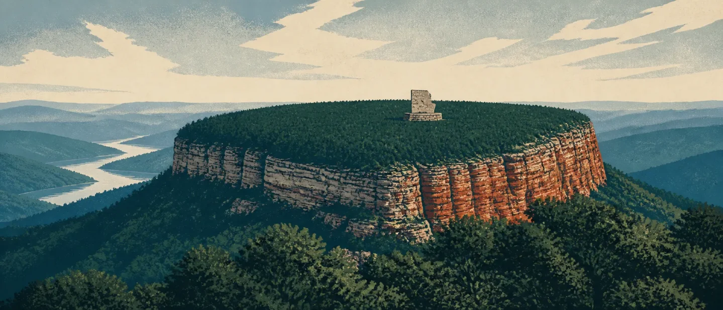
Mount Magazine is not a high-alpine climb disguised as a low summit. It is an isolated, flat-topped mountain whose bluffs, hardwood forests, unusual plants, and short high-point trail make the ecology more interesting than the number on the elevation sign suggests. Signal Hill reaches 2,753 feet, the highest point in Arkansas, inside Mount Magazine State Park. 1
At a glance
| Field note | What it means on the ground |
|---|---|
| High point | Signal Hill, 2,753 ft above sea level. The summit marker is a roughly 400-square-foot stone map of Arkansas. 23 |
| Mountain form | A plateau-like summit above steep sides, bluffs, and hollows — an “island in the sky” rather than a pointed alpine cone. 3 |
| Vegetation signal | Oak and hickory canopy, hardwood understory, scrub oak and cedar glades near the rim, plus special plants associated with the mountain’s geology and elevation. 45 |
| Best all-around window | Late spring into early summer for flowers and songbirds; spring or fall is the better choice if summer heat is a concern. 267 |
| Difficulty range | Signal Hill is a current moderate 1.5-mile, two-hour day hike. North Rim is moderate to strenuous at 2.2 miles and about three hours; Bear Hollow is moderate at 2.8 miles and about three hours. 289 |
Read the mountain from valley to summit
Mount Magazine’s cross-section is best understood as a change in landform and exposure, not as a neat series of conifer zones. The highpoint brochure places Magazine in Arkansas’s River Valley, where mountains such as Magazine rise with steep sides and flat tops. The park’s trail material then takes you through hardwood forest, scrub oak, cedar glades, bluffs, and hollows. 34
| Cross-section position | Habitat and terrain cue | What to look for |
|---|---|---|
| Valley and lower slopes | The mountain rises sharply above the surrounding Arkansas River Valley. Roads and longer trails reveal the relief more clearly than the summit number does. 3 | Broad valley views, steep side slopes, and the sense that the plateau is standing apart from the surrounding country. |
| Bluff and hollow edge | Windswept bluffs overlook rugged hollows. North Rim crosses tumbling creeks and follows the mountain’s northern edge. 8 | Open rock, abrupt drop-offs, creek crossings, and more wind than the sheltered woods below. |
| Plateau interior | Oak and hickory dominate the canopy. Dogwood, pawpaw, spicebush, and sassafras occupy the understory. 7 | A cool, shaded woodland feel, especially on Signal Hill, with seasonal flowers on the forest floor. |
| Summit and exposed rim | Signal Hill tops out at 2,753 feet. Rocky soils and cedar-hardwood glades create habitat that differs from the closed-canopy interior. 24 | The high-point marker, stronger views, scrubby openings, and plants adapted to exposed or rocky ground. |
That pattern explains the practical difficulty rating. Signal Hill gains only 153 feet from its campground trailhead in the park’s highpoint brochure, but the route still involves a steady climb and a mountain environment with bluffs and rough ground elsewhere. The current Arkansas.com trail page lists it as moderate, not as a paved viewpoint walk. 23
Plants worth noticing
Mount Magazine has 11 separate natural communities, a concentration the state park attributes to the mountain’s geology and elevation. Several plant species have unusually separated ranges in Arkansas, which is why the summit plateau feels more like an ecological island than a generic patch of upland forest. 5
- Maple-leaf oak (Quercus acerifolia) is the signature tree to seek on the northern slopes. The park’s special-plants page says it was discovered there in 1924 and was long known from nowhere else, although its taxonomic status has been under study. 5
- Western wallflower (Erysimum capitatum) favors rocky soil on the mountain’s western third. The park lists June as its bloom period and notes its orange flowers and association with swallowtail butterflies. 5
- Wood’s false hellebore (Veratrum woodii) grows on high-elevation, north- or east-facing wooded slopes. It can go years without flowering, but a mature bloom stalk may rise about seven feet and carry maroon, star-shaped flowers. 5
The broader flower calendar fills in the gaps. The park’s checklist places bloodroot and toothwort in late winter and spring, western wallflower from May through July, and Wood’s false hellebore from July through September. It also warns that temperatures on the summit are normally 10–15 degrees cooler than below, which can delay flowering by one to two weeks. 6
Wildlife: watch the edges and the canopy
Mount Magazine’s official wildlife guidance emphasizes variety rather than a guaranteed sighting. Black bears are present, while white-tailed deer, wild turkey, bobcat, coyote, and many butterflies are part of the park’s watchable-wildlife picture. The useful field-guide rule is simple: observe from a distance, never feed an animal, and do not treat a quiet trail as evidence that wildlife is absent. 10
Birders should read the habitat in layers. The park’s checklist marks wild turkey and red-tailed hawk as fairly common or common across the year, and it records a much wider seasonal list of warblers, vireos, tanagers, owls, and raptors. Signal Hill’s own description calls out plants and songbirds, especially in spring and summer. 211
The trail brochure is direct about bears: they usually avoid people, but food attracts them. Store food securely, never approach one, and slowly back away if you encounter a bear. The same brochure advises hikers to stay on marked trails, carry water, and use extra caution around loose or wet rock and bluff edges. 4
Best season: make spring your field-guide season
Late April through June is the strongest all-around window if the goal is to read the mountain as an ecosystem. Spring brings woodland flowers, late spring opens the main wildflower season, and the park’s highpoint material specifically identifies spring and summer as good times for plants and songbirds. The official checklist extends flowering into fall, so autumn remains a sensible alternative when you want to avoid the height of summer. 26
Summer is not off-limits, but it changes the planning equation. The USDA Forest Service warns that the area can be extremely hot in summer and recommends fluids, sun protection, and precautions for insects and snakes. Start early, carry more water than the short mileage suggests, and use the visitor center to check current trail conditions before committing to a rim route. 17
Difficulty and route choice
| Route | Official distance / time | Difficulty | Best for | Watch-outs |
|---|---|---|---|---|
| Signal Hill Trail | 1.5 mi / 2 hr | Moderate | The Arkansas high point, a gentle forest walk, and a clear summit objective. 2 | It is still a climbing trail, not a flat paved stroll. The highpoint brochure records a 153-ft climb from the campground trailhead. 3 |
| North Rim Trail | 2.2 mi / 3 hr | Moderate–strenuous | Bluffs, hardwood forest, scrub oak, cedar glades, creeks, and views into the hollow and Arkansas River Valley. 8 | The route follows exposed rim terrain and can connect with Mossback Ridge for a 4.4-mile loop. 8 |
| Bear Hollow Trail | 2.8 mi / 3 hr | Moderate | The upper rim of Bear Hollow, Sunrise Rock, Inspiration Point, Shoal Creek, and some of the mountain’s remaining unlogged hardwood forest. 9 | Wet-weather creeks, bluff scenery, and a longer 7.5-mile loop option mean the route can become a bigger day than the headline mileage suggests. 9 |
The park brochure describes a 14-mile state-park trail system that connects with nearly 60 miles of backcountry paths in the surrounding national forest. That distinction matters: a short park loop and a longer forest connection are not the same outing, even when they share a mountain name. 4
Practical planning
Use the visitor center as the first stop for maps, exhibits, and current conditions. The park lists the visitor center as open daily from 8 a.m. to 5 p.m.; the campground and picnic area are open year-round, but trail conditions and weather still control what is sensible on a given day. 1
For a first visit, the cleanest plan is to pair one route with one ecological question. Choose Signal Hill if the question is “Where is Arkansas’s high point?” Choose North Rim if it is “How does the plateau break into bluffs and hollows?” Choose Bear Hollow if the answer you want is “What does the mountain’s hardwood interior feel like?” Carry water, stay on marked trails, keep away from bluff edges, and leave the flowers and animals where you find them.
Mount Magazine rewards a slower reading of elevation. The summit is modest by western standards, but its isolated plateau concentrates forest, glades, rocky soils, bluff exposure, rare plants, birds, and large mammals in a compact walkable landscape. Start with Signal Hill for the high point, move to North Rim for the landform, and save Bear Hollow for the day when the forest itself is the destination.
References
- 1Mount Magazine State Park — Arkansas State Parks
arkansasstateparks.com
- 2Signal Hill Trail — Arkansas.com
arkansas.com
- 3
- 4
- 5Mount Magazine Special Plants — Arkansas State Parks
arkansasstateparks.com
- 6
- 7Mount Magazine — U.S. Forest Service
fs.usda.gov
- 8North Rim Trail — Arkansas.com
arkansas.com
- 9Bear Hollow Trail — Arkansas.com
arkansas.com
- 10Mount Magazine Watchable Wildlife — Arkansas State Parks
arkansasstateparks.com
- 11Bird Checklist — Mount Magazine State Park
arkansas.com
This story was produced automatically by a channel. One sentence is all it takes for Neodrop to keep producing for you.
Related content
More from this channel
- Mount Spokane field guide: beargrass meadows, Selkirk forest, and the summit complex
- Telescope Peak field guide: desert-to-bristlecone elevation bands in Death Valley
- Mount Diablo field guide: oak woodland, wind caves, and a Bay Area summit
- Mount Tallac field guide: granite ridges, red fir forest, and Lake Tahoe
- Mount Edith Cavell field guide: Angel Glacier, alpine meadows, and a 2026 closure
- Mount Rundle field guide: limestone bands, Bow Valley forest, and the Dragon's Back