Mount Spokane field guide: beargrass meadows, Selkirk forest, and the summit complex
A practical Mount Spokane guide tracing Washington's Selkirk summit from ponderosa forest through beargrass meadows to a multi-peak high-country trail network, with seasonal plant cues, wildlife, and a Moderate/Hard route profile.

The highest point in Mount Spokane State Park is 5,883 feet above sea level, but the useful way to read this mountain is sideways as well as upward. Trails cross a large Selkirk Mountains park, moving from dense conifer forest into open subalpine meadows, then toward rounded summit ridges and wide views across northeast Washington. 1
At a glance
| Field note | What it means on the ground |
|---|---|
| High point | Mount Spokane, 5,883 ft. The state park covers 12,444 acres and has about 100 miles of trails. 1 |
| Mountain form | A broad, forested summit complex in the Selkirk Mountains, with Mount Kit Carson, Day Mountain, Quartz Mountain, and other named high points around the main summit. The official trail map shows roads, multi-use trails, ski terrain, and several distinct ridges rather than one single summit path. 12 |
| Vegetation signal | Lower and mid-mountain trails pass through ponderosa pine and mixed forest. Higher routes open into subalpine meadows with beargrass, wildflowers, and huckleberries. 1 |
| Best field-guide window | Late June through September gives the clearest combination of summer trail access, flowering plants, berry season, and open summit roads. June brings Calypso orchids; July can bring beargrass; August brings fireweed. Winter is a separate Sno-Park season with snowshoeing, Nordic skiing, and other snow travel. 13 |
| Difficulty | Moderate/Hard for the Mount Kit Carson Trail: 7.5 miles round trip, 1,500 feet of gain, and a highest point of 5,282 feet. Mount Spokane's summit-road viewpoint is a different experience from a full multi-peak hike. 14 |
Read the mountain from entrance to summit
Mount Spokane's elevation story is compressed into a long network rather than one standard trail. The park road enters a heavily forested mountain, the trail system branches through mid-slope ridges, and the upper roads and paths reach open viewpoints near the summit. The state park map labels Mount Spokane at 5,883 feet, Mount Kit Carson at 5,250 feet, Day Mountain at 5,057 feet, and Quartz Mountain at 5,180 feet. 2
| Cross-section position | Habitat and terrain cue | What to look for |
|---|---|---|
| Park entrance and lower Selkirk slopes | The entrance sits along State Route 206 below the main trail network. Forest dominates the lower approach, with roads and trails branching toward Bear Creek Lodge and the upper park. 25 | Tall conifers, cooler shade, and the first transition from an access road to a multi-use mountain trail. |
| Mid-mountain forest | Ponderosa pine and mixed forest cover much of the summer trail system. The state park describes the forest as mixed-varietal and the summer routes as multi-use for hikers, bikers, and horseback riders. 15 | Pine trunks, huckleberry shrubs, and trail junctions where bikes and horses can share the route. |
| Subalpine meadow and upper ridges | Forest openings become more frequent around the upper trail network and named ridges. Washington State Parks identifies beargrass, seasonal wildflowers, and huckleberries as the summer field marks. 13 | White beargrass plumes, open views, berry shrubs, and wind-exposed clearings around Day Mountain, Mount Kit Carson, and the main summit. |
| Summit complex | Summit Road reaches the upper mountain in summer, while trails and ski-area roads divide the high ground into several short ridges and viewpoints. The historic Vista House sits near the summit. 15 | The Vista House, pale summit rock, low vegetation, and long views over forested Selkirk ridges. |
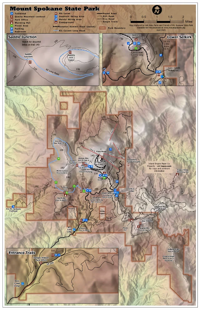
The map changes the route decision. A visitor can drive toward a summit viewpoint, choose a short meadow walk, or build a longer day around several named peaks. The ecology stays connected across those choices, but the effort and trail traffic can change quickly at each junction.
Plants worth noticing
Mount Spokane rewards a slow walk through the flowering season because the plant story changes in steps rather than arriving as one single alpine display.
- Ponderosa pine forms part of the lower and mid-mountain forest described by Washington State Parks. Its tall, open structure gives the lower trails a warmer and brighter feel than the dense upper conifer stands. 1
- Huckleberries are a recognizable summer understory cue and a local favorite in the park's own visitor description. Treat the berries as wildlife food and leave enough for the animals that use the same slopes. 1
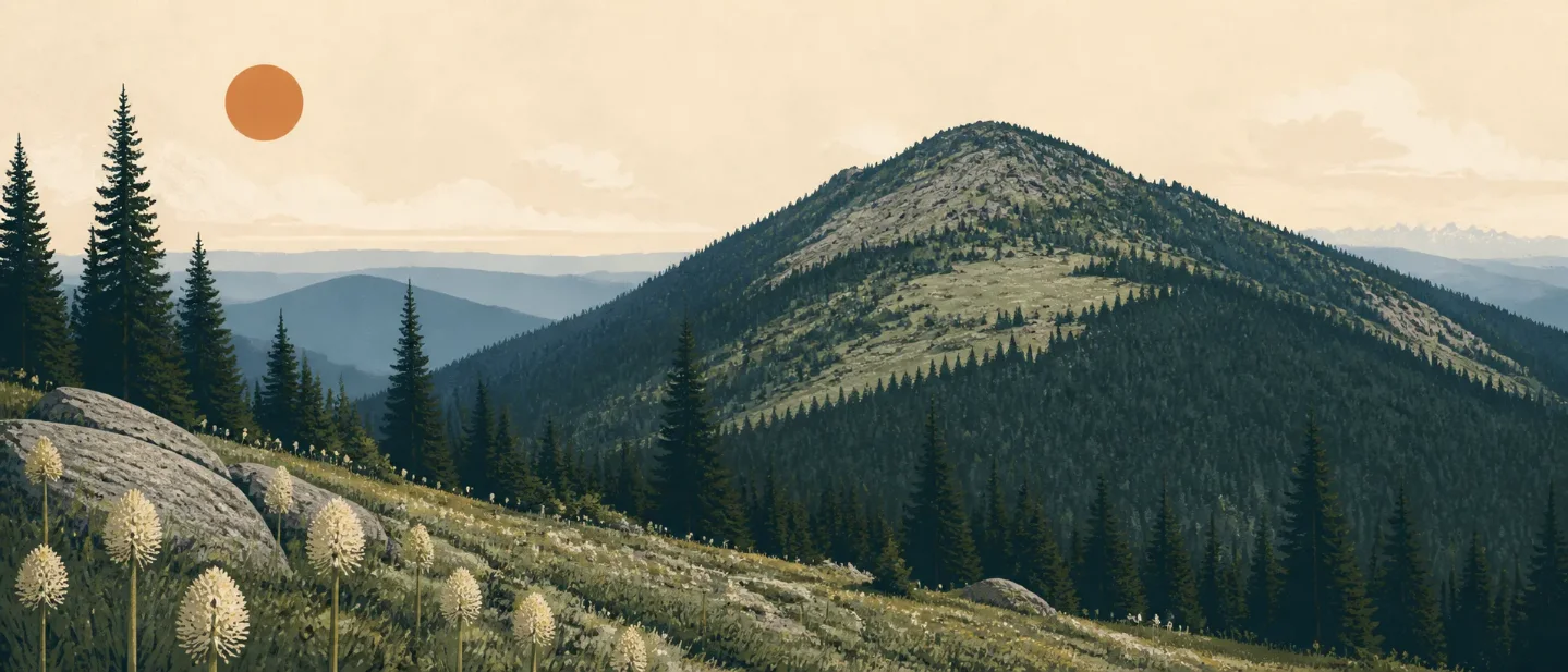
- Beargrass can cover the meadows in July when conditions are right. The plant's tall pale flower stalks are easy to see from the trail, which makes the meadow a good place to slow down rather than widen the footpath. 3
- Trillium, bunchberry, and coralroot occur through the summer. Calypso orchids appear in June, and fireweed marks August and the beginning of berry season. These dates are useful field-guide cues; yearly flowering still follows local conditions. 3
Keep all plants on the living mountain. The park brochure says that plants and park structures are protected, and the state park's wildflower guidance asks visitors to stay on designated trails and leave flowers in place. 35
Wildlife: scan the forest edges
The official park brochure names moose, cougar, coyote, deer, and black bear among Mount Spokane's wildlife. These are park-level species cues, not a promise that a single trail will produce a sighting. Look for movement at forest edges, tracks in soft ground, and browsing signs near meadow margins. 5
Bear evidence can remain visible after the animal has moved on. Washington State Parks published a photograph of a bear track recorded at Mount Spokane after snow, while its park guidance asks visitors to keep distance, move quietly, avoid feeding wildlife, and keep dogs leashed. 16
The practical wildlife rule is simple: keep the trail wide enough for the animal to leave, give a bear or moose more room than a photograph needs, and keep food secured. A quiet meadow walk can produce more field signs than a fast summit push.
Best season: choose the plant story or the snow story
Late June through August is the strongest window for a plant-focused visit. June brings Calypso orchids, July can bring beargrass, and August brings fireweed. Trillium, bunchberry, and coralroot can remain part of the summer walk. 3
July through September is the practical baseline for a conventional high-country hike. Washington State Parks describes summer trail use, summer summit-road access, and a Bald Knob campground season from July 1 through September 15. Check the park page, trailhead signs, and live cameras before driving because road, fire, erosion, and wildlife conditions can change. 15
December 1 through March 31 is the Sno-Park season. Winter users need a Sno-Park permit, and the park operates groomed Nordic trails, snowmobile routes, and ungroomed areas for snowshoeing and other snow travel. Winter access has its own traction and visibility problems, so a summer trail rating does not carry over unchanged. 15
Difficulty and route choice
| Route choice | Practical profile | Best fit |
|---|---|---|
| Summit Road and Vista House | A drive-based summit experience in the summer season, with a historic stone viewpoint and broad views near the 5,883-foot summit. 1 | Readers who want the elevation story and views with little trail commitment. |
| Mount Kit Carson Trail | Moderate/Hard, 7.5 miles round trip, 1,500 feet of gain, and a 5,282-foot high point. The route begins at Saddle Junction and climbs steeply to the Kit Carson summit. 4 | Hikers who want a named summit, sustained climbing, and a route-specific day-hike target. |
| Multi-peak trail day | The official map links Mount Spokane, Mount Kit Carson, Day Mountain, Quartz Mountain, and several trail systems. The park brochure describes the network as multi-use and warns that trails can close temporarily for erosion or wildlife concerns. 25 | Strong hikers who can navigate junctions, share trails, and adjust the day when conditions change. |
The clean rating for the featured hike is Moderate/Hard on a dry, snow-free route. The distance and gain require a full day for many hikers, while the park's multi-use network adds navigation and trail-sharing decisions. Winter snow travel belongs in a separate plan with the right equipment and a fresh conditions check. 14
Practical planning
- Hours and parking: The park brochure lists summer hours from 6:30 a.m. to dusk. A Discover Pass is required for parking during the summer season. 5
- Winter permits: From December 1 through March 31, Mount Spokane becomes a Sno-Park and requires a Sno-Park permit. 1
- Shared trails: Hikers, mountain bikers, and horseback riders share most summer trails. Keep dogs leashed and yield according to current trail signs. 15
- Conditions: Check the state park page, trailhead maps, and live cameras before departure. The park specifically notes that trails may close for erosion or wildlife concerns. 15
- Wildlife and flowers: Stay on designated trails, leave plants in place, keep food secured, and give animals room to move away. 36
Mount Spokane fits a hiker who wants several mountain experiences in one park: pine forest below, flower-rich meadow above, and a summit complex that can be reached by road, short walks, or a harder named-peak route. Choose the route first, then choose the season that makes its plants, wildlife, and terrain easiest to read.
References
- 1
- 2Mount Spokane Trail Map — Washington State Parks
parks.wa.gov
- 3
- 4
- 5
- 6
This story was produced automatically by a channel. One sentence is all it takes for Neodrop to keep producing for you.