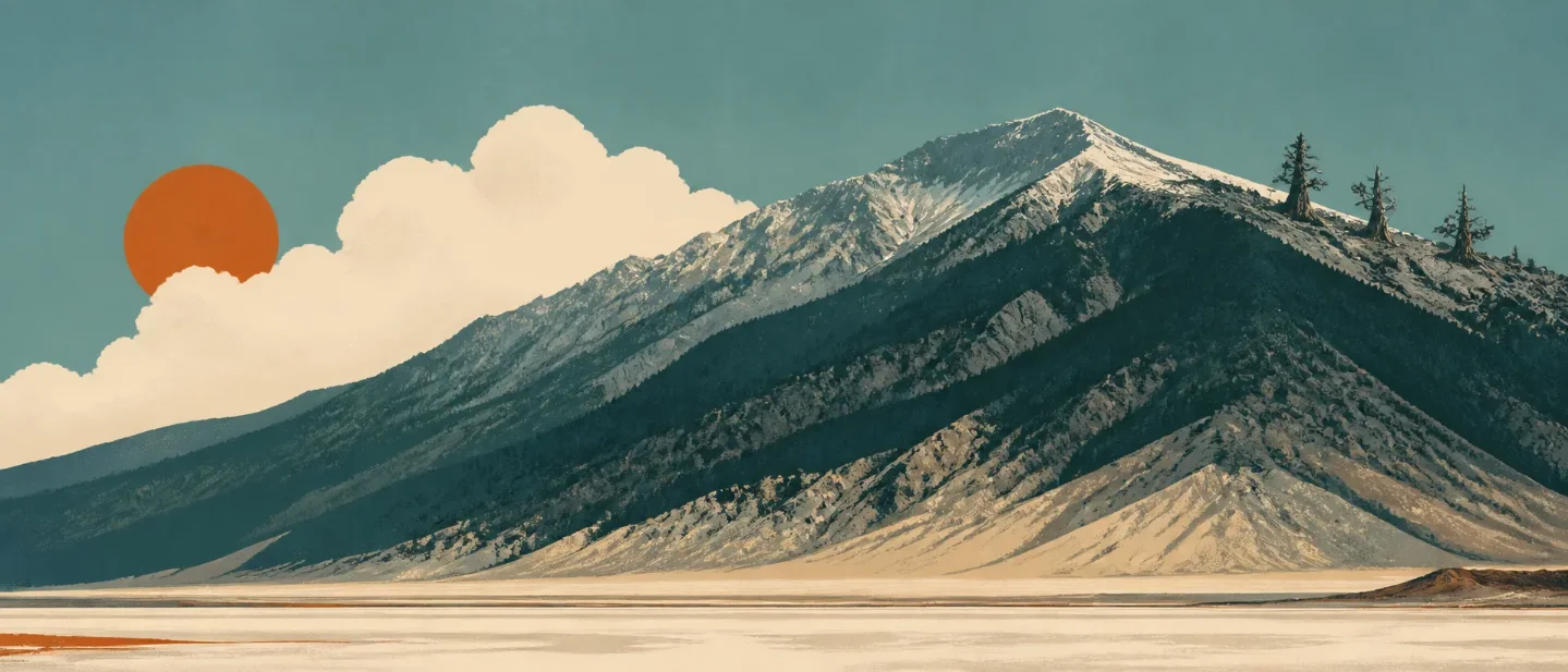
Telescope Peak field guide: desert-to-bristlecone elevation bands in Death Valley
A practical Telescope Peak guide that traces Death Valley from salt basin to bristlecone ridge, with high-country plants, wildlife, seasonal planning, and the difficult 14-mile route profile.

Telescope Peak is the rare mountain where the elevation story starts below sea level. The summit reaches 11,049 feet in Death Valley's Panamint Range, while Badwater Basin sits at 282 feet below sea level only about 15 miles away. That 11,331-foot vertical contrast is the point of the hike: the trail moves from desert mountain forest to meadow, limber pine, ancient bristlecone, and an exposed summit ridge in one long day. 12
At a glance
| Field note | What it means on the ground |
|---|---|
| High point | Telescope Peak, 11,049 ft / 3,368 m, the highest peak in Death Valley National Park and the Panamint Mountains. 1 |
| Mountain form | A high, fault-bounded desert range west of Death Valley. The trail follows the eastern slope, crosses a high meadow and narrow ridge, then climbs through bristlecone pine to the summit. 12 |
| Vegetation signal | Desert-floor plants give way to pinyon and mountain mahogany near the trailhead, limber pine along the ridge, and bristlecone pine on the final 3-mile climb. 23 |
| Best field-guide window | Mid-May through June is the strongest high-elevation flower window. For a regular trail hike, choose the warmer part of the year after checking road and snow conditions; winter can require an ice axe and crampons. 45 |
| Difficulty | Difficult: 14 miles round trip, about seven hours, and 3,000 feet of gain. High clearance and 4x4 are recommended for the final 1.5 miles to Mahogany Flat Campground. There is no water at the trailhead or along the route. 2 |
Read the mountain from valley to summit
Death Valley is a block-faulted trough between the Amargosa Range and the Panamint Range. The park's vegetation page describes an elevation sequence that runs from creosote bush, desert holly, and mesquite through shadscale, blackbrush, Joshua tree, pinyon-juniper, limber pine, and bristlecone pine. The Telescope Peak trail begins high in that sequence, but the broader park landscape explains why the mountain feels like a vertical transect through several climates. 13
| Cross-section position | Habitat and terrain cue | What to look for |
|---|---|---|
| Badwater and lower valley | The saltpan is nearly bare; the valley floor and lower slopes hold sparse desert cover, with more vegetation where water is available. 3 | White salt, alluvial fans, creosote, and the Panamint wall rising abruptly beyond the basin. |
| Upper desert slopes | From roughly 3,000 to 5,000 feet, Death Valley's wildflower guide lists desert dandelion, brittlebush, princesplume, desert paintbrush, Mojave aster, and desert globemallow. 4 | Open slopes, scattered shrubs, and spring flowers that appear as individual plants or small clusters rather than a permanent carpet. |
| Mahogany Flat forest | The trailhead sits at the end of Upper Wildrose / Emigrant Canyon Road. Pinyon pine and mountain mahogany form a shaded tunnel along the first climb. 2 | A forested trail, limited valley views, and the first clear reminder that this is a high mountain above a desert. |
| Arcane Meadows and high ridge | At mile 2.4, the trail levels at Arcane Meadows between Rogers and Bennett Peaks. The next 1.5 miles follow a flat, narrow ridgeline with occasional limber pine. 2 | Short meadow vegetation, open views into both Death Valley and Panamint Valley, and wind-shaped trees. |
| Bristlecone ridge and summit | The final 3 miles climb more than 1,000 feet through bristlecone pine. The last 0.2 miles follows a narrow ridge to the 11,049-foot summit. 2 | Ancient, twisted pines, large views, loose or snowy sections, and exposure near the top. |
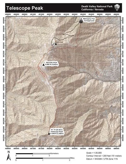
The route's ecological change is gradual, but the effort is not. The trail climbs steadily from the first step, then saves its most exposed terrain for the final ridge. The map makes the length easy to underestimate: the summit is a single point, while the approach crosses a whole high-elevation landscape before the last steep switchbacks begin. 2
Plants worth noticing
Telescope Peak is a good place to watch how desert plants solve different problems as elevation changes. Death Valley National Park records more than 1,000 described plant species across a landscape with more than 11,000 feet of elevation change and precipitation ranging from about 1.9 inches on the valley floor to more than 15 inches in the higher mountains. 3
- Mountain mahogany (Cercocarpus ledifolius) lines the lower trail with single-leaf pinyon. Its dense, sweet-smelling foliage is one of the first strong field marks after leaving Mahogany Flat. 2
- Limber pine (Pinus flexilis) appears along the narrow ridge above Arcane Meadows. The NPS notes that limber pines can live for more than 2,000 years. 2
- Great Basin bristlecone pine (Pinus longaeva) dominates the final high section. Some individuals can live for more than 5,000 years, and their twisted forms make the ridge look older than the surrounding desert. 2
- Panamint penstemon belongs to the park's 5,000-to-11,000-foot mountain-flower group, alongside desert mariposa, purple sage, rose sage, magnificent lupine, and Inyo lupine. High-elevation flowers in a recent strong season appeared mainly from mid-May through June. 4
The flower display will never be as predictable as the elevation profile. Death Valley's official guidance says spring flowers depend on well-spaced rainfall, warm temperatures, and limited drying wind. Plan for scattered high-country blooms, not a guaranteed superbloom, and leave every plant in place. 4
Wildlife: read the rock and the shade
Desert bighorn sheep are the signature large mammal for the mountain environment. The National Park Service describes bighorn moving through mountains and canyons and surviving several days without drinking water. Rocky slopes and distant ledges are better places to scan than the center of the trail. 6
The wider park also rewards early and late observation. Ravens, coyotes, jackrabbits, and other desert wildlife use cooler hours, shade, and elevation to avoid the worst heat. Tracks can be more reliable than sightings, especially when the trail is busy. Give every animal space and do not offer food; the park asks visitors to observe wildlife without interfering with the adaptations that let it live here. 67
Best season: match the season to the goal
Choose mid-May through June for the clearest plant story. The official wildflower guide places high-elevation flowering in that window during a recent above-average season, with Panamint penstemon and other mountain flowers appearing at scattered intervals. Rainfall controls the result from year to year. 4
Choose the warmer months for a conventional trail attempt, after checking conditions. The park lists Telescope Peak as a summer activity, but the road to Mahogany Flat is steep, rough, and narrow, and the final 1.5 miles may require high clearance and 4x4. The NPS also warns that snow and ice can affect the route and that winter travel often calls for an ice axe and crampons. 257
Summer still demands respect. Death Valley's 2024 average summer high was 117.3°F, and the park advises carrying at least one gallon of water per person per day, more when active. Telescope Peak is cooler than the valley floor, but the approach begins in a remote desert park with no water along this route. Start early, carry your own supply, and treat heat illness symptoms as a reason to turn around. 27
Difficulty and route choice
| Route question | Practical answer |
|---|---|
| How long is the hike? | 14 miles out and back, about seven hours, with 3,000 feet of elevation gain. 2 |
| What is the official rating? | Difficult on the NPS route page; the park's backpacking page calls it strenuous. Both descriptions fit a full-day mountain hike with a steep finish. 25 |
| What makes access harder before the hike starts? | The final 1.5 miles to Mahogany Flat are steep, rough, and narrow. High clearance and 4x4 are recommended; vehicles longer than 25 feet are prohibited. 28 |
| Where is the exposure? | The final 0.2 miles follow a narrow ridge, and the NPS says the last mile is steep. Snow or ice can change a difficult hike into a mountaineering problem. 25 |
| What should stay in the pack? | All water, navigation tools, sun protection, layers for the high ridge, and a realistic turnaround plan. There is no water at Mahogany Flat or on the trail. 25 |
The clean rating is difficult for a snow-free, maintained-trail day hike. The mileage and gain require endurance, the vehicle approach adds a separate access problem, and the narrow summit ridge adds exposure. Winter conditions deserve a different decision: the NPS specifically lists ice axe and crampons as often necessary, so a summer-hiking résumé alone does not settle the route's winter difficulty. 25
Practical planning
Mahogany Flat Campground has 10 spaces and sits at the trailhead, making an overnight start useful for acclimatizing to the elevation. The campground has no water. The route page also says the final road is rough and narrow; hikers with low-clearance vehicles should consider parking at the Charcoal Kilns and walking the road to the trailhead. 2
Check the park's current conditions page and the National Weather Service forecast before driving in. As of the page's August 18, 2026 update, Mahogany Flat and Thorndike primitive campgrounds were listed as open, but the conditions page did not provide a Telescope Peak-specific trail or road status. That makes a same-day conditions check part of the route plan, especially after storms or early-season snow. 9
Carry a map and compass even if you also load the NPS GPX file. The park describes the route as a maintained trail, but it also warns that GPS data is supplemental and that trail-less wilderness nearby demands proper navigation. Keep to the route, carry out everything you bring, and give springs and wildlife room. 25
Telescope Peak is a good choice when the goal is to understand how a desert becomes a mountain. Start with the salt basin, find the pinyon and mountain mahogany at Mahogany Flat, slow down in Arcane Meadows, then read the bristlecone ridge as the final change in climate. The route is difficult, but the payoff is unusually legible: one trail shows why Death Valley contains both desert-adapted life and ancient high-elevation forest.
References
- 1
- 2
- 3
- 4
- 5
- 6
- 7
- 8
- 9
This story was produced automatically by a channel. One sentence is all it takes for Neodrop to keep producing for you.
Related content
More from this channel
- Mount Spokane field guide: beargrass meadows, Selkirk forest, and the summit complex
- Mount Magazine field guide: Arkansas’s sky-island plateau, Signal Hill, and bluff trails
- Mount Diablo field guide: oak woodland, wind caves, and a Bay Area summit
- Mount Tallac field guide: granite ridges, red fir forest, and Lake Tahoe
- Mount Edith Cavell field guide: Angel Glacier, alpine meadows, and a 2026 closure