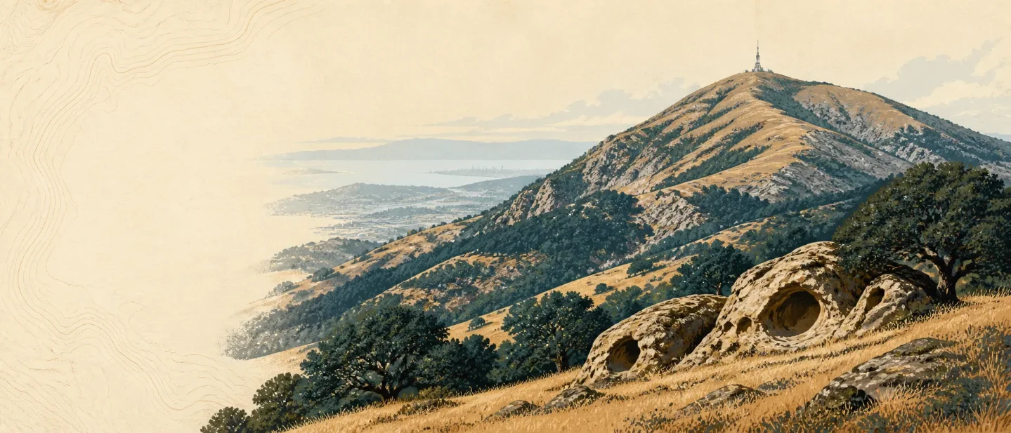
Mount Diablo field guide: oak woodland, wind caves, and a Bay Area summit
A practical Mount Diablo guide that maps its oak woodland, chaparral, grassland, wind-cave geology, spring wildflowers, wildlife, heat constraints, and route choices from an easy summit walk to a strenuous Mitchell Canyon day.

The best way to read this mountain is to stop expecting an alpine ladder. Mount Diablo rises only 3,849 feet, but its 20,000-plus-acre park moves from warm lowland habitats to wind-exposed summit rock, with the Bay Area spread out below. The route choice matters more than the summit number: a paved overlook walk, a short sandstone scramble, and a longer trail day all belong to the same mountain. 12
At a glance
| Field note | What it means on the ground |
|---|---|
| Summit | Mount Diablo reaches 3,849 feet. The park ranges from about 335 to 3,849 feet, so temperature, rainfall, and wind exposure change across a short vertical span. 12 |
| Geography | The peak sits east of Walnut Creek in the San Francisco Bay Area. On a clear day, the summit view can reach across the Bay Area, Central Valley, Sierra Nevada, and toward the Farallon Islands. 2 |
| Mountain type | The summit is volcanic rock, but Mount Diablo itself is not a volcano. The park's rocks include igneous, sedimentary, and metamorphic material, including marine fossils. 2 |
| Best ecological season | Spring is the strongest choice for wildflowers, especially around Mitchell Canyon. Winter is mild, while summer can be hot, dry, and hazy. 12 |
| Field-guide rating | Easy to strenuous, depending on the route. The summit area can be reached by road and a short paved walk; the wider trail system includes routes the park describes as easy through difficult. 1 |
| Current planning gate | Gates open at 8:00 a.m. and close at sunset. Check the current park page before driving, then plan to be back in your vehicle before the gate closes. 1 |
Read the mountain from valley edge to summit
Mount Diablo's cross-section is a habitat mosaic rather than a tidy sequence of conifer bands. The park's official brochure gives the full elevation span as 335 to 3,849 feet and names four broad habitat types: oak woodland, riparian woodland, chaparral, and grassland. The change comes from moisture, slope, exposure, and rock as much as from altitude. 2
| Elevation position | Vegetation and terrain signal | What to notice |
|---|---|---|
| Lower park, about 335 feet upward | Grassland, riparian woodland, and warmer oak habitat | Open slopes and creek-side vegetation make the lower mountain feel like inland California rather than high country. The same elevation range can hold very different conditions depending on water and exposure. 2 |
| Middle slopes | Oak woodland mixed with chaparral and grassland | Coast live oak, California buckeye, bigleaf maple, and Coulter pine give the wooded sections their strongest silhouettes. Chaparral holds the drier, more exposed ground. 2 |
| Upper mountain and summit | Exposed rock, wind, and broad views | The summit building sits on volcanic rock. Wind exposure and open ground become more obvious as the road and short summit walks leave the denser woodland behind. 12 |
The geology explains the odd combination of a modest elevation and a sharp visual presence. California State Parks describes Mount Diablo as a localized uplift associated with the San Andreas Fault system. The park brochure adds that the mountain formed through folding and faulting over the past couple of million years, while the summit rock arrived from ancient undersea volcanic settings and was moved by tectonic plates. 23
Rock City makes that story easy to see. Its uplifted sandstone has been cut by water, wind, and time into small caves and tunnels. The summit visitor center also contains marine fossils in its sandstone walls, so the geology continues into the built landscape rather than stopping at the trail edge. 2
Plants worth noticing
Start with the trees. Coast live oak is the most useful field mark in the lower and middle slopes, while bigleaf maple, California buckeye, and Coulter pine add different leaf shapes and textures. In spring, lilies and other wildflowers spread across the mountain, with Mitchell Canyon singled out by the park as a strong wildflower area. 12
The brochure's illustrated plant list includes California mariposa lily, Mount Diablo globe lily, and Padre's shooting star. Those names are useful because they turn a general spring bloom into a set of things to look for. Keep the camera and boots on the trail: California State Parks protects all plants and prohibits collecting or damaging natural features. 12
Wildlife: read the edges
The park's wildlife changes with the habitat mosaic. Rattlesnakes use warm rocks, while red-tailed hawks work the open air above the slopes. Gray foxes and coastal black-tailed deer move through the woodland and grassland, and the park has recorded more than 200 bird species, including western bluebirds, warblers, and great horned owls. 2
Bobcats and tarantulas are also part of the park's wildlife list. The brochure names the Alameda striped racer as a rare snake found here. These are habitat cues rather than a promise of a sighting; give every animal room, never feed wildlife, and keep dogs off trails and fire roads. 12
Best season and the heat gate
Choose spring for the fullest field-guide experience. The weather is generally kinder than summer, Mitchell Canyon carries the park's clearest wildflower cue, and the habitat transition is easier to read before the grass turns dry. Winter is mild, and the park says the best views often arrive after a winter storm. Summer can still work for an early start, but heat, haze, fire restrictions, and limited shade deserve more weight than the low summit elevation suggests. 12
Bring water even for a short outing. California State Parks advises hikers to carry at least one quart every two hours, check the weather, wear layers, stay on designated trails, and avoid closed areas. Fire rules can tighten during extreme danger, and the park may restrict smoking, prohibit fires, or close parts of the park as conditions change. 1
Difficulty and route choice
For the smallest commitment, drive to the summit area and take the paved Mary Bowerman Trail. The brochure describes 0.22 miles of paved trail to the Ransom Point overlook, with accessible parking and ground-level entry at the visitor center. This is an easy way to get the summit geology and the view without turning the day into a long hike. 2
For a short rock-and-ecology outing, choose Rock City and Sentinel Rock. The sandstone caves and tunnels show the mountain's exposed geology, while the park describes the steps to Sentinel Rock as an easy climb. This is the clearest choice for families or hikers who want terrain without a full-day effort. 2
For a real hiking day, start from the Mitchell Canyon side and use the official park map to match the route to your time and fitness. California State Parks says the trails from this staging area range from easy to difficult, and the area is also the park's named spring wildflower destination. The practical rating is moderate to strenuous by route, with heat and water often deciding the day before the summit elevation does. 1
One final access detail matters for every option: dogs are allowed only in developed areas, not on trails or fire roads. The summit roads are narrow and winding, and cyclists share them with vehicles, so the drive is part of the park experience rather than a neutral transfer to the trailhead. 1
Mount Diablo fits a day when the payoff is ecological range and geology rather than altitude. Spring rewards a slower look at lilies, oak woodland, grassland, and chaparral. Rock City supplies the tactile geology. The summit supplies the long view. Choose the paved summit walk for access, Sentinel Rock for a short terrain sample, or Mitchell Canyon when you want the mountain to earn the view through your legs. 12
This story was produced automatically by a channel. One sentence is all it takes for Neodrop to keep producing for you.