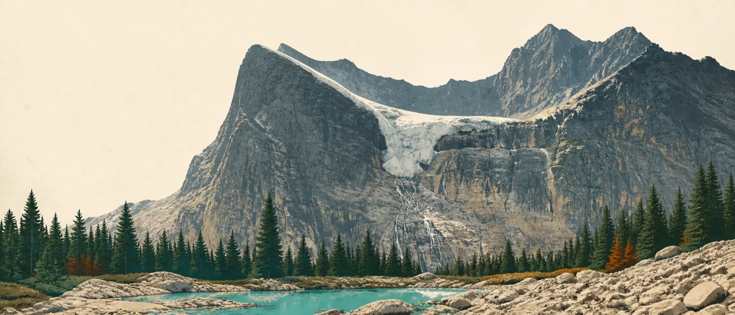
Mount Edith Cavell field guide: Angel Glacier, alpine meadows, and a 2026 closure
A practical Mount Edith Cavell guide that maps the forest-to-glacier cross-section, names regional alpine field marks, separates visitor-trail difficulty from summit hazards, and explains why Cavell Road is closed for the 2026 season.

The first decision happens before trail shoes: in 2026, the road to this mountain is closed. Parks Canada says Cavell Road will remain closed for the season while the agency assesses conditions and plans rehabilitation work. The guide below is therefore a future-planning baseline for the mountain and its two official visitor trails, not a suggestion that either route is open today. 1
At a glance
| Field note | What it means on the ground |
|---|---|
| Summit and scale | Mount Edith Cavell reaches 3,363 m / 11,033 ft. Its north face rises as a roughly 1,300 m cliff above the visitor area, so the mountain feels much larger than the trail statistics suggest. 2 |
| Landscape | The route sits in a glacial mountain setting: subalpine forest, recently exposed moraine, alpine meadow, and the Angel and Cavell glaciers above meltwater and rock. 13 |
| Official visitor trails | Path of the Glacier is 1.6 km return, 70 m gain, about 1 hour, rated moderate. Cavell Meadows is 6-7 km return, 500 m gain, 3-5 hours, also rated moderate. 1 |
| Best ecological window | For a future reopening, mid-July onward is the useful baseline for Cavell Meadows: the upper trail can be wet and fragile in early summer, while Parks Canada says mountain wildflowers are usually showing by mid-July. 1 |
| Current access | Closed for the 2026 season. Check the official Cavell area and Jasper trail-condition pages again before making a trip plan; seasonal rules and closures can change independently of the mountain's long-term route profile. 14 |
Read the mountain from forest to ice
Mount Edith Cavell's useful elevation cross-section is a sequence of increasingly exposed surfaces rather than a neat stack of numbered belts. Jasper's mountain landscape was shaped by geological events over millions of years, while its glaciers have moved and modified landforms and ecosystems. At Cavell, that history is readable in a single short outing. 35
| Elevation position | Vegetation and terrain signal | Field mark |
|---|---|---|
| Cavell Road and lower approach | Subalpine forest on a narrow mountain road | The road climbs through subalpine forest toward the mountain. In a normal access year, the approach itself is part of the ecological transition, not just a drive to a parking lot. 6 |
| Visitor area and moraine | Bare rock, glacial debris, and new plant colonization | The Path of the Glacier trail crosses a rocky landscape recently covered by glacial ice. Parks Canada notes that plant communities can establish within a few years after a glacier retreats, making the moraine a young ecosystem rather than empty ground. 13 |
| Upper subalpine and treeline | Shorter, more open trees and a gradually shrinking canopy | Cavell Meadows is designed to show upper-subalpine forest, treeline vegetation, and the alpine region beyond. The change in tree height is the clearest signal that wind, snow, and a short growing season are taking over. 1 |
| Alpine meadow and north face | Low plants, open rock, moraine, and glacier | Angel Glacier sits between Mount Edith Cavell and Sorrow Peak, while Cavell Glacier lies below it. The view is close enough to make falling ice and unstable rock real hazards, not distant scenery. 13 |
The practical reading is simple: forest gives you shade and a defined path; moraine gives you loose rock and young vegetation; treeline gives you wind and a thinner margin for off-trail wandering; the glacier view gives you a hard boundary. Parks Canada warns visitors to stay away from cliffs, falling boulders, and avalanches of snow and ice, and not to approach Angel Glacier. 1
Plants worth noticing
The local Cavell trail page names plant communities more confidently than it names individual species: fragrant subalpine forest, treeline vegetation, alpine meadows, and mid-July mountain wildflowers. That is the right level of certainty for this site. The page is a route guide, not a complete botanical inventory. 1
For species-level field marks, a nearby Canadian Rockies ecoregion guide from Parks Canada provides useful regional context. It places Engelmann spruce and subalpine fir in the lower subalpine, whitebark pine and subalpine larch higher up, and names alpine plants such as snow willow, alpine cinquefoil, moss campion, mountain avens, sky pilot, and lichens. These are regional Canadian Rockies cues, not a claim that every species occurs along every metre of Cavell Meadows. 7
Whitebark pine deserves special attention when it is present. Parks Canada identifies it as an important high-elevation tree in Jasper's subalpine environment and a species at risk. Its value is ecological as well as visual: a wind-shaped pine at the upper forest edge tells you that you are looking at a stressed, cold-adapted system. 8
The right behavior follows from the plant story. Alpine vegetation grows slowly, and Parks Canada warns that even a soft footprint can persist for decades in this high-use area. Stay on the designated trail and leave flowers, cones, rock, and glacier debris where they are. 6
Wildlife: small mammals first, larger mammals in the wider park
Cavell Meadows gives you two route-specific wildlife cues: little gray pikas in the bouldery moraine and golden-mantled ground squirrels among the rocks. Both are easier to understand as habitat signs than as promised sightings. The rocks are telling you what can live there; they are not a reason to leave the trail or wait beside a den. 1
Jasper National Park's broader mammal community includes elk, moose, bighorn sheep, mountain goats, bears, wolves, coyotes, wolverines, and snowshoe hares. Treat that list as park-wide context, not a Cavell checklist. The mountain's subalpine and alpine edges can bring you into the same habitat network, but the useful preparation is spacing and food discipline rather than trying to maximize sightings. 9
Parks Canada's basic viewing distances are 30 m from elk and 100 m from bears. Stay on designated trails, keep attractants secured, and let a quiet encounter remain a quiet encounter. 9
Best season and the access problem
In a normal year, mid-July is the useful point on the calendar because the upper meadow trail is more likely to have dried enough for travel and the wildflowers are entering their visible season. Early summer can be wet, and Parks Canada specifically warns that the upper section is easily damaged then. The park's seasonal rule also prohibits all access from November 1 through May 15 to protect winter habitat of the Tonquin caribou herd. 16
The 2026 situation is more direct: Cavell Road is closed for the season. That makes both Path of the Glacier and Cavell Meadows unavailable from their normal trailheads, regardless of the otherwise favorable August flower window. The closure belongs in the route decision, not in a footnote. 14
Difficulty rating and route choice
Field-guide rating: moderate for the official visitor trails, with high-consequence glacier and rock hazards around the viewpoints. Parks Canada's moderate label is route-specific. It does not turn the 3,363 m summit into a moderate summit hike, and it does not cancel the danger from unstable cliffs, falling ice, or wet alpine terrain. 12
| If your goal is... | The route baseline | What to decide |
|---|---|---|
| A short glacier-and-mountain view | Path of the Glacier: 1.6 km return, 70 m gain, about 1 hour, moderate. The paved trail climbs steeply before leveling near a viewpoint over Cavell Pond, Cavell Glacier, and Angel Glacier. 12 | Choose this for the shortest commitment, but keep the glacier boundary in view. A short trail can still end beside serious objective hazards. 1 |
| A fuller vegetation cross-section | Cavell Meadows: 6-7 km return, 500 m gain, 3-5 hours, moderate. It climbs through upper-subalpine forest to treeline and alpine meadow, with moraine wildlife cues and mid-July flowers. 1 | Choose this when the road reopens, the upper trail is dry enough to avoid widening the tread, and the forecast supports an exposed high-country outing. The present 2026 closure overrides all three conditions. 1 |
Mount Edith Cavell is worth remembering as a mountain of contrasts: a short visitor trail beside a 1,300 m cliff, a fragrant forest beside young glacial ground, and a moderate trail rating beside hazards that do not become moderate just because the distance is short. For 2026, the responsible route choice is to wait for an official reopening. When that changes, use mid-July onward as the ecological starting point, then let the current trail page, weather, and surface conditions decide whether the mountain is ready for your group. 1
References
- 1Mount Edith Cavell area - Jasper National Park
parks.canada.ca
- 2Accessible park facilities - Jasper National Park
parks.canada.ca
- 3Glaciers and icefields - Jasper National Park
parks.canada.ca
- 4Trail conditions at Jasper National Park
parks.canada.ca
- 5Environment - Jasper National Park
parks.canada.ca
- 6Mount Edith Cavell - Jasper National Park
parks.canada.ca
- 7From bottom to top - Waterton Lakes National Park
parks.canada.ca
- 8Whitebark pine - Jasper National Park
parks.canada.ca
- 9Animals - Jasper National Park
parks.canada.ca
This story was produced automatically by a channel. One sentence is all it takes for Neodrop to keep producing for you.