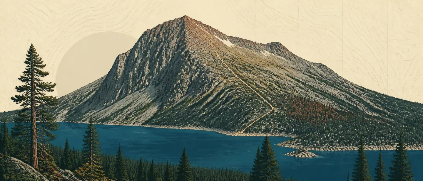
Mount Tallac field guide: granite ridges, red fir forest, and Lake Tahoe
A practical Mount Tallac guide that separates the moderate lake trails from the difficult summit route, then maps red-fir forest, granite, meadow plants, wildlife, weather, and the best high-country planning window.

The route starts beside Lake Tahoe and ends on exposed granite above a forest that still carries the shape of the Sierra's glacial past. That contrast is the point: the lower trail can feel like a straightforward lake-country hike, while the final miles are a difficult, weather-sensitive summit day. 1
At a glance
| Field note | What it means on the ground |
|---|---|
| Summit | Mount Tallac reaches 9,735 feet. The official Forest Service recreation page lists the elevation alongside the trailhead description. 1 |
| Setting | The trailhead sits about 3.5 miles northwest of South Lake Tahoe on Highway 89, across from Baldwin Beach, with views toward Fallen Leaf Lake, Lake Tahoe, and Desolation Wilderness. 1 |
| Route options | Floating Island Lake is 1.7 miles one way and easy to moderate. Cathedral Lake is 2.5 miles one way and easy to moderate. The Mount Tallac route is 5 miles one way and difficult. 1 |
| Best practical window | Plan around the snow-free summer-to-early-fall shoulder, with the final choice controlled by the current forecast and trail surface. The Forest Service warns that Sierra weather can change quickly and that storms can turn a pleasant outing into a life-threatening situation. 12 |
| Field-guide rating | Difficult for the summit; easy to moderate for the lake options. The official difficulty changes after Cathedral Lake, where the route becomes steep and strenuous on the mountain's front face. 1 |
Read the mountain from forest to granite
Mount Tallac does not offer a tidy staircase of numbered ecological bands. The useful cross-section is a change in tree density, soil, and exposure. Desolation Wilderness, the adjacent high-country landscape, is described by the Forest Service as a region of subalpine and alpine forest, granite peaks, and valleys and lakes shaped by glaciers. 3
| Elevation position | Vegetation and terrain signal | What to notice |
|---|---|---|
| Trailhead and lower approach | Forested Sierra slopes above the Tahoe basin | The trail begins in a lake-country setting, with Fallen Leaf Lake and Tahoe visible from the route area. The first sections are the gentler part of the outing. 1 |
| 7,400-9,000 feet | Red fir and lodgepole pine forest | The main forest band in the surrounding wilderness is dominated by red fir and lodgepole pine, with Jeffrey pine, mountain hemlock, western juniper, and western white pine mixed in. Trees grow in rocky, nutrient-poor soil, and the most continuous forest follows wetter ground near lakes, streams, and meadows. 4 |
| Above the main forest band | Patchy trees, open granite, and meadow pockets | Tree cover becomes patchy to rare at higher elevations. Decomposed granite is often shallow in glacially scoured basins, so bare rock is part of the habitat story rather than a gap between habitats. 4 |
| High ridge and summit | Exposed granite, wind, and a much smaller margin for error | The summit route leaves the easy rhythm of the lake trails and climbs the mountain's front face. The route length is only half the story: exposure, changing weather, and the absence of a forgiving tree canopy matter more near the top. 1 |
The result is a mountain that explains its geology through its vegetation. Glaciers left granite, shallow soils, and basin lakes; plants occupy the wetter pockets and the cracks where enough soil has collected. The Forest Service notes glacial polish, erratics, and other glacial features in the wilderness, with forests and meadows growing over some of that surface after the ice receded. 4
Plants worth noticing
Three plant groups make the route legible. In the main forest, red fir and lodgepole pine are the dominant field marks. Jeffrey pine, mountain hemlock, and western white pine add different silhouettes and bark textures. Higher and drier ground opens into scattered western juniper and lodgepole pine, with montane chaparral species holding onto the granite. 4
Look for pinemat manzanita, huckleberry oak, and mountain pride penstemon where chaparral meets exposed rock. In wet meadows, the plant story changes again: sedges, grasses, annuals, perennials, aspen, and willow gather where elevation, exposure, and soil depth create enough moisture. These are surrounding Desolation Wilderness field marks, so treat them as habitat cues rather than a complete Mount Tallac inventory. 4
The meadow plants also explain why shortcutting is a poor trade. A route that looks like bare granite in one step can become a shallow-soil meadow in the next. Stay on the established tread whenever it exists, especially around wet ground and the upper open slopes.
Wildlife: a habitat list, not a sighting promise
The surrounding wilderness supports mule deer and black bears, along with coyote, porcupine, badger, and bobcat. The Forest Service also lists fisher, pine marten, red fox, and wolverine as rare species of special interest in the area. 4
The most useful high-country cues are smaller. Yellow-bellied marmots, golden-mantled ground squirrels, Douglas squirrels, and pikas use the rocky and alpine edges. Steller's jays, Clark's nutcrackers, mountain chickadees, blue grouse, mountain bluebirds, American dippers, and occasional golden eagles are among the mountain birds named by the Forest Service. 4
Read those species as signs of habitat rather than a checklist. Marmots and pikas point you toward broken rock; nutcrackers fit the conifer edge; deer and black bears move through a larger forest-and-meadow system than the summit trail alone. Give animals room and keep food secured. If the trip becomes an overnight extension into Desolation Wilderness, the Forest Service requires permits and bear canisters for overnight visits. 3
Best season and the weather gate
Best practical window: mid-July through early October in a low-snow year. That is a planning recommendation for the difficult summit route, not a guarantee that the upper trail is clear. The official route page calls the hike difficult, warns that weather can change rapidly, and recommends carrying plenty of water and allowing enough time. The basin safety page adds a more serious rule: check the forecast before leaving, and be ready to backtrack if a storm hides trail markers or changes the surface. 12
The upper ridge deserves an early start. The Forest Service's lightning guidance says hikers above treeline should descend quickly when a storm approaches and avoid isolated trees, high terrain, and exposed ground during lightning activity. That guidance changes the route decision: a clear morning does not buy permission to remain on the summit once the sky turns. 2
Winter and shoulder-season travel needs a separate standard. The basin is avalanche country, snow can hide trail markers, and the Forest Service advises travelers to check current avalanche and weather conditions before entering the backcountry. Untreated lake and stream water can carry Giardia, and the safety guidance recommends acclimatizing before strenuous activity and drinking additional fluids at high elevations. 2
Difficulty and route choice
For a short ecological sample, choose Floating Island Lake. Its 1.7-mile one-way distance and easy-to-moderate rating keep the commitment modest while leaving you in the forest-and-lake side of the mountain. 1
For the first real high-country step, choose Cathedral Lake. At 2.5 miles one way and easy to moderate, it reaches farther into the mountain without asking for the difficult front-face climb. It is the route choice for hikers who want a stronger forest-to-open-ground transition while keeping a shorter turnaround point. 1
For the summit, treat the 5-mile one-way distance as a difficult, roughly 10-mile round trip before any navigation or weather delay. The official page says the trail becomes steep and strenuous beyond Cathedral Lake. Start early, carry more water than the lower elevation suggests, set a turnaround time before the exposed section, and descend when storms approach. 12
The trailhead itself has seasonal parking, no winter restrooms or trash service, no camping or overnighting, and no campfires at the trailhead or in Desolation Wilderness. Check those access details and current alerts before driving to Highway 89. 1
Mount Tallac fits hikers who want the Sierra's ecological change to arrive in a single day: red fir and lodgepole forest, chaparral on granite, wet meadows, alpine rodents, and an exposed summit above Tahoe. The choice is straightforward once the route is separated into its real parts. Floating Island Lake and Cathedral Lake are moderate outings. The summit is a difficult high-country day whose success depends as much on snow, wind, lightning, water, and turnaround discipline as on fitness. 14
References
- 1
- 2Stay Safe - Lake Tahoe Basin Management Unit
fs.usda.gov
- 3
- 4
This story was produced automatically by a channel. One sentence is all it takes for Neodrop to keep producing for you.