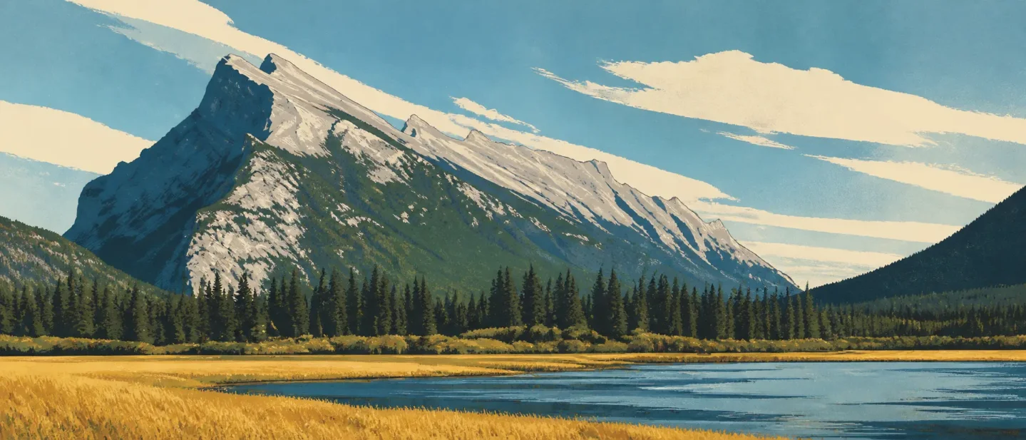
Mount Rundle field guide: limestone bands, Bow Valley forest, and the Dragon's Back
A practical Mount Rundle guide that separates Bow Valley forest from the exposed Dragon's Back scramble, with snow-free season timing, alpine plant and wildlife cues, and a route-specific difficulty rating.

From Banff, the mountain rises as a broad limestone wedge. The standard route starts close to town, then leaves the constructed trail for steep forest, loose rock, and an exposed summit ridge. That short approach to the map hides a full-day effort: Mount Rundle is a snow-free summer scramble, not a routine summit hike. 1
At a glance
| Field note | What it means on the ground |
|---|---|
| Summit | 2,949 m / 9,675 ft. The standard route gains 1,577 m / 5,175 ft over roughly 11 km round trip, with an average round-trip time of 7–8 hours. 1 |
| Mountain type | A steep Canadian Rockies peak built around layered limestone bedrock. The route's upper ridge and gullies expose the rock directly. 1 |
| Best season | Late July through mid-September is the most reliable hiking window in Banff's high country. For Mount Rundle itself, wait until the standard route is snow-free; the west face melts earlier than many nearby peaks. 12 |
| Field-guide difficulty | Very strenuous, difficult scramble. Parks Canada calls the standard line an easy scramble in the context of mountain climbing, but also describes most of it as very steep and strenuous. 1 |
| Best fit | Strong hikers with route-finding experience who want a full alpine day and can manage steep, loose, exposed terrain. The correct route is non-technical in the right season; a wet or snowy route changes that equation. 1 |
Read the mountain from valley to summit
Mount Rundle's useful elevation cross-section is a change in surface and exposure, not a neat set of hard elevation lines. The Bow Valley starts as a patchwork of grassland and open forest. The route then climbs through closed conifer forest, crosses a forested ridge, and finally opens into limestone gullies, scree, and an exposed summit crest. Parks Canada describes the broader Banff landscape as a mosaic of alpine meadows, closed subalpine forest, and grassland or open forest in valley bottoms. 3
| Elevation position | Vegetation and terrain signal | What to notice |
|---|---|---|
| Bow Valley base | Grassland and open forest | The lower landscape is more open, warmer, and easier to scan across. It is also the transition zone where wildlife movement and human access overlap. 3 |
| Lower route | Closed conifer forest and a constructed trail | The standard route climbs steadily through forest before the switchbacks begin. Shade ends when the route reaches the cliff bands and central gully. 1 |
| Forested ridge | Steep trees, exposed bedrock, and a shrinking tread | Above the central gully, the route follows a steep ridge through trees. Near treeline, erosion exposes smooth bedrock; wet conditions make this section especially slippery. 1 |
| Upper ridge | Loose gravel, limestone, scree, and cliff exposure | The Dragon's Back narrows between two gullies. Above it, the route becomes a long slog up loose scree to a sharp summit ridge with a vertical east face below. 1 |
That sequence tells you what kind of day you are having. Forest means shade and a defined line. The central gully means the maintained hike is over. The Dragon's Back means footing and exposure now control the pace. On the summit ridge, the view is the reward, but the edge is an active hazard.
Plants worth noticing
At the valley edge, look for Douglas-fir and open-forest structure rather than a continuous wall of spruce. Parks Canada describes Douglas-fir as a fire-resilient native species and identifies montane meadows and wetlands as sensitive habitats across Banff. 4
Higher on the mountain, the most useful field mark is the change in canopy. Trees become shorter and more wind-shaped before giving way to exposed limestone and scree. Across the park, Parks Canada is also restoring and monitoring whitebark pine and limber pine, both species of conservation concern. Treat them as high-elevation plants to recognize in the broader Banff setting, not as a promise that every Rundle outing will produce a confirmed sighting. 4
The alpine meadow is the seasonal counterpoint to the rock. Open meadows are part of Banff's natural habitat mosaic and can be fragile under repeated foot traffic. Stay on the route where one exists, and leave wildflowers, cones, rocks, and other natural objects in place. 23
Wildlife: habitat cues, not a checklist
Banff National Park supports hundreds of species, including grizzly bears, wolves, and elk. The lower Bow Valley and forest edge are the places where those larger mammals matter most to route behavior: keep food and garbage secured, keep dogs on leash, and give wildlife space. 5
The upper mountain adds a different set of cues. Parks Canada's 2025 report discusses mountain goats and pikas in the context of alpine connectivity and interpretation. On Rundle, cliffs and rocky gullies are the habitat signal for goats; talus is the cue to think about pika. Neither cue guarantees an encounter, and a quiet trail is the better outcome. 4
The practical wildlife rule is simple: scan before stepping around blind rock, never approach an animal for a photograph, and do not let a sighting change your route or group spacing. Parks Canada says wildlife may be present anywhere in the park, including the townsites, and feeding or disturbing wildlife is illegal. 5
Best season: dry rock beats an early calendar date
Banff's prime hiking season runs from July through mid-September. Many higher passes can remain snowbound until late June, while most alpine passes are usually snow-free by mid-July. Mount Rundle's own route guide is more specific: it is a summer climb, and conditions are best when there is no snow on the route. 12
- Late June to early July: lower-elevation travel may be reasonable, but snow can remain on steep upper terrain. The route is visible from the road to Sulphur Mountain and the Upper Hot Springs, which gives you a useful visual check before committing. 1
- Late July through August: the best starting window for a dry-rock summit attempt, with the trade-offs of heat, afternoon thunderstorms, and busy trailheads. Parks Canada warns that mountain weather can change quickly and that lightning is a serious hazard. 6
- September to mid-October: cooler days can improve comfort, but daylight shrinks and snow can return. A summit plan should still be based on the actual surface condition rather than the month on the calendar. 2
Before leaving, check the current trail-condition page, weather forecast, warnings, closures, and avalanche information. Parks Canada specifically notes that trails above the treeline can face avalanche hazard year-round, especially from November through June. 27
Difficulty rating and route choice
Field-guide rating: very strenuous and difficult, with scrambling exposure above the central gully. The brochure's phrase "easy scramble" is a comparison with harder mountain routes, not a description of the effort. The numbers explain the difference: 1,577 m of gain, 11 km round trip, and 7–8 hours before weather, route-finding, or a slow descent add anything. 1
The route breaks into decisions rather than one continuous difficulty label:
- Approach: start at the Bow Falls Day-use Area, cross the Spray River bridge, and follow the Spray River East Trail for about 600 m to the Mount Rundle Trail junction. The trailhead is also reachable by an easy 20-minute walk from downtown Banff. 1
- Lower trail: a constructed path climbs through forest and switchbacks toward the first cliff bands. The route is still hiking here, but the day is already accumulating most of its elevation gain. 1
- Central gully: this is the boundary. Parks Canada warns hikers not to climb directly up the gully because smooth slabs have caused fatal accidents. Cross it only where the standard route does, then follow the forested ridge. 1
- Dragon's Back and summit ridge: expect steep, slippery bedrock, loose gravel, narrow terrain, and cliffs on both sides. Descend the same marked route; the brochure warns against taking alternate gullies or shortcuts. 1
The cleanest decision is to treat Mount Rundle as two different experiences. The lower trail gives you a forested Bow Valley mountain day. The summit adds a long, steep scramble where wet rock, snow, route-finding, and exposure determine whether turning around is the right call. Go for the full ridge only when the route is dry, the weather is stable, and everyone in the group is comfortable moving over steep loose ground.
References
- 1Scrambler's Guide to Mount Rundle - Parks Canada
pcweb2.azureedge.net
- 2Hiking - Banff National Park
parks.canada.ca
- 3
- 4
- 5Wildlife and you - Banff National Park
parks.canada.ca
- 6Safety - Banff National Park
parks.canada.ca
- 7Trail conditions - Banff National Park
parks.canada.ca
This story was produced automatically by a channel. One sentence is all it takes for Neodrop to keep producing for you.