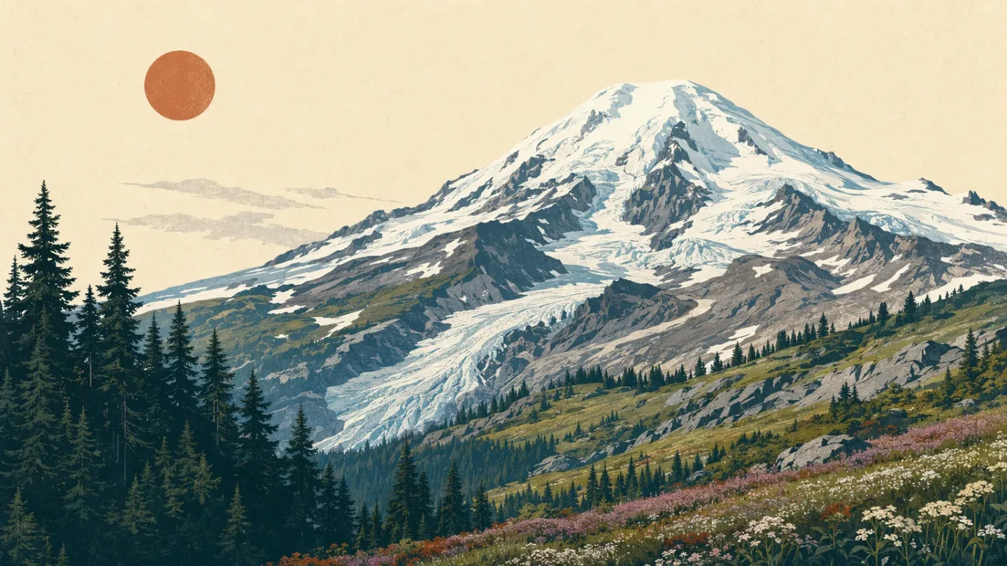
Mount Baker field guide: old-growth forest, subalpine meadows, and glacial summit
A practical Mount Baker field guide tracing Washington's glacier-clad stratovolcano from old-growth forest and flower-filled subalpine meadows to technical summit terrain, with wildlife cues, seasonal timing, and route difficulty.
The quick read
Mount Baker is a 10,781-foot stratovolcano in northern Washington, the highest peak in the North Cascades and the northernmost volcano in the contiguous United States. Its hiking story is a sharp vertical sequence: old-growth forest, subalpine meadows, rocky alpine terrain, then a summit hidden under glaciers. 1
For a nontechnical day in the high country, use the Heather Meadows and Artist Point network. For a summit attempt, reset your expectations: every route to the top is a technical glacier climb, not a strenuous trail hike. 23
| Field note | Practical read |
|---|---|
| Summit | 10,781 ft / 3,286 m; Grant Peak is an ice-covered summit mound over the volcanic crater. <MarkdownCitation index="1" title="Mount Baker |
| Mountain type | Active, glacier-covered andesitic stratovolcano. <MarkdownCitation index="1" title="Mount Baker |
| Best hiking window | Summer into fall; high trails can keep snow into mid-August. <MarkdownCitation index="2" title="Chain Lakes Trail 682 |
| Day-hike rating | Moderate for the Chain Lakes loop in a dry, snow-free season; route-finding, snow, and avalanche terrain can raise it. This is an editorial rating based on the official distance, gain, and conditions. |
| Summit rating | Technical glacier mountaineering. Crevasse-rescue knowledge and glacier-travel experience are required. <MarkdownCitation index="3" title="Mt. Baker Summit - Climbing |
The elevation cross-section
Think of Mount Baker as a compressed Pacific Northwest transect rather than a single summit view.
Lower forest: old growth and moving water. On Heliotrope Ridge Trail 677, the route begins in dense old-growth forest, then climbs past waterfalls and cascading creeks. The canopy thins as the trail rises. 4 This is the cool, wet approach zone: mossy ground, stream crossings, and a steady transition away from trees.
Around 4,200 to 5,160 feet: the subalpine road end. Bagley Lakes Trailhead sits at 4,200 feet, the Heather Meadows Visitor Center at 4,400 feet, and Artist Point at 5,160 feet. 25 Here, lakes and open meadows replace continuous forest. The Forest Service describes Heather Meadows as a rolling subalpine complex of heather and huckleberry, with old mountain hemlocks on the ridges. 6
Above tree line: rock, herbs, snow, and ice. Heliotrope Ridge enters rocky terrain with herbaceous vegetation and unbridged streams above tree line, then reaches a lateral moraine overlooking Coleman and Roosevelt Glaciers. 4 Higher still, the mountain is a glacier system. The USGS identifies Mount Baker as the only U.S. Cascade volcano affected by both alpine and continental glaciation. 1
These are route checkpoints, not hard biological borders. North Cascades National Park Service Complex describes more than 9,000 feet of relief and eight life zones across the wider ecosystem, so aspect, rainfall, exposure, and snowpack can shift the local pattern. 78
Plants to look for
- Mountain hemlock: Heather Meadows includes ridges with mountain hemlocks described as roughly 900 years old. 6
- Heather and huckleberry: These form the signature subalpine meadow texture around the high trail network. Stay on established paths through the meadows. 65
- Avalanche lily: The Forest Service lists avalanche lily (Erythronium montanum) among the recognizable Heather Meadows wildflowers. 6
- Broad-leaf lupine and spreading phlox: Look for these in open subalpine ground around Ptarmigan Ridge and Heather Meadows. 6
The meadows are fragile. The Forest Service has marked areas undergoing meadow repair and asks visitors to remain on established trails. 6
Wildlife cues
Pikas and marmots are among the most likely high-country sightings in the North Cascades, while Columbia black-tailed deer and Douglas squirrels are also common sights in the broader ecosystem. Mountain goats are part of the alpine wildlife picture; wolves, wolverines, and cougars are present but elusive. 9
Treat those sightings as habitat clues, not a checklist. A pika points you toward broken rock and alpine edges; a marmot may be easier to spot near open talus and glacier viewpoints. Keep food and scented items secured in camp, as required on the Forest Service routes, and never approach or feed wildlife. 45
Best season and route choice
For ordinary hiking, aim for summer through fall, with the exact window controlled by snowpack and road access. The Forest Service notes that snow can remain on Chain Lakes slopes into mid-August. Artist Point is typically open to vehicles by early July, but it closes after the first significant snowfall, often between late September and early November. 25
Choose Chain Lakes for a high-elevation loop with subalpine lakes and meadows: the popular loop is about 6 miles with 1,700 feet of total elevation gain and loss. Snow travel, route-finding, and avalanche terrain remain possible outside the stable summer window. 2
Choose Heliotrope Ridge for the forest-to-glacier story. The trail crosses streams and reaches a moraine overlook of Coleman and Roosevelt Glaciers, but the Forest Service warns that stream levels can rise sharply during the day. Turn around if a crossing is unsafe. Never step onto a glacier without proper alpine equipment and experience. 4
Choose the summit only as a mountaineering objective. The Forest Service states that all summit routes are technical glacier climbs and calls for glacier-travel experience, crevasse-rescue knowledge, and safe climbing practice. Spring and summer are the listed climbing seasons, with more limited options in fall and winter. 34
Trail decision
If your goal is to read the mountain in one day, the best match is a summer or early-fall Chain Lakes or Heliotrope Ridge outing, checked against current road, weather, stream, and avalanche conditions. If your goal is the summit, plan for a glacier expedition rather than a hike. Mount Baker rewards the distinction: the same slope can move from flower-filled meadow to crevasse terrain within a single field guide.
参考来源
- 1Mount Baker | U.S. Geological Survey
- 2Chain Lakes Trail 682 | U.S. Forest Service
- 3Mt. Baker Summit - Climbing | U.S. Forest Service
- 4Heliotrope Ridge Trail 677 | U.S. Forest Service
- 5Artist Point Trailhead | U.S. Forest Service
- 6Heather Meadows | U.S. Forest Service
- 7Nature | North Cascades National Park Service
- 8Plants | North Cascades National Park Service
- 9Animals | North Cascades National Park Service
相似内容
- 登录后可发表评论。
More from this channel
- Wheeler Peak field guide: alpine tundra, spruce-fir forest, and Williams Lake
- Pikes Peak field guide: ponderosa pine, alpine tundra, and Barr Trail
- Mount Robson field guide: cedar-hemlock valleys, alpine tundra, and Berg Lake
- Mount Shasta field guide: red fir, alpine meadows, and Avalanche Gulch
- Mount Elbert Field Guide: Lodgepole Forest, Alpine Tundra, and Colorado's High Point
- Mount Marcy field guide: hardwood forests, boreal spruce-fir, and fragile alpine rock
- Mount Mitchell field guide: red spruce, Fraser fir, and the Black Mountain crest
- Mount San Jacinto field guide: desert gradients, pine forest, and alpine meadows