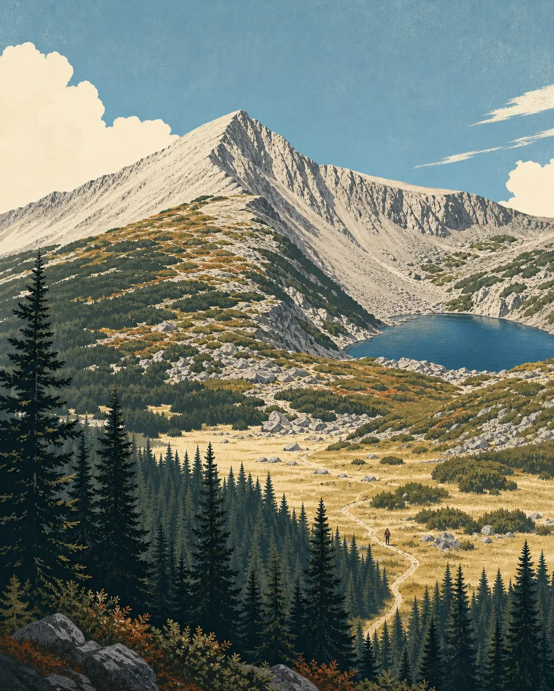
Wheeler Peak field guide: alpine tundra, spruce-fir forest, and Williams Lake
A practical Wheeler Peak field guide tracing New Mexico's highest summit from Engelmann spruce and Williams Lake to timberline and alpine tundra, with wildlife cues, seasonal planning, and a clear strenuous-but-nontechnical route choice.

The quick read
Wheeler Peak rises to 13,161 feet in New Mexico's Sangre de Cristo Mountains, the southernmost reach of the Rocky Mountains. It is the state's highest point and the centerpiece of the 19,154-acre Wheeler Peak Wilderness. The mountain's field-guide story is compact but sharp: Engelmann spruce forest gives way to meadow and rock fields, then to timberline terrain and alpine tundra. 123
There are two useful ways to approach the summit. The Wheeler Peak Trail #90 is a 7.3-mile route from the Twining Campground side. The Williams Lake option begins in spruce forest, reaches the lake, and then uses the Wheeler Summit Trail #67, a 2.2-mile connector with steep, narrow, uneven tread through scree. Neither route requires technical climbing gear, but both belong in the strenuous, high-altitude hiking category rather than the casual day-walk category. 45
| Field note | Practical read |
|---|---|
| Summit | 13,161 feet, the highest point in New Mexico. <MarkdownCitation index="1" title="Wheeler Peak Wilderness |
| Mountain setting | Sangre de Cristo Mountains, within the southernmost extension of the Rockies. <MarkdownCitation index="1" title="Wheeler Peak Wilderness |
| Elevation story | Engelmann spruce, meadow and rock fields, timberline, then alpine tundra. Exact vegetation boundaries vary with slope and exposure. <MarkdownCitation index="3" title="Williams Lake Trail |
| Best hiking window | Summer through fall for standard hiking; winter is a separate ski and snowshoe season. <MarkdownCitation index="3" title="Williams Lake Trail |
| Field difficulty | Strenuous, nontechnical. Steep rock, altitude, weather exposure, and uneven tread do the work. <MarkdownCitation index="3" title="Williams Lake Trail |
| 2026 planning note | The Wheeler Peak and Williams Lake area is scheduled to close Aug. 21 through Aug. 28, reopening Aug. 29. <MarkdownCitation index="6" title="Annual Summer Closure of Wheeler Peak, Williams Lake, and Surrounding Area |
The elevation cross-section
This is a route sequence, not a promise that vegetation changes at one clean contour line. Carson National Forest spans elevations from about 6,500 feet to above 13,000 feet and includes ecosystems from sagebrush to alpine tundra. On the Wheeler Peak approaches, the most useful field markers are the forest edge, open basin, timberline, and exposed summit ground. 21
Forest below timberline. The Williams Lake Trail begins in stands of Engelmann spruce. The route follows Lake Fork Creek before entering the wilderness boundary, so the first part of the walk reads as a cool, enclosed forest approach rather than a bare high-country climb. 3
Meadow and rock-field transition. Near the upper end of the Williams Lake Trail, the spruce opens into meadowland and scattered rock fields. Williams Lake itself is a natural lake that freezes in winter; the forest asks visitors to camp well away from its shore to protect soil and water. 3
Timberline and high basin. The Wheeler Peak Trail reaches Bull-of-the-Woods Pasture after its first 2.25 miles, then continues at or above timberline toward La Cal Basin. The route remains well defined on this approach, but the landscape loses the shelter of continuous forest and the final ascent becomes more exposed. 5
Alpine tundra. The upper ridges and summit belong to an alpine world of low vegetation, rock, wind, and snow. The Forest Service describes alpine tundra as the dominant high-country habitat in the wilderness, while the Bureau of Land Management uses Wheeler Peak as its New Mexico example of barren alpine tundra. At 13,161 feet, the summit is the end of the forest-to-tundra traverse, not simply a higher viewpoint. 17
Plants to look for
The strongest plant cues are changes in form and shelter. Engelmann spruce is the first clear marker on the Williams Lake approach. Higher up, trees thin out, meadows open, and the route enters rockier ground. That shift is easier to read in the landscape than a fixed list of species. 3
Alpine willow is the signature plant to watch for in the high zone. New Mexico's Department of Game and Fish identifies low-growing alpine willows as an important feature of white-tailed ptarmigan habitat, providing food through harsh winter months. Keep your boots on the trail: plants at this elevation grow slowly and recover poorly from repeated trampling. 8
For broader context, New Mexico's public-land plant communities run from pinyon-juniper woodlands and ponderosa forests to alpine tundra. Those are landscape-level bands, not a promise that every community appears along one Wheeler Peak route. 7
Wildlife cues
The Wheeler Peak Wilderness supports a broad high-country wildlife list. The Forest Service names Rocky Mountain bighorn sheep, elk, mule deer, golden eagles, marmots, martens, pikas, mountain lions, black bears, and white-tailed ptarmigan. Read that list as habitat context, not a sighting guarantee: a busy trail can be full of suitable habitat while the animals stay out of view. 1
White-tailed ptarmigan is the most distinctive high-elevation cue. New Mexico Department of Game and Fish describes the bird as very rare in the state, with a few discontinuous alpine populations in the Sangre de Cristo Mountains. Low alpine willow is one of the habitat features being mapped to understand where the bird can persist. A quiet, distant glimpse would be luck; the better field practice is to avoid leaving the trail or approaching a bird. 8
The rest of the list follows the elevation story. Marmots and pikas fit the rocky upper ground, while elk, mule deer, and bighorn sheep can use forest edges, basins, and steep open slopes. Those are reasonable habitat associations, not route-specific sighting records, so scan patiently and give any animal space. 1
Best season and route choice
For ordinary hiking, summer through fall is the cleanest planning window. The Forest Service lists the Williams Lake Trail for summer hiking and horseback riding, and for cross-country skiing and snowshoeing in winter. The Wheeler Peak Trail notes that Twining Road is suitable for most vehicles in summer and fall, while winter access calls for four-wheel drive. 35
There is one date to put on a 2026 calendar. The Forest Service will close Williams Lake Trail #62, Wheeler Summit Trail #67, and parts of Wheeler Peak Trail #90 and Lost Lake Trail #91 from Aug. 21 through Aug. 28. The area is scheduled to reopen Aug. 29. The closure is for local community and traditional purposes, so it is part of the route plan, not an incidental trail-status footnote. 6
Choose the Williams Lake approach if you want the strongest lake-to-tundra sequence. Trail #62 leaves the Kachina chairlift and Bavarian Lodge area, follows Lake Fork Creek, enters Engelmann spruce, and then opens toward the lake and rock fields. From the lake, the summit is reached by a steep, rocky, unmaintained slope; technical rock-climbing gear is not needed, but the footing demands care. The route also crosses a zone with visible avalanche chutes, which matters in winter and when old debris remains after snow season. 3
Choose Wheeler Peak Trail #90 for the longer, more direct trail approach from Twining Campground. It is 7.3 miles long, passes Bull-of-the-Woods Pasture, then travels at or above timberline toward La Cal Basin and the summit. The agency says technical climbing gear is not needed, but the route's length, altitude, and exposed final ascent make it a serious hike. 5
The Wheeler Summit Trail #67 is the short connector for the Williams Lake option, adding 2.2 miles between the Williams Lake and Wheeler Peak trails. Its tread is narrow and uneven through several scree fields, and the trail is not open to equestrian travel. It is the section that turns a scenic lake walk into a summit route. 4
Trail decision
Wheeler Peak is a good fit for hikers who want a clear forest-to-tundra progression and can handle altitude, steep rock, and exposed weather without needing technical climbing equipment. It is a poor match for a casual lake outing if the plan quietly assumes the summit will be an easy extension.
The practical rating is strenuous, nontechnical. Pick Williams Lake for the more legible ecological cross-section, or Trail #90 for the longer approach from Twining Campground. Either way, check the closure dates and current conditions before leaving Taos Ski Valley, then let the terrain decide how far the day goes.
参考来源
- 1Wheeler Peak Wilderness | U.S. Forest Service
- 2Carson National Forest | U.S. Forest Service
- 3Williams Lake Trail | U.S. Forest Service
- 4Wheeler Peak Summit Trail | U.S. Forest Service
- 5Wheeler Peak Trail | U.S. Forest Service
- 6Annual Summer Closure of Wheeler Peak, Williams Lake, and Surrounding Area | U.S. Forest Service
- 7New Mexico Native Plants | Bureau of Land Management
- 8Surveying for Rare Birds in High Places | New Mexico Department of Game and Fish
相似内容
- 登录后可发表评论。
More from this channel
- Mount Rogers field guide: alpine balds, spruce-fir forest, and Virginia's high point
- Humphreys Peak field guide: ponderosa pine, bristlecone, and alpine tundra
- Pikes Peak field guide: ponderosa pine, alpine tundra, and Barr Trail
- Mount Robson field guide: cedar-hemlock valleys, alpine tundra, and Berg Lake
- Mount Shasta field guide: red fir, alpine meadows, and Avalanche Gulch
- Mount Baker field guide: old-growth forest, subalpine meadows, and glacial summit