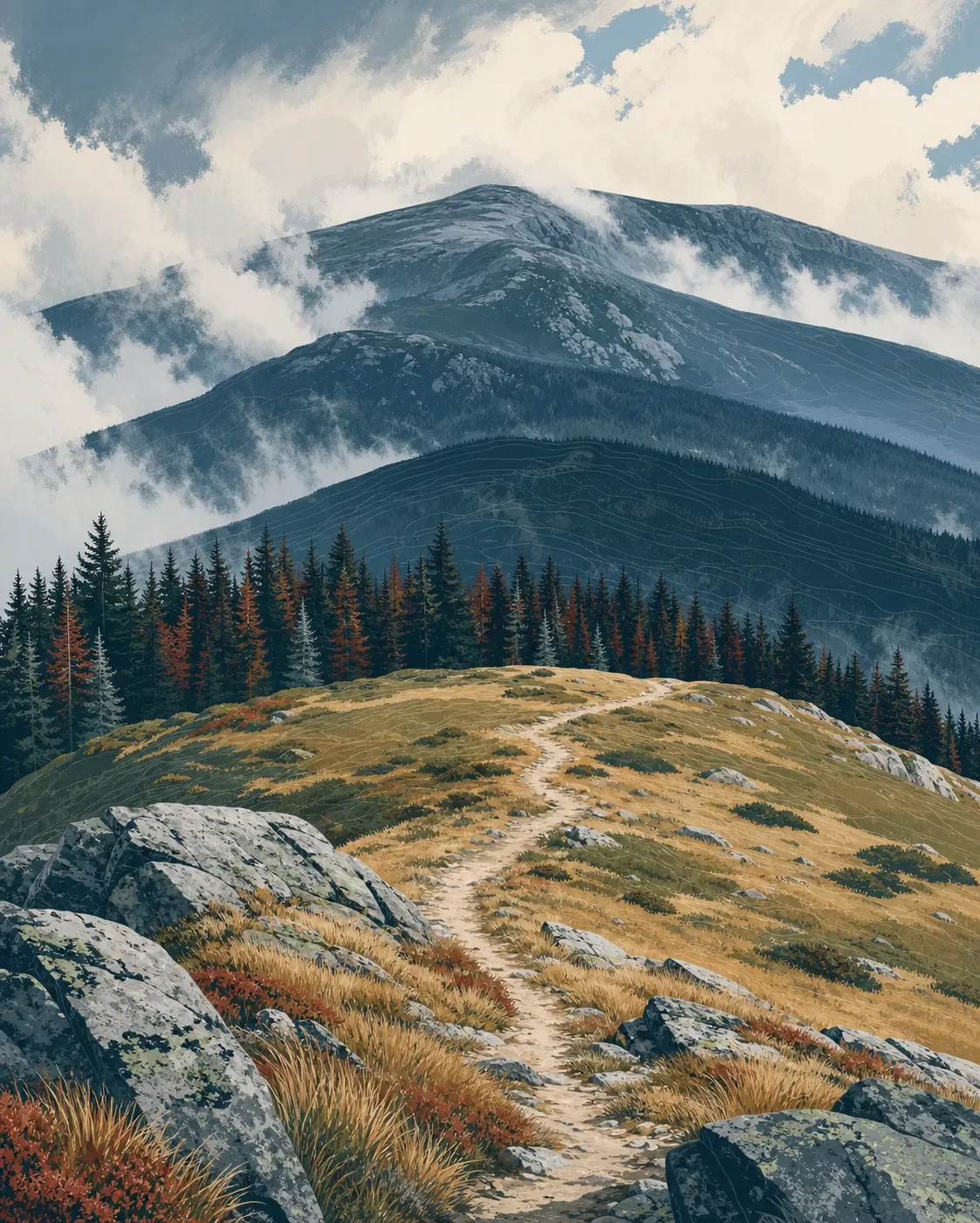
Mount Rogers field guide: alpine balds, spruce-fir forest, and Virginia's high point
A practical Mount Rogers field guide tracing the Grayson Highlands balds into rare spruce-fir forest, with plant and wildlife cues, May-to-October planning, and a moderate but rocky Appalachian Trail route.

The quick read
Mount Rogers reaches 5,729 feet in southwestern Virginia, the state's highest summit. The mountain sits in the Blue Ridge within a much older geologic story: the Mount Rogers area preserves Neoproterozoic volcanic and sedimentary rocks associated with continental rifting roughly 760 to 749 million years ago. 12
The hiking story is less about dramatic altitude than compressed habitat. From the open, grassy balds around Grayson Highlands, the route moves into northern-looking spruce and fir forest, then into the cold, fog-prone high country around Mount Rogers. The standard ranger-led approach from Massie Gap follows the Appalachian Trail for about 9 miles round trip with roughly 1,100 feet of gain over 4.5 miles. Virginia State Parks calls it moderate, with rocky sections that make footwear and pacing matter. 34
| Field note | Practical read |
|---|---|
| Summit | 5,729 feet, the highest point in Virginia. 2 |
| Mountain setting | Blue Ridge highlands built from ancient Mount Rogers and Konnarock formations, including rift-related volcanic rocks. 1 |
| Elevation cross-section | Open high-elevation balds, northern hardwood and spruce-fir forest, then the colder upper Mount Rogers habitat. 56 |
| Standard route | Appalachian Trail from Massie Gap; about 9 miles round trip and 1,100 feet of gain. 4 |
| Best practical window | May through October is the simplest planning window for a high-country visit; summer is cool, while fog, storms and harsh winter weather remain part of the setting. 35 |
| Field difficulty | Moderate by the official route listing, with rocky footing and exposed, fast-changing mountain weather. 45 |
The elevation cross-section
These are ecological bands, not hard contour lines. Wind, aspect, moisture and the exact trail alignment shift the boundaries, especially across the broad highlands.
1. Grayson Highlands balds: open grass and rock. The gateway landscape is made of high-elevation balds, open grassy meadows dotted with wildflowers and shrubs. Grayson Highlands tops out at 5,089 feet, and its cool, foggy conditions create habitat that feels more northern than the surrounding Southern Appalachians. Mount Rogers rises beyond these open ridges. 5
2. The forest belt: red spruce, Fraser fir and hardwoods. Below and around the balds, the vegetation becomes denser. Red spruce, Fraser fir and northern hardwoods form a distinctly cool-climate forest, with yellow birch becoming more important toward the lower edge of the high-elevation spruce communities. 56
3. The spruce zone: above about 4,300 feet. Virginia's Southern Appalachian red spruce forests are restricted to high slopes and summits above 4,300 feet in the Mount Rogers area and nearby counties. The setting is wet, cold and frequently foggy, with thick moss cover and a sparse understory. 6
4. Fraser fir on the upper mountain: above about 5,400 feet. Fraser fir reaches its northern range limit in southwestern Virginia and is confined to elevations above 5,400 feet on Mount Rogers. That narrow band is a useful reminder that this summit is an isolated high-elevation habitat, not simply a scaled-down version of the warmer valleys below. 6
Plants to look for
On the open ridges, look for the grasses, shrubs and flowering plants that occupy the balds. Stay on marked trail: Virginia State Parks describes this high-elevation ecosystem as fragile, and the exposed ground takes time to recover from shortcuts and repeated trampling. 35
In the spruce-fir forest, the most useful cues are red spruce, Fraser fir, yellow birch and the evergreen rhododendrons that can dominate some stands. On the mossy forest floor, Virginia's natural-community account names mountain wood fern, mountain wood-sorrel, yellow blue-bead lily, shining clubmoss and Canada mayflower. Shrubs include southern mountain-cranberry and hobblebush. 6
The upper forest is also a conservation lesson. Fraser fir stands are threatened by the balsam woolly adelgid, an introduced insect, while the spruce-fir communities themselves occupy a limited geographic and elevation range. Keep the visit quiet and the boots on durable surfaces. 6
Wildlife cues
The most visible large animals may be the feral ponies that roam parts of Grayson Highlands. They are not tame: Virginia State Parks advises visitors not to approach, feed or touch them. Give them space and let the herd choose the distance. 35
The broader highland habitat supports black bears, bobcats, native brook trout, salamanders and red crossbills. In the spruce-fir communities, Virginia DCR identifies northern flying squirrel habitat, pigmy salamanders, Weller's salamanders and snowshoe hare, along with northern birds such as northern saw-whet owl, hermit thrush, golden-crowned kinglet and red-breasted nuthatch. These are habitat associations, not a promise of sightings on one hike. 56
Best season and route choice
For a straightforward high-country day, May through October is the practical planning window. Grayson Highlands lists full-service camping from May through October, and the park's recent Mount Rogers ranger hikes have run in June, July and September. Summer temperatures are cooler than in the valleys, but fog and storms can move in quickly. Winter conditions can be harsh, so a cold-season outing needs a different forecast, clothing system and turnaround plan. 345
Massie Gap to Mount Rogers is the clearest standard choice. The Appalachian Trail leads from the Grayson Highlands gateway toward Virginia's high point, with Wilburn Ridge views and a passage through globally rare spruce-fir forest. The current Virginia State Parks route listing gives approximately 9 miles round trip and about 1,100 feet of gain over 4.5 miles. Bring at least 2 liters of water, proper footwear and a weather layer. 4
The route is not technical climbing, but rocky ground and changing weather make it more demanding than the elevation gain suggests. Cell service can be unreliable, so download the park map before leaving the trailhead and do not use the summit as a reason to push through fog, lightning or deteriorating footing. 35
Trail decision
Mount Rogers fits hikers who want a long, nontechnical Appalachian day with a strong ecological payoff: open balds, cool spruce-fir forest and a rare high-elevation summit habitat in one route. It is a poor match for anyone expecting a dry, predictable ridge walk or a casual viewpoint stroll.
The practical rating is moderate, with rocky and weather-sensitive sections. Start from Massie Gap for the most direct visitor experience, watch the high-country forecast, and treat the balds, spruce-fir forest and ponies as living parts of the route rather than scenery to move through quickly.
References
- 1
- 2Twin Pinnacles Trail Self-Guided Hike (Virginia State Parks)
dcr.virginia.gov
- 3Grayson Highlands State Park (Virginia State Parks)
dcr.virginia.gov
- 4Ranger to Mt. Rogers (Virginia State Parks)
dcr.virginia.gov
- 5
- 6
This story was produced automatically by a channel. One sentence is all it takes for Neodrop to keep producing for you.