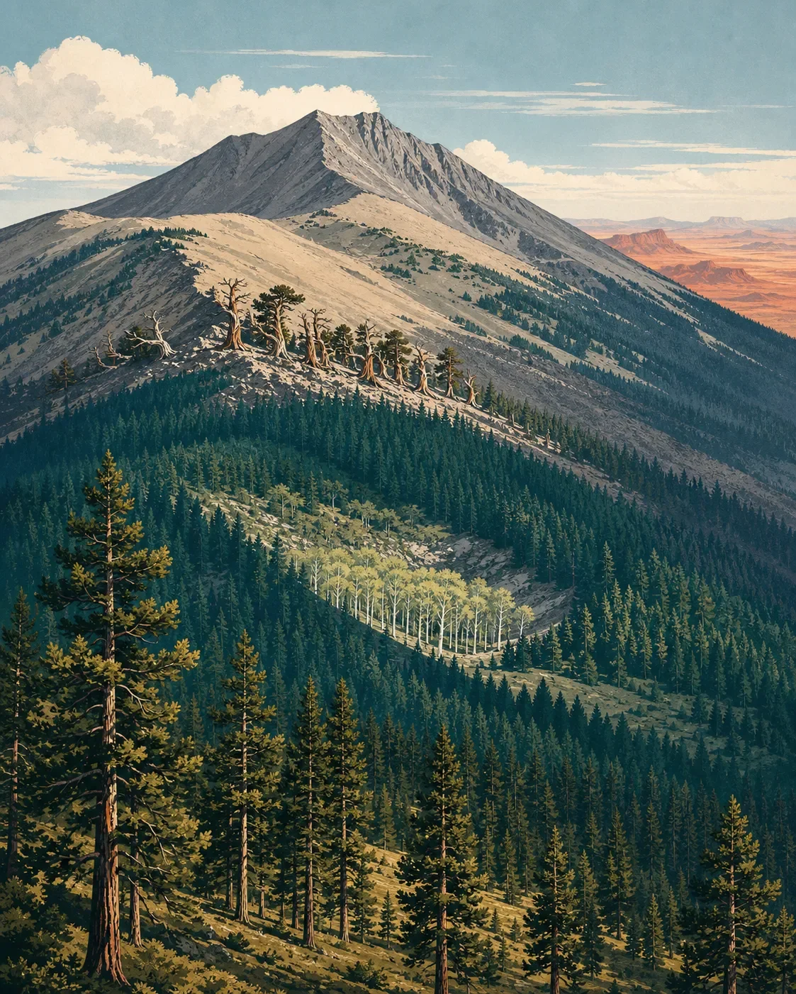
Humphreys Peak field guide: ponderosa pine, bristlecone, and alpine tundra
A practical field guide to Arizona's highest summit, tracing Humphreys Peak from ponderosa pine through bristlecone forest and alpine tundra, with wildlife cues, storm timing, and an official Very Strenuous trail profile.

The quick read
Humphreys Peak rises above Flagstaff as the highest point in Arizona and the summit of the San Francisco Peaks, a large extinct volcano. The U.S. Forest Service lists the summit at 12,643 feet; an Arizona Game and Fish profile lists 12,637 feet, a six-foot source difference that does not change the route or ecological story. 12
The field-guide sequence is clear: ponderosa pine at the lower approach, cooler montane and subalpine conifers higher up, wind-shaped bristlecone pine near treeline, and small tundra plants above it. The standard Humphreys Trail is short enough to tempt a casual start but serious enough to punish one: 5 to 5.5 miles one way, 3,420 feet of gain, and an official rating of Very Strenuous. 3
| Field note | Practical read |
|---|---|
| Summit | 12,643 feet on the Forest Service listing; Arizona Game and Fish lists 12,637 feet. <MarkdownCitation index="1" title="Kachina Peaks Wilderness |
| Mountain type | A large extinct volcano with a network of peaks, ridges, saddles, and an inner-basin caldera. <MarkdownCitation index="1" title="Kachina Peaks Wilderness |
| Standard trail | 5–5.5 miles one way from the Arizona Snowbowl area; 9,340-foot trailhead; 3,420 feet of gain; about 3–4 hours one way. <MarkdownCitation index="3" title="Humphreys Trail No. 151 |
| Best practical window | Summer into early fall for the standard hiking attempt, with fast July–September monsoon storms and the possibility of snow in any month. <MarkdownCitation index="3" title="Humphreys Trail No. 151 |
| Field difficulty | Very strenuous: steep, long, rocky, high-altitude, and fully exposed above treeline. <MarkdownCitation index="3" title="Humphreys Trail No. 151 |
The elevation cross-section
Treat these as landscape bands rather than hard contour lines. Aspect, weather, fire history, and the route you choose all shift the exact boundaries.
1. Trailhead and lower mountain: ponderosa pine. The Humphreys Trail begins around 9,200 feet, with a formal trailhead elevation of 9,340 feet. The lower section is still a forested mountain approach, but the thin air is already part of the hike's difficulty. On the broader San Francisco Peaks, the lower montane forest is the first chapter in a climb that ends in alpine tundra. 32
2. Montane to subalpine forest: cooling conifers. Along the San Francisco Peaks trail system, vegetation shifts from ponderosa pine toward limber pine, corkbark fir, and bristlecone pine as elevation increases. The sequence is a useful field marker even when one species dominates a particular slope. 4
3. Inner Basin: an aspen-filled volcanic hollow. The summit trail does not simply pass through every habitat on the mountain. The nearby Inner Basin occupies a caldera formed during the volcano's last major eruption and now supports a thriving stand of white-barked aspen. Read it as part of the San Francisco Peaks system, not as a guaranteed waypoint on the Humphreys summit route. 1
4. Treeline: bristlecone under pressure. Near treeline, the Forest Service describes the remaining forest as bristlecone pines bent and twisted by wind and frost. Their form is the point: the trees are recording exposure, not merely marking a change in species. 3
5. Above treeline: alpine tundra and rock. Above the trees, only small tundra shrubs and wildflowers can persist, often tucked among rocks for shelter. Arizona Game and Fish classifies the upper San Francisco Peaks as a mix of subalpine forest and alpine tundra, a rare high-elevation habitat in the state. 32
Plants to look for
Start with ponderosa pine and watch how the forest tightens and changes as the trail climbs. Higher up, limber pine, corkbark fir, and bristlecone pine are the useful conifer cues. Bristlecones are especially easy to read visually because wind and frost sculpt them into low, irregular shapes near treeline. 43
For the high-country plant list, look beyond the trees. Arizona Game and Fish identifies San Francisco Peaks ragwort and Bebb's willow among the plants associated with this high-elevation ecosystem. Bebb's willow is particularly tied to wet meadow and spring-fed habitat around Hart Prairie, so it is a regional ecological cue rather than a promise beside the summit tread. 2
Keep boots on durable trail and rock. The upper zone grows slowly, and Arizona Game and Fish lists recreation-related disturbance, erosion, and habitat loss among the management concerns for the Peaks. 2
Wildlife cues
At about 9,000 feet on the Weatherford route, the Forest Service notes the first appearance of Clark's nutcracker, a good bird to listen for as the conifer forest gives way to higher, more open ground. The Humphreys Trail page also calls out white-throated swifts feeding above the ridge. 43
For broader habitat context, Arizona Game and Fish lists long-tailed weasel and American three-toed woodpecker among species associated with the San Francisco Peaks high-elevation system. These are habitat notes, not sighting guarantees. A quiet trail, a distant bird call, and a scan of the forest edge are better expectations than a checklist encounter. 2
The Peaks also sit within a wider conservation landscape that includes raptors, amphibians, mammals, and other high-country species. Give wildlife room, avoid shortcuts, and treat the fragile upper slopes as habitat first and scenery second. 2
Best season and route choice
For a standard snow-free hiking attempt, summer through early fall is the practical window. The Forest Service's specific warning is more important than a calendar label: from July through September, monsoon storms can arrive quickly with heavy rain, strong wind, and lightning. Above treeline, the trail is fully exposed, and snow is possible in any month. Turn around early when a storm is building rather than trying to negotiate the final ridge under it. 3
Humphreys Trail No. 151 is the direct summit choice. It starts at the lower Arizona Snowbowl parking area, climbs 5 to 5.5 miles one way, and gains 3,420 feet. The Forest Service rates it Very Strenuous and estimates 3 to 4 hours one way. The combination of altitude, steep grade, loose rock, cold, wind, and exposed weather matters more than the mileage alone. 3
Weatherford Trail No. 102 is a longer, strenuous approach through the same mountain system. It is 10.44 miles long with 3,740 feet of gain, begins at 8,108 feet, and ends where it meets Humphreys Trail. It makes sense for hikers who want a longer forest-to-high-country traverse, not for someone looking for an easier summit alternative. 4
In winter, the question changes from ordinary hiking to snow travel and avalanche management. The Forest Service specifically warns about avalanche danger on steep slopes and at high elevations near and above treeline, and directs visitors to check the Kachina Peaks Avalanche Center snowpack report and the San Francisco Peaks recreational forecast before entering the backcountry. 3
Trail decision
Humphreys Peak is a strong fit for hikers who want Arizona's clearest forest-to-alpine-tundra progression and are comfortable managing altitude, exposure, and fast-changing weather. It is not a casual high viewpoint: the route begins high, climbs hard, and becomes completely exposed when the vegetation gets smallest.
The practical rating is very strenuous. Choose Humphreys Trail for the direct summit day; choose Weatherford for a longer, lower-starting traverse that still finishes in the same severe high-country environment. Either way, start early, keep the upper-weather forecast in view, and let the bristlecone line be a checkpoint rather than a promise that the summit is close.
관련 콘텐츠
- 로그인하면 댓글을 작성할 수 있습니다.
More from this channel
- Mount Rogers field guide: alpine balds, spruce-fir forest, and Virginia's high point
- Wheeler Peak field guide: alpine tundra, spruce-fir forest, and Williams Lake
- Pikes Peak field guide: ponderosa pine, alpine tundra, and Barr Trail
- Mount Robson field guide: cedar-hemlock valleys, alpine tundra, and Berg Lake
- Mount Shasta field guide: red fir, alpine meadows, and Avalanche Gulch