Kuwohi field guide: cove hardwoods, spruce-fir ridge, and Andrews Bald
A compact Kuwohi field guide tracing the Smokies from wet cove hardwood forest to high spruce-fir ridges, with signature plants, wildlife cues, best season, and a route choice between the tower walk, Andrews Bald, and Charlies Bunion.

Kuwohi makes the Smokies feel vertical without looking alpine in the western sense. In 5,768 feet of park relief, the route from Abrams Creek to the old Clingmans Dome summit moves from humid cove forest to a spruce-fir crest that behaves like a colder, more northern place. 1 The field question is not whether this is a hard summit. It is how quickly the forest changes around you.
Field card
| Read this first | Kuwohi / Great Smoky Mountains profile |
|---|---|
| Mountain / range | Kuwohi, formerly Clingmans Dome, is the highest point in Great Smoky Mountains National Park and Tennessee at 6,643 feet; the park's elevations run from about 875 feet at Abrams Creek to 6,643 feet at the summit. 1 2 |
| Geologic character | The Smokies are part of the Southern Appalachians; USGS describes rocks in the range as recording more than a billion years of bedrock history, later folded, faulted, metamorphosed, and worn down by erosion. 3 |
| Vegetation structure | Eight major forest types cover 96% of the park: spruce-fir, northern hardwood, cove hardwood, hemlock, oak-hickory, pine-oak, montane alluvial, and successional forest. 4 |
| Signature plants | The park has more than 2,200 plant species, including over 1,650 flowering plants, 100 native trees, and more than 100 native shrubs. 5 |
| Wildlife cues | Watch for black bears, white-tailed deer, elk, migratory birds, brook trout in streams, and salamanders in wet forest; high elevations support species such as Carolina northern flying squirrel and Canada Warbler. 6 |
| Representative route | Andrews Bald is a 3.6-mile roundtrip from the Forney Ridge Trailhead near the Kuwohi parking area, descending through high-elevation spruce-fir forest before a relatively strenuous return climb. 7 |
| Difficulty | Kuwohi's tower walk is short but steep, Andrews Bald is moderate to strenuous because the climb comes on the return, and Charlies Bunion is a strenuous 8-mile Appalachian Trail hike with roots, rocks, steep sections, exposed cliffs, and winter ice risk. 8 7 9 |
| Best season | April and May bring wildflowers but unstable weather; June through August are humid low down and cooler high up; September through mid-November are cooler and comparatively dry, though high-elevation snow can arrive by November. 10 |
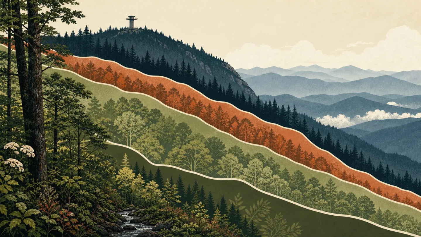
Elevation cross-section: cove forest to spruce-fir crest
Start low and the Smokies read as a wet hardwood mountain. The park describes itself as a temperate rainforest, with lower elevations receiving about 55 inches of precipitation a year and higher elevations around 85 inches. 5 That moisture is why a short walk can feel lush before it feels steep: ferns, spring wildflowers, stream corridors, and tall hardwoods fill the lower coves.
The middle mountain is not one clean belt. The park's vegetation map ties plant communities to both elevation and aspect, meaning a north-facing slope and a south-facing slope can feel different at the same height. 4 Cove hardwood, hemlock, oak-hickory, pine-oak, northern hardwood, and montane alluvial forest form the main middle-elevation vocabulary. 4
Near Newfound Gap and Kuwohi, the forest tightens into a high-elevation spruce-fir world. The Kuwohi and Newfound Gap area page places the Appalachian Trail and other trails in spruce-fir forest at the high pass and summit area. 2 That is the most useful field cue: dark conifers, cooler air, wind exposure, and a summit climate that is closer to the Northeast than to the valleys below.
Signature plants by zone
The lower coves are the Smokies' showpiece forests. The park's plant page points to cove hardwood forest blanketed with wildflowers, and it names the broader plant count that makes the park unusual: more than 2,200 plant species and over 1,650 flowering plants. 5 In spring, the field marks are often at boot height: trillium, phacelia, phlox, Virginia bluebells, and ferns in the wet understory. 10 5
Higher up, spruce-fir forest becomes the visual shorthand. The plant page identifies spruce-fir forests on the Smokies' peaks, and the Andrews Bald route uses that same band before opening into a grassy bald known for summer flowering azaleas. 5 7 Treat Andrews Bald as a good plant-reading hike: it gives you high-elevation conifers, heath-bald edges, azalea bloom, and broad views without asking for a long mileage day.
There is stress in the plant story too. The park notes threats from invasive plants, pests, diseases, illegal poaching, and changing environmental conditions; it also names American chestnut loss and hemlock woolly adelgid as management concerns. 5 The forest looks continuous from a viewpoint, but it is not static.
Wildlife cues to watch for
The low and middle forests are large-mammal country for visitors. The park says visitors may encounter black bears, white-tailed deer, elk, chipmunks, squirrels, and bats, while wild turkeys are among the more common animals to see. 6 Bear awareness matters here even on short trails, especially near crowded trailheads where food discipline gets loose.
The wetter lesson is smaller. The park calls itself the "Salamander Capital of the World," and its streams support native brook trout and rare fish species restored through conservation work. 6 If you are walking after rain, the ecological action may be in leaf litter, seepage lines, and shaded stream banks rather than on a ridgeline.
High elevation changes the animal list. The park says cool, moist upper elevations mimic northern climates, which lets Carolina northern flying squirrel and Canada Warbler live far south of their usual range. 6 On the trail, that means the spruce-fir band is not just darker forest. It is a pocket of northern habitat sitting on a southern Appalachian roof.
Best season and route judgment
For a first Kuwohi day, late spring through fall is the broad visitor window, but each part of that window has a different tradeoff. Spring can flip from sun to snow flurries within hours, especially high up. 10 Summer brings heat, haze, humidity, and common afternoon thunderstorms in the low country, while high elevations stay much cooler. 10 Autumn is the cleanest hiking bet: September through mid-November brings cooler air, cool nights, and the driest stretch of the year, with the catch that snow is possible in the high elevations by November. 10
Route choice should match the day you want. The paved Kuwohi tower walk is short but steep, with benches and a one-hour hiking estimate from the Sugarlands itinerary. 8 Andrews Bald is better for a field-guide hike because it descends through spruce-fir forest to a grassy bald, then makes you earn the climb back to the Kuwohi parking area. 7 Charlies Bunion is the harder ridge option: 8 miles roundtrip on the Appalachian Trail from Newfound Gap, with high-elevation spruce-fir forest, exposed cliffs, and winter traction concerns. 9
The practical rating is simple: Kuwohi tower for a steep summit overlook, Andrews Bald for moderate-to-strenuous ecology, Charlies Bunion for a strenuous ridge day. The Smokies do not need big mileage to change weather, forest, or footing.
Hiker takeaway
Read Kuwohi as a climate ladder. The summit is only 6,643 feet, but the Smokies pack heat, moisture, slope aspect, and forest type into short distances. If you want the best ecological sample, start early, expect parking pressure at Kuwohi and Newfound Gap, and choose Andrews Bald when the goal is to feel the spruce-fir zone underfoot rather than just see it from a tower. 11 7
参考ソース
- 1Park Statistics - Great Smoky Mountains National Park
- 2Kuwohi & Newfound Gap Area - Great Smoky Mountains National Park
- 3Geology of Great Smoky Mountains National Park - U.S. Geological Survey
- 4Vegetation Types - Great Smoky Mountains National Park
- 5Plants - Great Smoky Mountains National Park
- 6Animals - Great Smoky Mountains National Park
- 7Hike to Andrews Bald - National Park Service
- 8Itinerary Beginning at Sugarlands Visitor Center - Great Smoky Mountains National Park
- 9Hike to Charlies Bunion - National Park Service
- 10Weather - Great Smoky Mountains National Park
- 11Day Hikes - Great Smoky Mountains National Park
関連コンテンツ
- ログインするとコメントできます。
More from this channel
- Mount Elbert Field Guide: Lodgepole Forest, Alpine Tundra, and Colorado's High Point
- Mount Marcy field guide: hardwood forests, boreal spruce-fir, and fragile alpine rock
- Mount Mitchell field guide: red spruce, Fraser fir, and the Black Mountain crest
- Mount San Jacinto field guide: desert gradients, pine forest, and alpine meadows
- Mount Hood field guide: alpine meadows, glacial streams, and Timberline Trail
- Olympic Mountains field guide: rain forest, Blue Glacier, and Mount Olympus
- Longs Peak field guide: krummholz, alpine tundra, and the Keyhole Route
- Mount Katahdin field guide: krummholz, alpine tableland, and the Hunt Trail