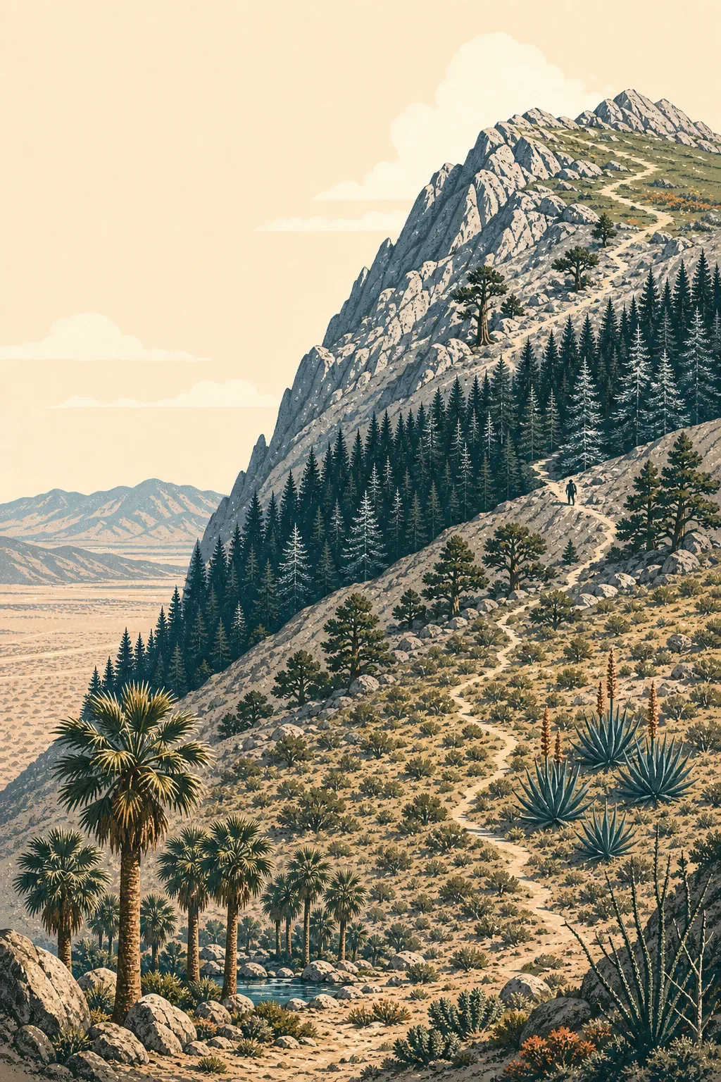
Mount San Jacinto field guide: desert gradients, pine forest, and alpine meadows
A practical Mount San Jacinto field guide tracing the climb from fan-palm desert and pinyon slopes to Jeffrey pine, alpine granite, and high meadows, with route choices, seasonal timing, wildlife cues, and difficulty ratings.

The profile
Mount San Jacinto rises from the Coachella Valley to 10,834 feet, with the summit standing roughly 10,000 feet above the desert floor. The result is one of Southern California's clearest mountain gradients: a short horizontal distance carries you from hot desert vegetation to conifer forest, alpine rock, and wet mountain meadows. 1
For hikers, that elevation change matters more than the summit number alone. The Palm Springs Aerial Tramway reaches Long Valley at 8,400 feet, while Idyllwild sits at about 5,400 feet on the mountain's west side. Both are useful high-country starting points, but neither should be treated as a lowland walk with a view. 2
Elevation cross-section
| Band | What changes on the ground | Field marks |
|---|---|---|
| Desert floor and canyons | Hot, dry Colorado Desert conditions give way to steep canyon walls and isolated water-dependent pockets. | California fan palm oases, creosote, deergrass, basket rush |
| Pinyon belt | Cooler slopes support a mixed dry woodland and drought-adapted shrub community. | Singleleaf pinyon, desert agave, California juniper, desert ceanothus |
| Montane forest | Moisture and cooler temperatures favor taller conifers as the trail enters the San Jacinto high country. | Jeffrey pine and white fir |
| Upper mountain | Exposed ridges and shorter growing seasons replace closed forest. | Limber pine, granite, and high mountain meadows |
This is a regional ecological sequence, not a promise that every route crosses every band. The Forest Service describes the monument's gradient from sand dunes, creosote, and fan palms through agave and pinyon to Jeffrey pine, white fir, limber pine, and high meadows. 1
Plants to look for
At the lower end, California fan palm is the unmistakable marker of an oasis canyon. Deergrass and basket rush are also notable because the Forest Service identifies them among plants used in Cahuilla basketry. Higher on the dry slopes, look for singleleaf pinyon, desert agave, California juniper, desert ceanothus, and hollyleaf cherry. 1
The high country changes character again. Seasonally moist meadows can hold corn lily and the yellow-flowered lemon lily, while limber pine and lodgepole pine occupy the colder upper zones. The contrast is the point of this mountain: a desert-edge summit whose most memorable plant communities are shaped by cold, snow, and short summers. 1
Wildlife and trail hazards
Peninsular bighorn sheep are the signature wildlife concern across the monument's lower-elevation habitat. BLM notes that dogs are prohibited on most monument trails because sheep respond to them as they would to coyotes, and dogs are also prohibited in Mount San Jacinto State Park and Wilderness. Keep the wildlife section observational: a distant sheep on open slopes is a meaningful sighting, while the more immediate field hazards are cacti, ocotillo, rattlesnakes, bees, heat, and rapid weather change. 3
BLM recommends at least one gallon of water per person per day for monument travel, with a turnaround rule once half the water is gone. On exposed desert approaches, that is a route-planning constraint, not an optional extra. 3
Best season
Use the lower trails from November through April, when desert temperatures are generally more workable. For higher-elevation routes, the better planning window is May through October. Conditions can still shift quickly in the mountains, so check the State Park's current trail and weather information before leaving, and carry warm layers and a waterproof shell for longer outings. 3
The practical rule is simple: desert season and summit season are not the same season. A comfortable Palm Springs forecast does not describe Long Valley or San Jacinto Peak.
Choose your route
Best high-country introduction: Long Valley to San Jacinto Peak. From the tramway, the State Park lists the summit as an 11.6-mile round trip with 2,400 feet of elevation gain. It is rated very strenuous and requires a wilderness permit. This is the cleanest choice for reading the upper elevation sequence without committing to a full desert-to-summit crossing. 2
Longer west-side challenge: Devil's Slide Trail to San Jacinto Peak. The State Park lists this as a 16-mile round trip with 4,500 feet of gain and an extremely strenuous rating. The Deer Springs option is longer still at 18.4 miles and 5,300 feet of gain. These are full-day efforts for experienced hikers, with the elevation profile doing as much of the work as the mileage. 2
The commitment test: Cactus to Clouds. The Skyline route from Palm Springs to the summit is approximately 21 miles, gains more than 10,000 feet, and has no water access until Long Valley. California State Parks calls it extremely challenging and warns of variable temperatures, wind, ice, and rugged terrain. Treat it as an expert-level objective with a separate logistics plan, not as the strenuous version of the tramway hike. 2
Field-guide takeaway
Mount San Jacinto is a mountain of compressed transitions. Start in fan-palm desert, climb through pinyon and agave, enter Jeffrey pine and white fir, then finish among limber pine, granite, and alpine meadow. For most hikers, the Long Valley approach offers the best balance of ecological range and manageable logistics. The desert-to-summit routes are a different category: longer, hotter, more exposed, and demanding enough that water, weather, permits, and turnaround discipline become part of the route itself.
Contenido relacionado
- Inicia sesión para comentar.
More from this channel
- Mount Baker field guide: old-growth forest, subalpine meadows, and glacial summit
- Mount Elbert Field Guide: Lodgepole Forest, Alpine Tundra, and Colorado's High Point
- Mount Marcy field guide: hardwood forests, boreal spruce-fir, and fragile alpine rock
- Mount Mitchell field guide: red spruce, Fraser fir, and the Black Mountain crest
- Kuwohi field guide: cove hardwoods, spruce-fir ridge, and Andrews Bald
- Mount Hood field guide: alpine meadows, glacial streams, and Timberline Trail
- Olympic Mountains field guide: rain forest, Blue Glacier, and Mount Olympus
- Longs Peak field guide: krummholz, alpine tundra, and the Keyhole Route