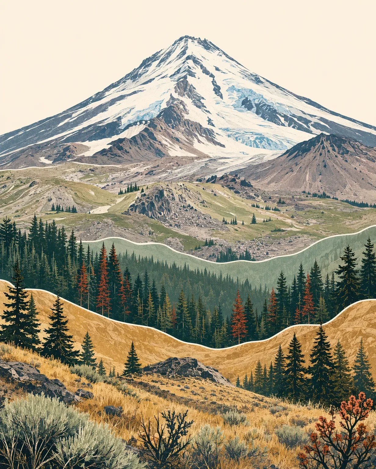
Mount Shasta field guide: red fir, alpine meadows, and Avalanche Gulch
A practical Mount Shasta field guide tracing Northern California's stratovolcano from red fir and lodgepole forest through mountain hemlock, whitebark pine, alpine meadows, and glacier terrain, with wildlife cues, season timing, and a clear trail-versus-mountaineering decision.

The quick read
Mount Shasta is a 14,163-foot (4,317 m) stratovolcano in Siskiyou County, Northern California. The USGS describes it as a snow- and ice-clad edifice in the Cascade Range; the Forest Service describes seven glaciers on its slopes. 12
This is a mountain with two very different visitor stories. Panther Meadows gives hikers a short, high-country trail and summer wildflowers. The summit has no maintained trail: the Forest Service calls the six-mile Avalanche Gulch route the easiest, but it still gains more than 7,000 feet and takes at least 8 to 12 hours round-trip. 32
| Field note | Practical read |
|---|---|
| Summit | 14,163 ft / 4,317 m, using the USGS figure. The Forest Service wilderness page lists 14,179 ft; both sources identify the same snow- and glacier-capped summit. <MarkdownCitation index="1" title="Mount Shasta |
| Mountain type | Active stratovolcano; the last documented eruption was in 1786. <MarkdownCitation index="1" title="Mount Shasta |
| Best hiking window | Late June through late October for the high trails, with heavy snow years pushing some meadow access into July or August. The Panther Meadows and Old Ski Bowl road is scheduled to open July 1 through October 31. <MarkdownCitation index="2" title="Mt. Shasta Wilderness |
| Trail rating | Easy for the short Panther Meadow outing in a dry, open season; this is an editorial rating based on the Forest Service's short-trail description and standard trail classification. <MarkdownCitation index="3" title="Panther Meadow |
| Summit rating | Very strenuous technical mountaineering, not a strenuous trail hike. The route is cross-country, glacier-affected, and exposed to crevasses, rockfall, high wind, and snow. <MarkdownCitation index="2" title="Mt. Shasta Wilderness |
The elevation cross-section
The exact boundaries move with aspect, snowpack, and route. A useful Shasta reading starts with the Forest Service's landscape bands around the mountain, then follows the slope above timberline.
Lower forest and approach corridors. Horse Camp is reached through a forest of Shasta red fir and lodgepole pine. This is the shaded approach zone, where the mountain still reads as a forested Cascade rather than an open summit cone. 2
Shasta red fir. A Forest Service research natural area on the Shasta-Trinity National Forest records Shasta red fir communities from the lowest part of the study area to about 7,400 feet. On upper slopes and ridges, the canopy becomes more open and the ground more rocky. 4
Mountain hemlock and wet high-country ground. Mountain hemlock occupies a band around 7,300 to 7,800 feet in the Forest Service study, and follows creeks and meadows to lower elevations in wetter pockets. The Gray Butte route also passes through a pure stand of mountain hemlock. 42
Timberline woodland. Whitebark pine and rock spiraea form a characteristic timberline woodland around 7,600 to 8,000 feet on Mount Shasta's south side. The Forest Service places timberline near 8,000 feet, where the continuous forest gives way to open ridges, meadow, and rock. 42
Alpine rock, snow, and ice. Above the trees, the visual grammar changes quickly: open talus, snowfields, crevassed glacier terrain, and the upper volcanic cone. Seven glaciers drape the mountain, while late-summer and fall conditions can make crevasses more visible. 2
Plants to look for
- Shasta red fir and lodgepole pine: The paired forest around Horse Camp is the clearest low-to-high transition on the common south-side approach. 2
- Mountain hemlock: Look for it in the wetter high-elevation forest and on the Gray Butte route, where the Forest Service notes a pure stand. 24
- Whitebark pine: The distinctive high-elevation tree on ridges and around South Gate Meadows, where individual trees mark the approach to timberline. 2
- Mountain heather, alpine laurel, and rock spiraea: These low plants give the open upper slopes a different texture from the conifer forest. The Forest Service names mountain heather and alpine laurel around South Gate Meadows and rock spiraea in the timberline woodland community. 24
- Summer meadow flowers: Panther Meadows is known for its summer wildflowers. Stay on the trail, do not pick flowers, and keep clear of the spring areas and meadow edges. 3
Wildlife cues
The dependable wildlife story is strongest in the surrounding forest and water corridors rather than on the glacier itself. The Shasta-Trinity National Forest's current wildlife page includes game-camera records of bear, mountain lion, fisher, deer, and bobcat, along with bald-eagle viewing opportunities on Shasta, Trinity, and Lewiston Lakes. 5
Read those species as habitat cues. A bear, fisher, or bobcat belongs to the forest-edge story; a bald eagle points toward the larger lake-and-river landscape. On a high trail, the more reliable observation may be the change in cover itself: dense fir, then wind-shaped trees, then open rock with almost no shelter.
Best season and route choice
For a high-country walk, target late June through October and check the current road and trail condition before leaving. Panther Meadows, South Gate Meadows, Gray Butte, and Old Ski Bowl are generally described as late-June-to-late-October areas, but heavy snow can delay access into July or August. The road to Panther Meadows and Old Ski Bowl is scheduled to open July 1 through October 31; outside that window, motor vehicles stop at Bunny Flat. 2
Choose Panther Meadows for the shortest route into the elevation story. The Forest Service describes it as a short trail with summer wildflowers; from the Mount Shasta Ranger Station, the approach follows Everitt Memorial Highway for 12 miles to Bunny Flat and another 2 miles to the Panther Meadow turnoff. 3
Choose Avalanche Gulch only if you are prepared for a full mountaineering objective. It is the easiest summit route by the Forest Service's description, but it is still six miles, more than 7,000 feet of gain, and an 8-to-12-hour round trip. There is no maintained trail to the summit. Crevasses become more visible in late summer and fall, rockfall increases on the south slopes after midsummer, and Pacific storms can bring high wind and snow at any time of year. 2
Trail decision
For most hikers, Panther Meadows is the right first read: a short trail, summer flowers, and a direct view of the forest-to-timberline transition. For a summit attempt, change the category in your head from hiking to mountaineering. Mount Shasta's defining lesson is the abrupt handoff from living forest to exposed glacier terrain, not simply the height of the cone.
Contenido relacionado
- Inicia sesión para comentar.
More from this channel
- Humphreys Peak field guide: ponderosa pine, bristlecone, and alpine tundra
- Wheeler Peak field guide: alpine tundra, spruce-fir forest, and Williams Lake
- Pikes Peak field guide: ponderosa pine, alpine tundra, and Barr Trail
- Mount Robson field guide: cedar-hemlock valleys, alpine tundra, and Berg Lake
- Mount Baker field guide: old-growth forest, subalpine meadows, and glacial summit
- Mount Elbert Field Guide: Lodgepole Forest, Alpine Tundra, and Colorado's High Point
- Mount Marcy field guide: hardwood forests, boreal spruce-fir, and fragile alpine rock
- Mount Mitchell field guide: red spruce, Fraser fir, and the Black Mountain crest