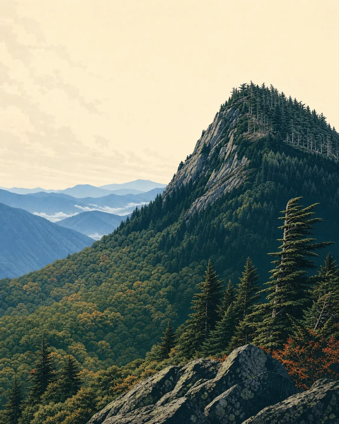
Mount Mitchell field guide: red spruce, Fraser fir, and the Black Mountain crest
A practical Mount Mitchell field guide tracing the climb from Appalachian woodland into red spruce and Fraser fir, with wildlife cues, seasonal access, and the split between easy summit walks and a strenuous full approach.

Why Mount Mitchell belongs on the field guide
Mount Mitchell is not a high alpine peak in the western sense. Its 6,684-foot summit is the highest point east of the Mississippi River, but the more useful hiking story is how quickly a southern Appalachian forest changes on the way up. The route moves from broadleaf woodland into a cool red spruce and Fraser fir band, then finishes in a weather-exposed summit landscape. 1 2
The practical split is simple: drive to the summit area for a short, easy introduction to the fir forest, or start much lower and earn the entire elevation change on foot. The second option is the real field study.
Elevation cross-section
Read the mountain as a sequence of habitat changes rather than as a set of hard ecological lines:
| Elevation story | What to look for | Field meaning |
|---|---|---|
| Lower approach | Mixed southern Appalachian woodland and flowering understory | Expect a warmer, greener forest and a long climb before the summit forest appears. |
| Above about 4,500 feet | Red spruce and Fraser fir stands | The Forest Service specifically notes that these trees fill the upper trail with a Christmas-like resin scent. <MarkdownCitation index="3" title="Mount Mitchell Trail |
| Summit zone at 6,684 feet | Compact spruce-fir forest, exposed rock, colder and faster-changing weather | Stay on durable surfaces. High-elevation rock outcrops along the Parkway can support fragile alpine plant communities that are vulnerable to trampling. <MarkdownCitation index="1" title="Mount Mitchell State Park |
This is a compressed profile. The trail climbs 3,630 feet from Black Mountain Campground to the state park boundary, so the ecological change is legible within one hike rather than spread across a long western approach. 3
Vegetation zones and signature plants
Mixed forest on the lower climb. The lower approach is the transition zone: a tall, humid Appalachian forest with flowering shrubs in the understory. Across the Blue Ridge Parkway, the National Park Service records more than 1,400 vascular plant species and highlights rhododendron, flame azalea, and mountain laurel as characteristic flowering shrubs. Treat these as corridor-level field marks, not a promise that every bloom will be present beside the summit trail. 4
Red spruce and Fraser fir above 4,500 feet. This is Mount Mitchell's signature plant community. The two conifers create a darker, cooler forest with a distinct high-elevation feel. Look for dense evergreen structure, short sight lines, and wind-shaped growth rather than a broad, open western treeline. 3
Fragile summit flora. The highest ridges and rock outcrops hold plant communities that are rare in the southern Appalachians. The Parkway's plant guidance emphasizes that these high-elevation plants are easily damaged by footsteps. Keep boots on marked tread and avoid treating thin soil, moss, or rock ledges as viewpoints. 4
Wildlife cues
The safest expectation is a forest soundtrack rather than a guaranteed sighting. The connected Blue Ridge Parkway corridor protects habitat from valley bottoms to mountaintops and supports more than 50 mammal species, over 150 nesting bird species, and dozens of amphibians and reptiles. Black bears, wild turkeys, flying squirrels, shrews, and peregrine falcons are among the animals named in National Park Service material for the Parkway landscape. 5
At Mount Mitchell, watch the edges of the trail and the canopy openings for movement, listen before approaching blind bends, and keep food secured. The high spruce-fir forest is the main observation subject even when no animal appears: its dense structure, cool air, and limited sight lines explain why wildlife often announces itself before it shows itself.
Best season to hike
Best overall window: late spring through early fall, with a weather check before departure. High-elevation blooms generally arrive later than blooms at lower elevations, while the highest deciduous leaves begin changing in October. That gives hikers two strong seasonal angles: cooler summer forest conditions and an early autumn color window on the upper slopes. 4
Winter is a different trip. North Carolina State Parks warns that the park can have frequent and prolonged winter closures because the primary access route is the Blue Ridge Parkway, which closes sections when icy. The temperature at the summit is also often several degrees colder than in Burnsville. Check both park and Parkway status before driving up. 1
Difficulty and route choice
| Route choice | Official profile | Best for |
|---|---|---|
| Summit area walks | Easy trails explore the Fraser fir forest; the park also has an observation deck. <MarkdownCitation index="1" title="Mount Mitchell State Park | NC State Parks" url="https://www.ncparks.gov/state-parks/mount-mitchell-state-park" /> |
| Mount Mitchell Trail | 5.7 miles one way, 3,630 feet of elevation change, difficult, about six hours one way from Black Mountain Campground. The Forest Service currently reports partial closures on the route, so verify conditions before starting. <MarkdownCitation index="3" title="Mount Mitchell Trail | U.S. Forest Service" url="https://www.fs.usda.gov/r08/northcarolina/recreation/trails/mount-mitchell-trail" /> |
| Black Mountain Crest Trail | 11.3 miles one way and strenuous on the state park trail table. <MarkdownCitation index="6" title="Mount Mitchell Trails | NC State Parks" url="https://www.ncparks.gov/state-parks/mount-mitchell-state-park/trails" /> |
Field-guide rating: strenuous for the full approach; easy for the summit-area introduction. That distinction matters more here than a single difficulty label. A summit road can make the top feel close, but the Black Mountain approach still carries a full 3,630-foot climb and current access limitations.
Leave with the right read of the mountain
Mount Mitchell is a lesson in latitude and elevation working together. The summit is not defined by glaciers or open scree, but by a compact spruce-fir forest, fragile high-elevation plants, colder weather, and a long climb through changing Appalachian woodland. Choose the summit walks for a quick introduction. Choose the lower approach when the point is to watch the mountain change under your boots.
Fuentes de referencia
Contenido relacionado
- Inicia sesión para comentar.
More from this channel
- Mount Shasta field guide: red fir, alpine meadows, and Avalanche Gulch
- Mount Baker field guide: old-growth forest, subalpine meadows, and glacial summit
- Mount Elbert Field Guide: Lodgepole Forest, Alpine Tundra, and Colorado's High Point
- Mount Marcy field guide: hardwood forests, boreal spruce-fir, and fragile alpine rock
- Mount San Jacinto field guide: desert gradients, pine forest, and alpine meadows
- Kuwohi field guide: cove hardwoods, spruce-fir ridge, and Andrews Bald
- Mount Hood field guide: alpine meadows, glacial streams, and Timberline Trail
- Olympic Mountains field guide: rain forest, Blue Glacier, and Mount Olympus