8/7/2026 · 8:09
Mount Katahdin field guide: krummholz, alpine tableland, and the Hunt Trail
A compact Mount Katahdin field guide tracing the climb from northern spruce-fir forest into wind-shaped krummholz and fragile alpine tableland, with signature plants, wildlife cues, best season, and the very strenuous Hunt Trail profile.

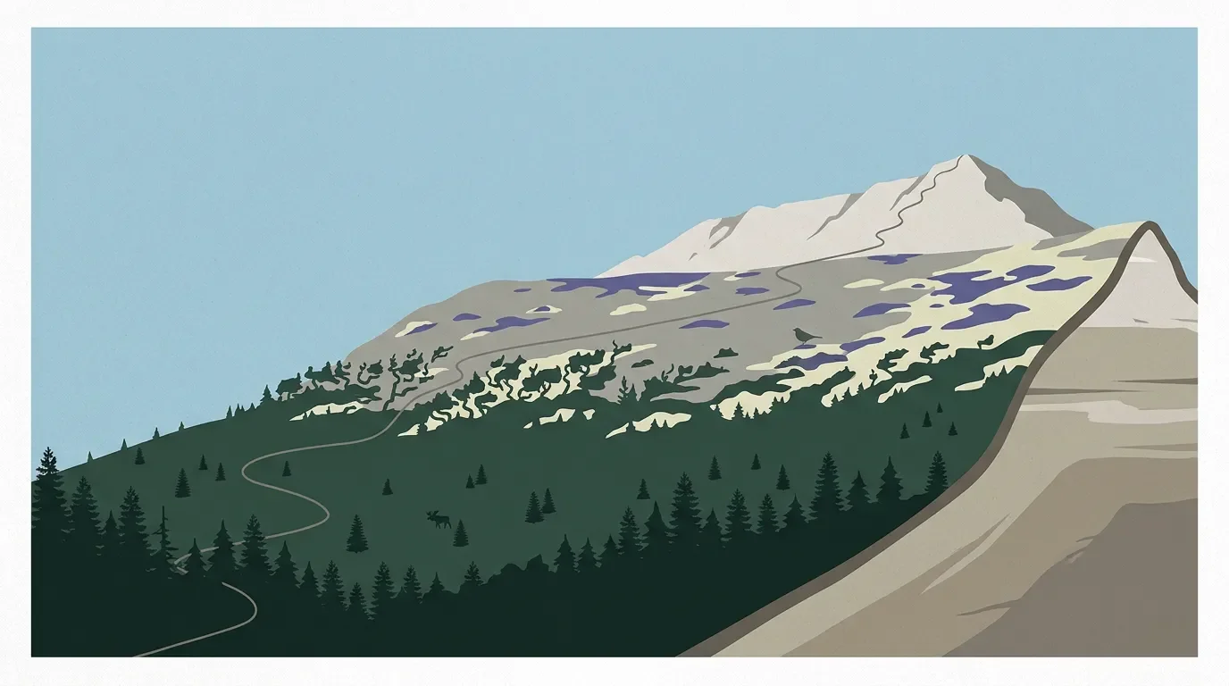
Katahdin saves its hardest work for the last miles. The Hunt Trail begins in closed northern forest, then spends 2.4 miles above treeline before it crosses the Tableland to Baxter Peak, a 5,268-foot summit where the ecological shift feels sharper than the elevation number suggests. 1 2
Quick field card
| Field note | Katahdin profile |
|---|---|
| High point | Baxter Peak, labeled by the park at 5,268 ft above sea level after comparing USGS, NOAA, LiDAR, and field-measurement sources. 2 |
| Standard hiker route | Hunt Trail from Katahdin Stream Campground: 5.2 miles one way, 4,188 ft of gain, very strenuous. 1 |
| Time budget | Baxter State Park says a Katahdin hike averages 8-12 hours round trip and requires about 4,000 ft of gain no matter which trailhead you choose. 1 |
| Best season | Aim for the main summer window into early fall. Baxter says summer conditions peak in July and August, fall color often peaks in late September or early October, and summit trails face shoulder-season closures. 3 4 |
| Difficulty rating | Very strenuous for the Hunt Trail; the route combines long gain, boulder scrambling, exposure above treeline, and weather-driven closures. 1 |
Elevation cross-section
Think of Katahdin as four stacked field zones rather than one continuous forest walk.
| Elevation band | What changes underfoot | What to watch for |
|---|---|---|
| Lower north woods | Baxter's forest history describes an Acadian forest mix shaped by red spruce, yellow birch, sugar maple, paper birch, and balsam fir. 3 | Moist forest, stream crossings, and early miles where pace feels deceptively easy. |
| Upper spruce-fir slope | Maine's krummholz fact sheet places spruce-fir-birch krummholz in upper mountain terrain, typically around 2,700-3,700 ft. 5 | Black spruce, balsam fir, and heart-leaved paper birch shrink into wind-shaped mats and thickets. 5 |
| Above treeline | The Hunt Trail spends 2.4 miles above treeline, crossing boulders, open ridge, and the Tableland. 1 | Exposure becomes the main hazard: wind, cold rain, lightning, and limited shelter. |
| Alpine tableland and summit | Maine's alpine-ridge communities are built from dwarf shrubs, sedges, rushes, and plants rooted in gravelly pockets above treeline. 6 7 | Step only on durable trail surfaces. The plants are low because the climate is harsh, not because they can take trampling. |
Vegetation zones
Katahdin's lower approaches sit inside the northern forest. Baxter's own natural-systems notes describe the park as part of the Northern Forest Region, with cool, moist conditions, variable weather, and a forest mosaic that grew after the Laurentide ice sheet retreated. 3
Higher up, spruce and fir stop behaving like upright forest. In the krummholz belt, black spruce, balsam fir, and heart-leaved paper birch form dense, wind-sheared shrubs only 0.5-2 meters high. The Maine Natural Areas Program notes that this habitat supports Bicknell's thrush, with blackpoll warblers and spruce grouse as common associates. 5
Above treeline, the Tableland shifts into a low, fragile alpine garden. Heath alpine ridge vegetation is dominated by dwarf evergreen shrubs and herbs, often including alpine bilberry, diapensia, mountain cranberry, Bigelow's sedge, highland rush, and three-toothed cinquefoil. 6
The most exposed pockets can become windswept alpine ridge, where cushions of diapensia and alpine bilberry grow among fractured rock. Maine's fact sheet is blunt about the management issue: sparse alpine flats are easy places for hikers to wander off trail, and the vegetation is very sensitive to impact. 7
Signature plants and wildlife
The plant list is small in stature but not in significance. On the Tableland, look for mat-forming alpine bilberry, diapensia, Bigelow's sedge, highland rush, and mountain cranberry rather than tall wildflowers. Those species are built for wind, thin soil, and a short growing season. 6 7
Katahdin's alpine zone also carries two unusually specific wildlife notes. Maine lists the Tablelands of Mount Katahdin as the only known habitat in the world for the Katahdin Arctic butterfly, and Mount Katahdin as the only known nesting area in Maine for the American pipit. 6
Lower in the park, wildlife signs shift back to the north woods. Baxter's landscape notes list moose, deer, bear, otter, mink, marten, fisher, coyote, bobcat, beaver, snowshoe hare, and many birds across the park's forests, bogs, streams, ponds, and wetlands. 3 On a summit day, most hikers will see more habitat than animals, but the habitat tells you what lives nearby.
Best season and route choice
For most hikers, the cleanest Katahdin window is July through September, with a cautious eye on early October. Baxter says summer conditions peak in July and August, fall color usually peaks in late September or early October, and lasting snow often begins in mid to late November. The same page warns that snow can occur in any month. 3
The park's Appalachian Trail guidance recommends completing a Katahdin summit hike before October 15 because of annual shoulder-season closures. It also notes that Katahdin trails, including the Hunt Trail, can close temporarily during the camping season because of weather and trail conditions. 4 Treat that as route-planning information, not a footnote.
If you want the classic west-side profile, choose the Hunt Trail from Katahdin Stream. It is popular because it passes Katahdin Stream Falls, climbs the Boulders on Hunt Spur, crosses the Tableland, and opens wide views in all directions. It is still a very strenuous route, with more than 4,000 feet of gain and long exposure above treeline. 1
If you want the shortest roadside approach, Abol reaches Baxter Peak in 4.4 miles one way after joining the Hunt Trail for the final mile, but Baxter still rates it very strenuous and notes limited water after the first mile plus full exposure after 2.5 miles. 1 The easier-looking mileage does not make it an easy mountain.
Hiker difficulty call
Rating: very strenuous. Katahdin is not technical on the Hunt Trail in the rope-and-harness sense, but it demands mountain judgment. The difficulty comes from cumulative gain, long above-treeline travel, boulder sections, fast weather changes, and the need to turn around early enough to get back in daylight.
Pack it like a full mountain day. Baxter's hiking guidance tells visitors to bring navigation, insulation, illumination, first aid, extra food, at least two quarts of water per person for a Katahdin hike, and a turnaround time. 1 The ecological rule is just as simple: stay on the built trail. On Katahdin, protecting the alpine zone is part of finishing the hike well.
Contenido relacionado
- Inicia sesión para comentar.
Más de este canal
- Guadalupe Peak field guide: desert scrub, high-country pines, and the Top of Texas trail
- Lassen Peak field guide: red fir forest, subalpine cinders, and a volcanic summit trail
- Mount Whitney field guide: treeline pines, alpine granite, and the Whitney Trail
- Grand Teton field guide: sagebrush flats, alpine mats, and Garnet Canyon