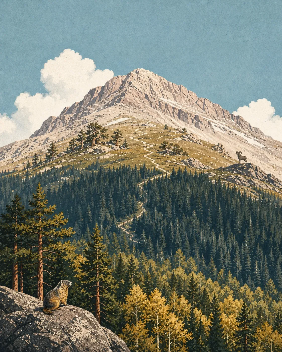
Pikes Peak field guide: ponderosa pine, alpine tundra, and Barr Trail
A practical Pikes Peak field guide tracing Colorado's 14,115-foot summit from pine and spruce-fir forest to alpine tundra, with plant and wildlife cues, seasonal planning, and a clear highway-versus-Barr-Trail difficulty split.

The quick read
Pikes Peak rises to 14,115 feet above Colorado Springs and is the 31st-highest peak in Colorado. Its useful field-guide story is vertical: ponderosa pine and aspen woodlands give way to lodgepole pine, Engelmann spruce, and subalpine fir, then to bristlecone pine, subalpine grassland, and alpine tundra. The Forest Service describes habitats across roughly 7,000 to 14,000 feet, with slope aspect changing the pattern from one side of the mountain to another. 12
The access split is unusually clear. The paved Pikes Peak Highway climbs 19 miles to the summit and is open year-round when weather allows. Barr Trail is a foot and horse trail from Manitou Springs, about 13 miles to the summit, rated "more difficult" by the Forest Service. An average hiker may take about 16 hours for the round trip, and the agency advises people who are not used to high-altitude hiking not to attempt it in one day. 13
| Field note | Practical read |
|---|---|
| Summit | 14,115 feet, using the current Forest Service recreation page. <MarkdownCitation index="1" title="Pikes Peak |
| Mountain type | The peak is part of the Pikes Peak batholith, a granite body about a billion years old. Its coarse, sandy soil dries quickly across much of the mountain. <MarkdownCitation index="2" title="Pikes Peak |
| Elevation story | A broad 7,000-to-14,000-foot sequence, not a set of hard lines. Aspect, slope, and moisture shift the vegetation boundaries. <MarkdownCitation index="2" title="Pikes Peak |
| Best hiking window | Late spring through early fall is the practical window for a less winterized outing. Official access remains year-round, weather permitting, and summer thunderstorms can develop by late morning or early afternoon. <MarkdownCitation index="1" title="Pikes Peak |
| Barr Trail rating | More difficult. The long sustained grade and high altitude make the summit day a serious endurance hike, not a casual walk from town. <MarkdownCitation index="3" title="Barr Trail #620 |
The elevation cross-section
The exact bands are broad ecological zones rather than contour-line promises. Pikes Peak changes with exposure and drainage, so the same elevation can look different on the east and west slopes. The Forest Service's vegetation account is the right scale for reading the mountain in the field.
Lower montane woodlands. Ponderosa pine and quaking aspen form the lower forest story, with lodgepole pine appearing higher in the profile. Open grasslands and dry, coarse granite soil break up the canopy. Lower-elevation flowers include Columbian monkshood, orange agoseris, wholeleaf Indian paintbrush, and mountain bluebells. 2
Spruce-fir forest. Engelmann spruce and subalpine fir create a darker, cooler band. In deep shade, the Forest Service notes arctic yellow violet; moist aspen stands can carry western yarrow, darkthroat shootingstar, and elephanthead lousewort, especially near flowing water. 2
High subalpine slopes. Bristlecone pine, subalpine grasslands, and krummholz mark the transition toward treeless ground. Ross' avens, threeflower avens, and Whipple's penstemon occur in open sites. The forest becomes shorter and more broken as wind, snow, and exposure take over. 2
Alpine tundra. Above 12,000 feet, the flora becomes small and close to the ground. Alpine springbeauty, arctic-alpine forget-me-not, Rocky Mountain snowlover, alpine bluebells, moss campion, and dwarf clover are among the species listed by the Forest Service. The upper terrain is open, bright, and weather-exposed, with granite outcrops replacing the shelter of forest. 2
Plants to look for
The mountain has a few strong botanical signatures, but they are easiest to notice when the larger habitat change is already in view.
- James' telesonix grows on shaded or sunlit granite outcrops and is associated with the Pikes Peak granite formations. 2
- Pikes Peak alpineparsley occurs in the peak's tundra and krummholz communities. It is a useful upper-mountain cue, not a plant to expect in the forest. 2
- In open alpine ground, look for moss campion, dwarf clover, alpine springbeauty, and Ross' avens. These plants stay low because wind, cold, and a short growing season limit height. 2
- In the lower and middle zones, the canopy change from ponderosa pine and aspen to lodgepole, spruce, and fir is often easier to read than any single flower. 2
Wildlife cues
The City of Colorado Springs visitor guide names Rocky Mountain bighorn sheep and yellow-bellied marmots among the animals visitors may see along the mountain. The Forest Service also notes that wildlife species common to the montane, spruce-fir, and alpine zones are frequently observed along Barr Trail. Treat both as habitat cues rather than a sighting guarantee: marmots are most at home around open high-country rocks, while bighorn sheep may use steep, open slopes. 43
Give animals room and keep food secured. On a crowded route, the absence of a sighting says little about the habitat; the elevation profile is still doing its work even when the animals stay out of view.
Best season and route choice
For a typical hiker, late spring through early fall offers the simplest planning window, but Pikes Peak is not a low-risk summer mountain. The Forest Service warns that weather can change rapidly, lightning often begins in the early afternoon and sometimes late morning, and steep slopes plus gravelly trail surfaces can be treacherous. Start early, check the current road and trail information, and turn around before a storm commits to the ridge. 21
Choose the Pikes Peak Highway if the goal is to see the elevation zones with limited walking. The paved 19-mile road reaches the 14,115-foot summit house, with observation sites and picnic areas along the way. It is open year-round when weather allows, but conditions change frequently and the official road information line should be checked before departure. 14
Choose Barr Trail for the full forest-to-tundra traverse. The route is about 13 miles one way, rises on a long sustained grade, and is rated more difficult. The Forest Service says drinking water is not readily available, so carry enough or treat stream water. An open shelter sits about 9 miles up, just below timberline, and the agency warns that a same-day round trip is not appropriate for people unused to the altitude. 3
The summit visitor center is an access option, not a substitute for acclimatization. At 14,115 feet, the top can be cold, windy, and exposed even when Colorado Springs feels warm. 14
Trail decision
Pikes Peak gives hikers two distinct ways to read the same mountain. The highway makes the ecological cross-section accessible with short stops and a summit visit. Barr Trail turns that cross-section into a long, high-altitude day or overnight effort through montane, spruce-fir, and alpine communities.
Choose the route by the descent you can still manage after the weather changes. On Pikes Peak, the mountain's difficulty is not hidden in a technical summit pitch. It is spread across the sustained grade, thin air, exposed upper slopes, and the time required to come back down.
Contenido relacionado
- Inicia sesión para comentar.
More from this channel
- Mount Rogers field guide: alpine balds, spruce-fir forest, and Virginia's high point
- Humphreys Peak field guide: ponderosa pine, bristlecone, and alpine tundra
- Wheeler Peak field guide: alpine tundra, spruce-fir forest, and Williams Lake
- Mount Robson field guide: cedar-hemlock valleys, alpine tundra, and Berg Lake
- Mount Shasta field guide: red fir, alpine meadows, and Avalanche Gulch
- Mount Baker field guide: old-growth forest, subalpine meadows, and glacial summit
- Mount Elbert Field Guide: Lodgepole Forest, Alpine Tundra, and Colorado's High Point