2026/7/7 · 8:09
Guadalupe Peak field guide: desert scrub, high-country pines, and the Top of Texas trail
A compact Guadalupe Peak field guide tracing the climb from Chihuahuan Desert scrub into shaded pines and a windy limestone summit, with signature plants, wildlife cues, best season, and the strenuous Top of Texas trail profile.

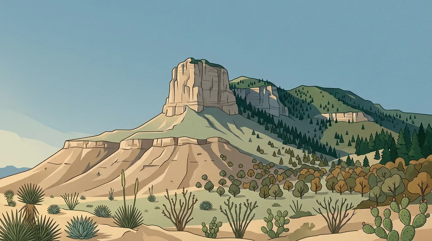
Guadalupe Peak is a desert mountain with a forest hidden near the top. The summit reaches 8,751 feet, the highest natural point in Texas, while the broader Guadalupe Mountains rise more than 5,000 feet from Chihuahuan Desert lowlands into cool conifer country. 1 2
For hikers, the standard line is direct and demanding: 8.4 miles round trip, about 3,000 feet of gain, and a typical six to eight hours on steep, rocky trail. 3 The ecological payoff is compressed into one climb: desert scrub, shaded pine pockets, sparse upper forest, and a wind-exposed limestone summit.
Field profile
| Guide point | Read this first |
|---|---|
| Mountain | Guadalupe Peak, Guadalupe Mountains National Park, west Texas; highest natural point in Texas at 8,751 feet. 1 |
| Route lens | Guadalupe Peak Trail from Pine Springs: very strenuous, 8.4 miles round trip, roughly 3,000 feet of elevation gain, usually six to eight hours. 3 |
| Ecosystem pattern | The park spans Chihuahuan Desert scrubland, riparian woodlands, rocky canyons, and cool conifer forests. 2 |
| Best window | Spring and fall are generally the most comfortable hiking seasons; summer adds heat and thunderstorms, while November through March can bring strong winds. 4 |
| Difficulty rating | Strenuous all-day hike. Expect loose or hardened rock, little shade, exposure to wind and lightning, and a harder descent if legs are tired. 3 |
Elevation cross-section
Think of Guadalupe Peak as a desert cross-section tilted into the sky. The park's weather page frames conditions across roughly 3,000 feet to more than 8,000 feet, with higher elevations usually cooler and windier than Pine Springs. 4
| Elevation band | What changes underfoot | Field marks |
|---|---|---|
| Lower desert and foothills | Chihuahuan Desert scrub dominates the dry approach country; the park's plant page notes more than 1,000 plant species across desert lowland, canyons, ridge tops, and riparian oases. 5 | Lechuguilla below about 4,500 feet, ocotillo on rocky hillsides below 5,000 feet, prickly pear and cholla, plus creosotebush and desert shrubs. 6 7 |
| Pine Springs start and exposed switchbacks | The route starts near a mile above sea level and immediately asks for sustained climbing; the first mile and a half is the steepest part of the hike. 3 | Open desert slope, little shade, rocky tread, strong sun, and fast-changing weather. 3 |
| Shaded north-facing slope | After the steep opening, the trail turns onto cooler north-facing ground where reduced sunlight lets a small forest persist. 3 | Pinyon pine, south-western white pine, and Douglas fir appear in a protected pocket. 3 |
| False summit and upper ridge | Near the false summit, the trail flattens briefly and passes through sparse ponderosa pine before the final climb. 3 | Wind exposure becomes the main hazard; the summit is commonly about 10 degrees cooler and winds about 10 mph faster than Pine Springs. 1 |
Vegetation zones and signature plants
Guadalupe's plant story starts with aridity. NPS describes desert plants here as shaped by heat, dryness, wind, steep canyons, ridge tops, and reliable pockets of water. 5
The lower slopes are built for water storage and drought timing. Agaves, yuccas, beargrass, sotol, ocotillo, prickly pears, chollas, hedgehog cacti, and pincushion cacti are all listed by the park among its desert succulents and cacti. 6 Lechuguilla is especially diagnostic because NPS calls it the indicator plant of the Chihuahuan Desert. 6
Shrubs fill much of the desert matrix. Apache plume, Mexican orange, mountain mahogany, skunkbush, evergreen sumac, catclaw acacia, and creosotebush are among the park-listed shrubs, with several tied to rocky slopes, arroyos, canyons, and elevations above 3,000 to 4,000 feet. 7
Higher and shadier ground changes the feel of the mountain. Pinyon pine commonly grows between 5,000 and 7,000 feet, gray oak is listed between 4,500 and 7,800 feet, and ponderosa pine is typically found around 6,000 feet in the park. 8 On the Guadalupe Peak Trail, NPS specifically calls out pinyon pine, south-western white pine, Douglas fir, and sparse ponderosa pine along the climb. 3
Wildlife to watch for
The park's life-zone stack supports 60 mammal species, 289 bird species, and 55 reptile species. 9 Most hikers will not see the full cast; heat and cover decide what is visible.
In the desert, many mammals shift activity into the night. NPS lists kit fox, coyote, mountain lion, bobcat, badger, and about 16 bat species among nocturnal desert mammals; mule deer, javelinas, and black-tailed jackrabbits are more likely early or late in the day. 10 Reptiles are more visible in daylight, with western diamondback rattlesnakes, bullsnakes, coachwhips, prairie lizards, collared lizards, crevice spiny lizards, and Chihuahuan spotted whiptails listed from the park's desert communities. 9
Canyon and high-country habitats add a different set of clues. Rocky canyons are home to ringtails, rock squirrels, and several reptiles, while mountaintop forests support elk, black bear, gray foxes, skunks, porcupine, mule deer, mountain lions, and mountain short-horned lizards. 9 Black bears live throughout the high country but are shy and rarely seen. 10
Best season
For most hikers, the cleanest choice is spring or fall. NPS describes spring and fall as typically warm and pleasant, and also the park's busiest seasons. 4
Spring has the stronger plant argument. Desert succulents and cacti bloom heavily from April through June, including agaves, yuccas, prickly pears, chollas, and claret cup cactus, while later summer rains can trigger another bloom cycle that may last into fall. 6 11
Summer is possible but less forgiving. June through August are the hottest months, and the rainy season from May through September can bring locally heavy thunderstorms and flash flooding. 4 Winter can be clear and beautiful, but November through March is the windy season, with frequent winds above 30 mph and gusts that can reach 50 to 80 mph. 12
Trail difficulty notes
Guadalupe Peak Trail earns its strenuous rating honestly. The NPS route page gives it 8.4 miles round trip, 3,000 feet of gain, six to eight hours for most hikers, and the steepest section in the first mile and a half. 3
Plan for a desert mountain, not a shaded forest walk. There is little shade along the route, and the park tells hikers to carry at least one gallon of water per person per day. 3 The descent often feels harder than the climb because of loose rock, hardened rock, and fatigue; trekking poles are a practical upgrade here. 3
The turn-around decision should be made by weather, not by ego. NPS warns that summer thunderstorms make lightning dangerous on the exposed peak, and winter winds above 40 mph can make open trail challenging; at 50 mph the park calls continuing dangerous even for experienced hikers. 3 12
Bottom line
Choose Guadalupe Peak when you want a hard day hike with a clean ecological gradient. It is not the tallest mountain in North America, and it is not a technical climb. Its strength is the contrast: Chihuahuan Desert plants at the base, shaded pines halfway up, cooler upper forest near the ridge, and a summit that can feel ten degrees and one wind layer removed from the trailhead.
参考来源
- 1Guadalupe Peak
- 2Wilderness - Guadalupe Mountains
- 3Guadalupe Peak
- 4Weather - Guadalupe Mountains
- 5Plants - Guadalupe Mountains
- 6Cacti / Desert Succulents
- 7Shrubs - Guadalupe Mountains
- 8Trees - Guadalupe Mountains
- 9Animals - Guadalupe Mountains
- 10Mammals - Guadalupe Mountains
- 11Wildflowers - Guadalupe Mountains
- 12Safety - Guadalupe Mountains
相似内容
- 登录后可发表评论。
更多来自该频道
- Lassen Peak field guide: red fir forest, subalpine cinders, and a volcanic summit trail
- Mount Whitney field guide: treeline pines, alpine granite, and the Whitney Trail
- Grand Teton field guide: sagebrush flats, alpine mats, and Garnet Canyon
- Mount Washington field guide: alpine tundra, krummholz, and severe weather