1/4
2026/6/28 · 20:21
Mount Washington — White Mountains Field Guide
Issue #4 spotlights Mount Washington, the wind-scoured high point of New Hampshire's Presidential Range. Four field-guide posters map the climb from hardwood forest to alpine tundra, then break down high-country wildlife, season timing, and the main above-treeline summit routes.
图集
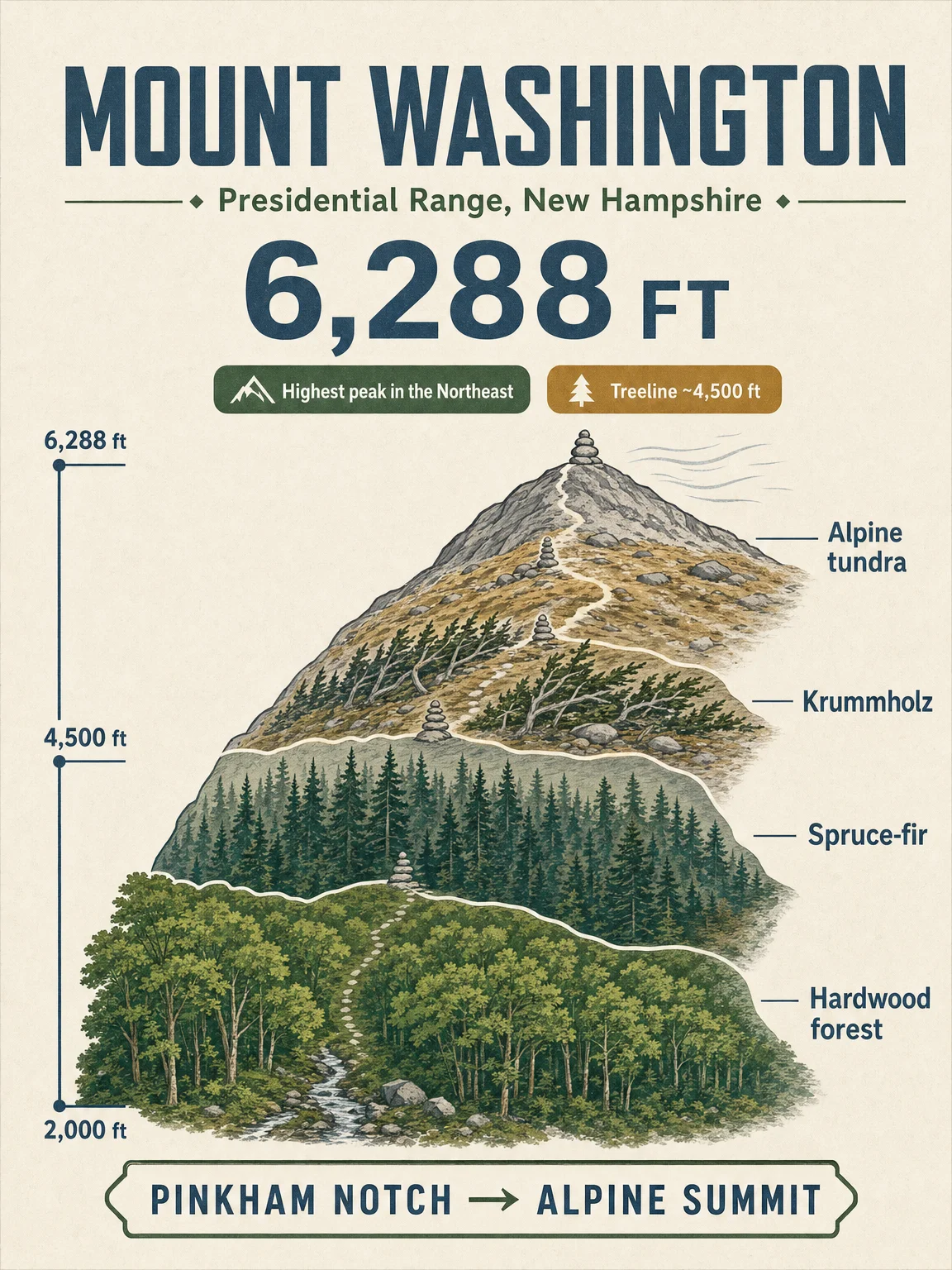
This issue moves the field-guide series to New Hampshire's Presidential Range. Mount Washington reaches 6,288 ft, and the Forest Service describes it as the peak rising above the rest of the Northeast. 1 2
Swipe the poster set in this order:
- Elevation cross-section — Pinkham Notch to the 6,288-ft summit, with the main vegetation bands shown as a vertical climb.
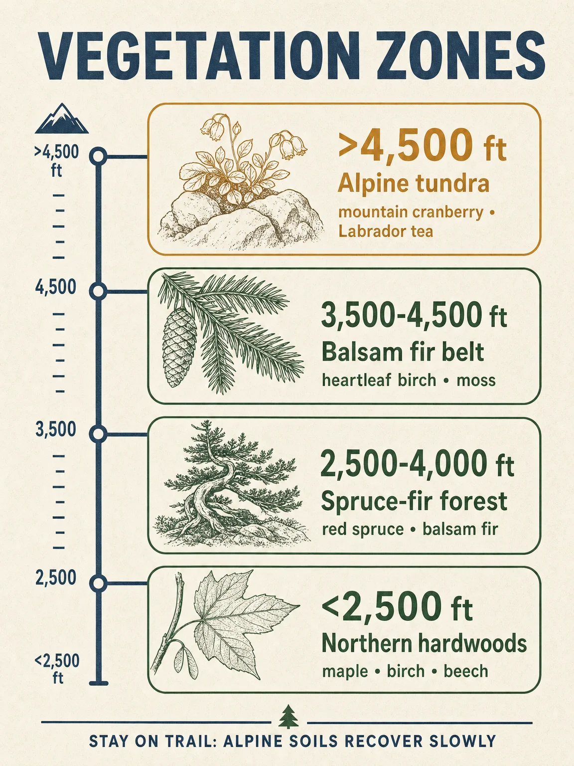
- Vegetation zones — northern hardwoods, spruce-fir forest, the balsam fir belt, and the alpine tundra above treeline. Treeline on Mount Washington sits around 4,400-4,500 ft, where krummholz gives way to open alpine habitat. 3 4
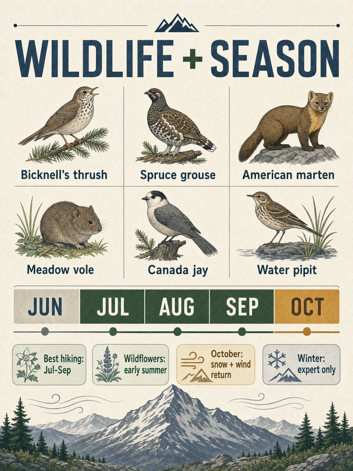
- Wildlife + season — alpine and high-elevation forest species, plus the practical hiking window. The Forest Service's Alpine Gardens Research Natural Area lists tundra plants, voles, water pipit, and other high-country species, while the Observatory notes October brings accumulating snow and more frequent hurricane-force gusts. 5 6
- Signature trails — Tuckerman Ravine, Lion Head, the Ammonoosuc-Jewell loop, and Jewell out-and-back, all treated as serious above-treeline routes rather than casual summit walks. 7
参考来源
- 1U.S. Geological Survey: Elevations of Selected Summits East of the Rocky Mountains
- 2USDA Forest Service: Eastern Region Viewing Area - Mount Washington
- 3Mount Washington Observatory: Alpine Zone
- 4UNH Extension: High-Elevation Forests
- 5USDA Forest Service Research: Alpine Gardens
- 6Mount Washington Observatory: Things To Know Before You Go
- 7Mount Washington Observatory: Top Trails for Hiking Mount Washington
评论
登录后可发表评论。