
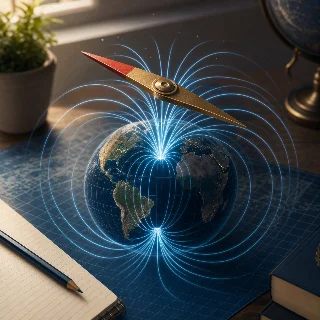
Listening practice: The map that follows magnetic northPart one: full English listening1×2:41Part two: Chinese explanation and vocabulary4:20Part three: English replay0:007:000:00hostA compass looks simple. A needle turns, settles, and points you toward north. But the north it follows is not the same as the North Pole on a map. According to the British Geological Survey, Earth's magnetic field is generated mainly by slow motion in the liquid iron of the outer core. That field reaches the surface, passes through rocks, oceans, cities, and the phone in your hand, and gives a compass its direction. The important detail is that the field is alive in a slow way. It changes over years. Magnetic north wanders, and a compass reading that was correct in one decade may need a different correction later.0:36hostThat correction is called magnetic declination. It is the angle between true north, which points along lines of longitude toward the geographic pole, and magnetic north, which follows Earth's magnetic field. If the angle is small, you may not notice it while walking through a park. If you are flying a plane, steering a ship, drilling underground, or building software that gives a heading, small errors can become real problems. NOAA's National Centers for Environmental Information says the World Magnetic Model is used for navigation, attitude, and heading systems that depend on the geomagnetic field. In plain words, it is a regularly updated map of where a magnetic compass should point.1:17hostThe latest standard version, called W M M twenty twenty-five, was released by NOAA, B G S, and partners in December twenty twenty-four. NOAA says the model is produced at five-year intervals and the current version is valid until the end of twenty twenty-nine. The release also included a high-resolution version for the first time. The standard model has a spatial resolution of about three thousand three hundred kilometers at the equator, while the high-resolution model improves that to about three hundred kilometers. That does not mean every student needs to calculate magnetic coefficients. It means the invisible field around Earth is measured, modeled, checked, and turned into data that navigation systems can use.1:59hostThere is one more strange detail. Near the North and South poles, NOAA and the National Geospatial-Intelligence Agency describe blackout zones where Earth's magnetic field can be unusable for navigation. In those places, a compass may become a poor guide because the field points steeply into or out of the ground. So the story is not just that Earth has a magnetic field. The story is that modern navigation depends on watching that field change. A quiet needle on a compass is connected to molten iron deep below us, satellites above us, observatories on the ground, and a model that has to be updated before the old map drifts too far from the real planet.2:41coach先抓主线:这期讲的不是普通地图,而是地球磁场的「方向地图」。指南针指向的是 magnetic north,也就是磁北,不是地理北极。因为地球外核里的液态铁运动会让磁场缓慢变化,所以导航系统需要定期更新。3:02coach关键词一,magnetic field,磁场。关键词二,magnetic north,磁北。关键词三,true north,真北或地理北。关键词四,magnetic declination,磁偏角,也就是真北和磁北之间的夹角。听到 angle between true north and magnetic north,就要反应出「两种北方之间的角度」。3:29coach关键词五,World Magnetic Model,世界磁场模型。它不是给普通人看的纸质地图,而是导航、飞机、船舶、手机罗盘等系统使用的数据模型。文中 five-year intervals 表示每五年更新一次,valid until the end of twenty twenty-nine 表示有效到二零二九年底。3:54coach长句提示:The important detail is that the field is alive in a slow way. 这里 alive 不是说磁场真的有生命,而是说它会缓慢变化。最后一段的 blackout zones 指极区附近磁场不适合导航的区域。第二遍复听时,重点听 cause,change,correction,model 这条逻辑线。4:20hostA compass looks simple. A needle turns, settles, and points you toward north. But the north it follows is not the same as the North Pole on a map. According to the British Geological Survey, Earth's magnetic field is generated mainly by slow motion in the liquid iron of the outer core. That field reaches the surface, passes through rocks, oceans, cities, and the phone in your hand, and gives a compass its direction. The important detail is that the field is alive in a slow way. It changes over years. Magnetic north wanders, and a compass reading that was correct in one decade may need a different correction later.4:57hostThat correction is called magnetic declination. It is the angle between true north, which points along lines of longitude toward the geographic pole, and magnetic north, which follows Earth's magnetic field. If the angle is small, you may not notice it while walking through a park. If you are flying a plane, steering a ship, drilling underground, or building software that gives a heading, small errors can become real problems. NOAA's National Centers for Environmental Information says the World Magnetic Model is used for navigation, attitude, and heading systems that depend on the geomagnetic field. In plain words, it is a regularly updated map of where a magnetic compass should point.5:37hostThe latest standard version, called W M M twenty twenty-five, was released by NOAA, B G S, and partners in December twenty twenty-four. NOAA says the model is produced at five-year intervals and the current version is valid until the end of twenty twenty-nine. The release also included a high-resolution version for the first time. The standard model has a spatial resolution of about three thousand three hundred kilometers at the equator, while the high-resolution model improves that to about three hundred kilometers. That does not mean every student needs to calculate magnetic coefficients. It means the invisible field around Earth is measured, modeled, checked, and turned into data that navigation systems can use.6:21hostThere is one more strange detail. Near the North and South poles, NOAA and the National Geospatial-Intelligence Agency describe blackout zones where Earth's magnetic field can be unusable for navigation. In those places, a compass may become a poor guide because the field points steeply into or out of the ground. So the story is not just that Earth has a magnetic field. The story is that modern navigation depends on watching that field change. A quiet needle on a compass is connected to molten iron deep below us, satellites above us, observatories on the ground, and a model that has to be updated before the old map drifts too far from the real planet.