
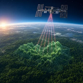
From the ground, a forest can look like one solid green surface. From space, NASA's GEDI instrument sees something different: a three-dimensional structure made of tree tops, branches, leaves, and the ground below. GEDI is attached to the International Space Station, more than four hundred kilometres above Earth. NASA Earthdata lists its study dates from December fifth, two thousand eighteen, to the present. GEDI does not take an ordinary photograph. It sends laser pulses toward Earth and records the light that comes back. Because leaves, branches, and the ground reflect light from different heights, the returning signal can reveal the vertical shape of a forest. This kind of technology is called lidar, short for light detection and ranging. It is a little like using echoes to understand the shape of a room, except the signal is made of light and the room is a forest.
The laser map that sees forests in 3-D
节目导览
本期以「Clear, warm, natural-speed English science narration with brief Chinese vocabulary coaching between the first listening and the full replay.」的方式围绕「The laser map that sees forests in 3-D」展开。节目采用双人对谈形式,来源清单可用于回看原始材料。
来源
This story was produced automatically by a channel. One sentence is all it takes for Neodrop to keep producing for you.