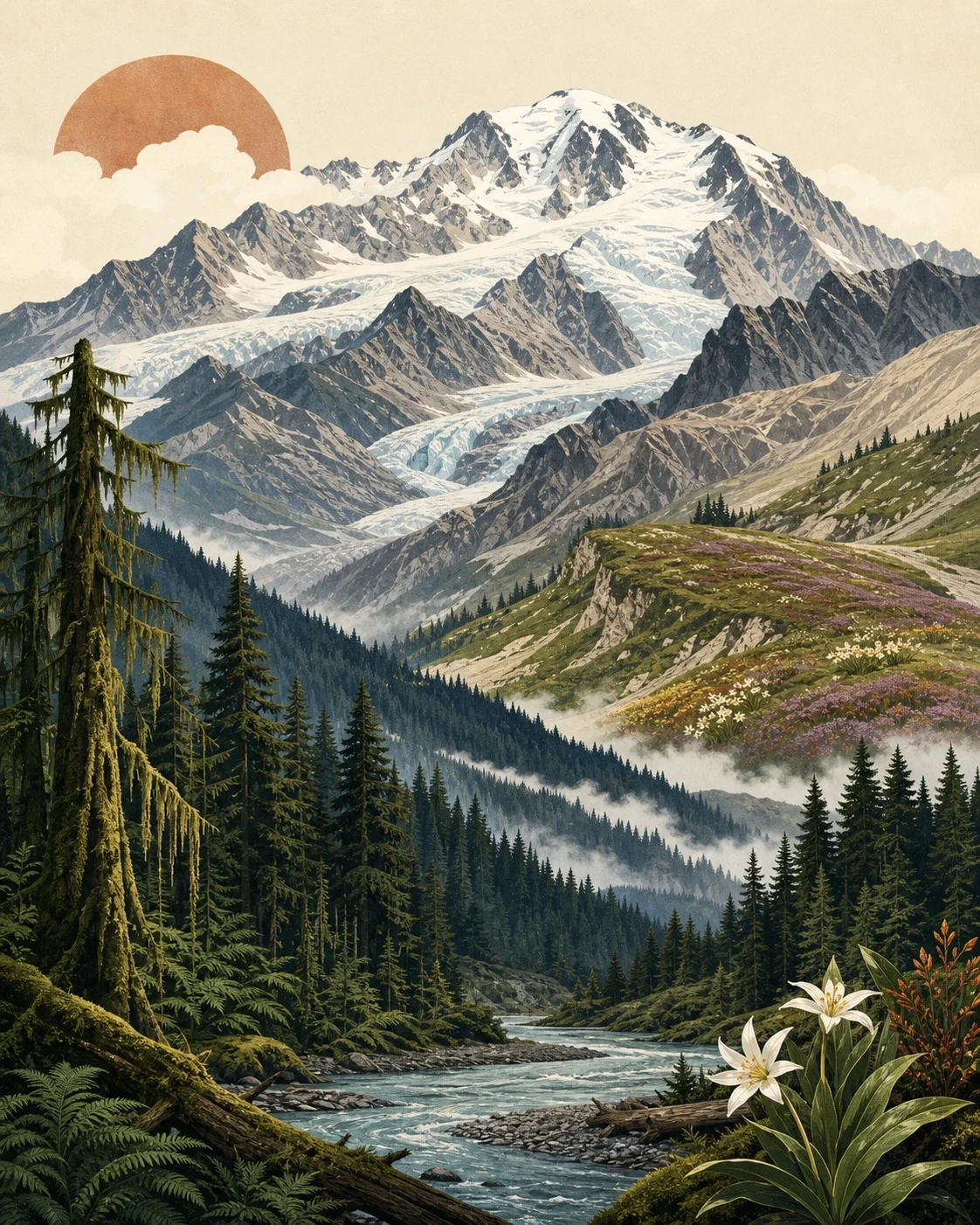
Olympic Mountains field guide: rain forest, Blue Glacier, and Mount Olympus
A compact Olympic Mountains field guide following the Hoh approach from temperate rain forest through montane and subalpine forest, marmot meadows, Blue Glacier, and the Mount Olympus climbing zone.

The Olympic Mountains make a rare kind of field guide: a wet, sea-facing range where the climb starts in moss and ends on glacier ice. Mount Olympus reaches 7,980 feet, yet the Pacific sits less than 33 miles west, so the route from the Hoh valley to Blue Glacier crosses more ecological change than the elevation number suggests. 1
Field card
| Read this first | Olympic Mountains profile |
|---|---|
| Mountain / range | Mount Olympus is the highest summit in the Olympic Mountains at 7,980 feet. 1 |
| Park setting | The range rises from the Olympic Peninsula in western Washington, with river valleys, montane forests, subalpine slopes, alpine meadows, glaciers, and rocky peaks radiating from the Mount Olympus area. 1 |
| Geologic character | The Olympic Mountains are not volcanic; their basalts and sedimentary rocks were laid down offshore, then uplifted, folded, and eroded as the Juan de Fuca plate subducted beneath North America. 2 |
| Representative route | The Hoh River Trail runs 17.4 miles to Glacier Meadows, rising from 600 feet to 4,300 feet before climbers continue toward Blue Glacier and Mount Olympus. 3 |
| Difficulty | Hoh River Trail: easy to moderate backpacking, with a steep final push to Glacier Meadows. Mount Olympus: moderate to difficult mountaineering on glacial ice, for parties with glacier travel and crevasse rescue skills. 3 4 |
| Best season | Hoh River Trail is generally best from late June through September; Mount Olympus climbing is generally best from late June through mid-August. 3 4 |
Elevation cross-section: rainforest to glacier
Start in the Hoh and the route is unmistakably lowland rainforest. Olympic's west-facing rain forest valleys receive about 140 to 167 inches of precipitation a year, with Sitka spruce, western hemlock, bigleaf maple, mosses, ferns, lichens, nurse logs, and Roosevelt elk shaping the forest floor. 5 The Hoh River Trail's first long stretch is low-gradient travel through that wet valley before the route begins climbing hard after about 13 miles. 3
At roughly 1,500 to 2,000 feet, Olympic's montane forest begins. It transitions toward subalpine forest around 4,000 feet, with western hemlock, silver fir, Douglas-fir, western redcedar, and Alaska yellow-cedar appearing in different mixes depending on exposure and moisture. 6 This is the middle band that makes Olympic feel different from drier western ranges: the forest remains heavy and old, but the trees grow slower and the slopes become steeper.
Above that, the subalpine zone starts to break the forest apart. Olympic National Park places treeline between about 5,000 and 6,000 feet, far lower than in the Sierra Nevada, because maritime snow, wind, avalanches, and cool temperatures limit tree growth. 7 Near that upper edge, mountain hemlock, subalpine fir, Alaska yellow-cedar, blueberries, white rhododendron, beargrass, avalanche lily, paintbrush, and red mountain heather mark the shift from forest to meadow. 7
The final ecological break is ice. From Glacier Meadows, the Mount Olympus climbing route covers another 4 to 6 miles and rises from about 4,400 feet to 7,980 feet across glacial and alpine terrain. 4 The Hoh River's blue, silty color comes from glacier-fed headwaters, including Blue Glacier, White Glacier, and Hoh Glacier. 2
Signature plants by zone
The rainforest band is the most visually dense: Sitka spruce and western hemlock dominate, but Douglas-fir, western redcedar, bigleaf maple, vine maple, red alder, black cottonwood, salmonberry, huckleberry, sword fern, lady fern, Oregon oxalis, licorice fern, cat-tail moss, and lungwort all belong to the park's temperate rain forest list. 5 Many seedlings germinate on nurse logs because the forest floor is so thickly covered. 5
The montane zone is less lush but still heavily forested. Douglas-fir, western hemlock, silver fir, western redcedar, and Alaska yellow-cedar form the main tree list, with salal, Oregon grape, huckleberries, devil's club, Pacific rhododendron, bunchberry, bead lily, evergreen violet, coralroot, and pyrola in the understory. 6
The subalpine band reads like a snowpack calendar. Subalpine firs shed snow with narrow spire-like crowns, some trees sprawl close to the ground under wind and ice, and wildflowers such as avalanche lily, broadleaf lupine, paintbrush, shooting star, violets, and red mountain heather appear after melt-out. 7 For hikers, that means the meadow bloom can lag well into summer even when the low valley feels warm and green.
Wildlife cues to watch for
Roosevelt elk are the low-valley signature. Olympic's rainforest page ties elk browsing to the open look of parts of the rain forest understory, and the park's animal overview notes that deer, elk, cougars, and bears range from valleys to mountain meadows. 5 8
Higher up, watch for what is present and what is missing. The Olympic Peninsula has endemic animals found nowhere else, including the Olympic marmot, Olympic snow mole, and Olympic torrent salamander. 8 It also lacks several species common in other western mountains, including pikas, ptarmigan, ground squirrels, lynx, wolverine, grizzly bears, bighorn sheep, and historically native mountain goats. 8
The Olympic marmot is the high-country animal to know. It lives only in the Olympic Mountains, occupies mountain meadows above 4,000 feet, and feeds on tender flowering plants such as lupine and glacier lilies before a seven- to eight-month hibernation. 9 A sharp whistle from a meadow slope is often a better first clue than a visual sighting.
Best season and route judgment
For backpackers, the practical window is late June through September on the Hoh River Trail. The trail is usually easy to moderate overall, but the character changes near Glacier Meadows: early-season snow can make route-finding harder, a washed-out avalanche-chute section uses a rope ladder, and winter travel above Elk Lake is not recommended because of avalanche terrain. 3
For climbers, the Mount Olympus window is narrower. The park lists late June through mid-August as the best season and describes the route from Glacier Meadows to the summit as glacial ice, moderate to difficult, and suitable only for experienced mountaineers with glacier travel and crevasse rescue skills and gear. 4
The field-guide rating splits cleanly: Hoh Rain Forest day hikes are approachable, the full Hoh-to-Glacier Meadows backpack is strenuous by distance and remoteness, and Mount Olympus is a mountaineering objective. Treat Blue Glacier as a boundary. Reaching its moraine is a long wilderness hike; crossing it belongs to rope teams, not casual trail traffic.
Hiker takeaway
Olympic is a mountain range built from compression: oceanic rock folded upward, Pacific storms wrung into rainforest, and treeline pressed low by maritime snow. The best route reading follows that compression step by step: moss and elk in the Hoh, slower montane forest on the climb, subalpine flowers after melt-out, marmot meadows above 4,000 feet, then ice under Mount Olympus. The reward is not a single summit view. It is watching a whole peninsula change ecosystems under your boots.
관련 콘텐츠
- 로그인하면 댓글을 작성할 수 있습니다.
More from this channel
- Mount Mitchell field guide: red spruce, Fraser fir, and the Black Mountain crest
- Mount San Jacinto field guide: desert gradients, pine forest, and alpine meadows
- Kuwohi field guide: cove hardwoods, spruce-fir ridge, and Andrews Bald
- Mount Hood field guide: alpine meadows, glacial streams, and Timberline Trail
- Longs Peak field guide: krummholz, alpine tundra, and the Keyhole Route
- Mount Katahdin field guide: krummholz, alpine tableland, and the Hunt Trail
- Guadalupe Peak field guide: desert scrub, high-country pines, and the Top of Texas trail
- Lassen Peak field guide: red fir forest, subalpine cinders, and a volcanic summit trail