1/4
22/6/2026 · 8:18
Mount Whitney — Sierra Nevada Field Guide
Issue #3 spotlights Mount Whitney, the Sierra Nevada summit and highest point in the contiguous United States. Four infographic posters cover the Whitney Portal-to-summit elevation profile, vegetation zones, high-Sierra wildlife and season window, and route difficulty from preview hikes to the main 22-mile summit trail.
Galería
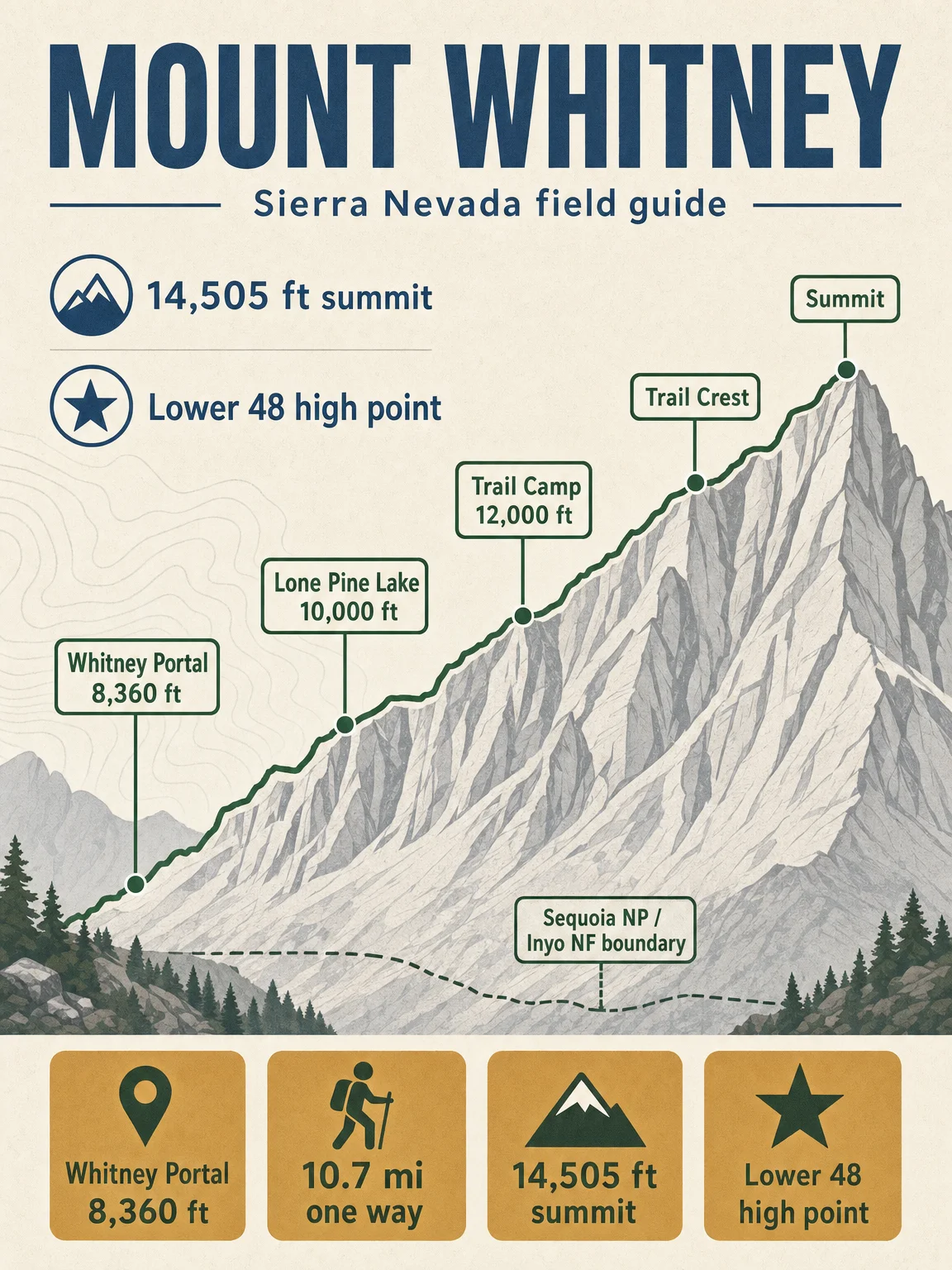
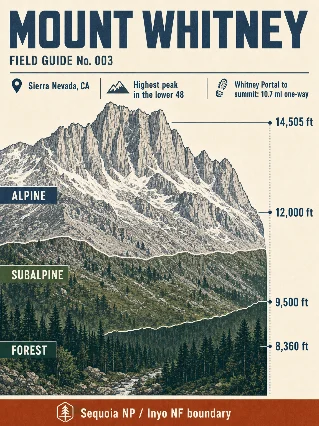
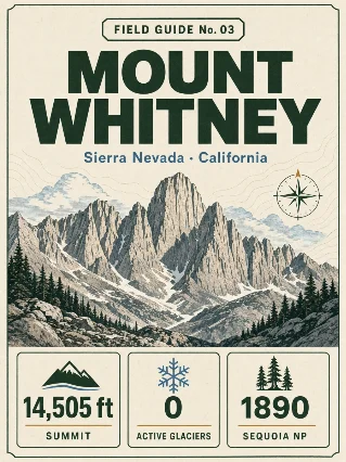
This week's four-poster field guide follows Mount Whitney from Whitney Portal to the 14,505 ft summit, the highest point in the contiguous United States. The standard east-side route starts at Whitney Portal, runs 10.7 miles one way, and climbs from roughly 8,360 ft to the summit on the Sequoia National Park / Inyo National Forest boundary. 1
Poster 1: elevation cross-section
The opening poster maps the classic climb: Whitney Portal at 8,360 ft, Lone Pine Lake around 10,000 ft, Trail Camp near 12,000 ft, Trail Crest, then the final summit ridge at 14,505 ft. The Forest Service describes the standard Mount Whitney Trail as a 22-mile round trip with more than 6,200 ft of gain, usually a 12- to 14-hour day for fit hikers. 2
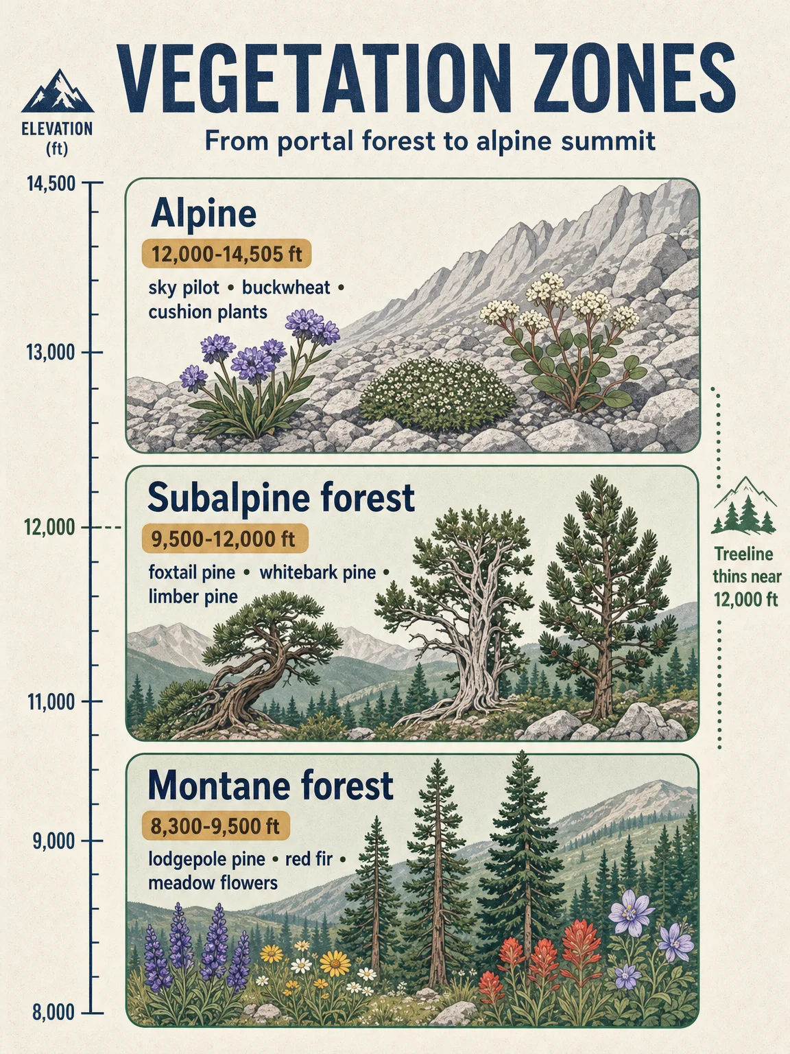
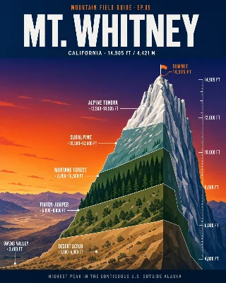
Poster 2: vegetation zones
The vegetation card uses three route-facing bands rather than the full west-to-east park gradient: montane forest from the portal to the lower subalpine boundary, subalpine forest from about 9,500 to 12,000 ft, and alpine terrain above treeline. NPS describes southern Sierra subalpine forests as typically 9,500-12,000 ft and identifies mountain hemlock, whitebark pine, foxtail pine, limber pine, and western juniper as trees hikers may encounter there. 3 Above treeline, NPS describes low perennial herbs, cushion plants, oval-leafed buckwheat, and other alpine plants adapted to short summers, wind, snow, and thin soils. 4
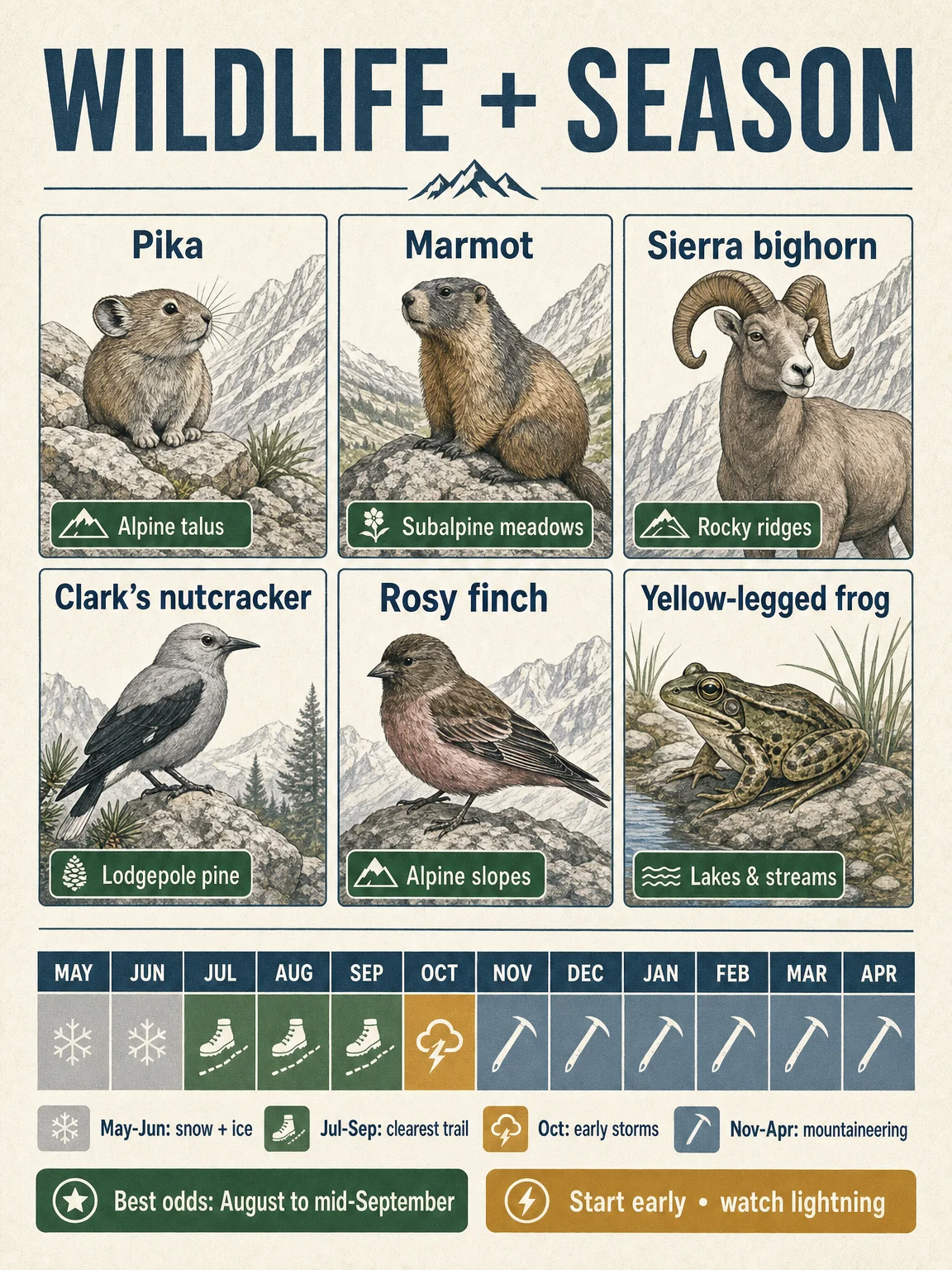
Poster 3: wildlife and season
The wildlife grid focuses on high-Sierra species that fit Whitney's upper trail: pika, marmot, Sierra Nevada bighorn sheep, Clark's nutcracker, gray-crowned rosy finch, and mountain yellow-legged frog. NPS lists marmot, pika, white-tailed jackrabbit, Clark's nutcracker, mountain bluebird, American pipit, gray-crowned rosy finch, Sierra Nevada bighorn sheep, and mountain yellow-legged frog among subalpine and alpine animals in Sequoia and Kings Canyon. 5 The season strip marks the practical hiking window: the Forest Service says the trail is usually snow-free from July to late September, while snow or ice turns the route into winter-mountaineering terrain. 2
Poster 4: route difficulty
The route card separates day-hike, preview-hike, backpacking, and climbing options. The standard Mount Whitney Trail is the most common non-technical summit route when snow-free; the Lone Pine Lake preview uses the first three miles of the same trail and stops before the Whitney Zone; the High Sierra Trail reaches the John Muir Trail after 49 miles and then continues to Whitney before descending to Whitney Portal; the Mountaineer's Route is treated as a climber's route, not a casual alternative. 6 7
Planning note: A wilderness permit is required year-round for the Mount Whitney area, and the quota season runs May 1-November 1. 2
Comentar
Inicia sesión para comentar.