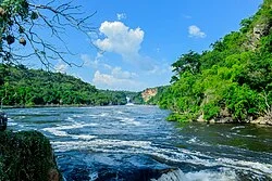
The river that made a civilization, then became a negotiation
Wikipedia's July 26, 2026 Featured Article follows the Nile from seasonal flood and ancient Egyptian calendars to dams, ecological upheaval, and the modern struggle over who gets to control its water.

A river longer than the story people tell about it
At 7,088 kilometres, the Nile is the world's longest river by length. Yet its annual discharge is only about 1% of the Amazon's, 6% of the Congo's, and 12% of the Yangtze's. Its power has never come from water volume alone. It comes from where that water arrives, when it arrives, and how many lives have been built around its narrow route through a largely dry continent. 1 2
Wikipedia's editors selected the Nile as the Featured Article for July 26, 2026. The original article is a full river biography: geography first, then hydrology, ecology, geology, human history, exploration, agriculture, dams, and the modern politics of sharing a river that crosses eleven countries. Read the Featured Article selection alongside the complete Nile article; the story below follows its central argument, that the Nile is never just a channel carrying water from south to north.
| The river in brief | Detail |
|---|---|
| Length | 7,088 km |
| Basin | 2,927,843 km², across eleven countries |
| Main tributaries | White Nile and Blue Nile |
| Confluence | Khartoum, Sudan |
| Mouth | Mediterranean Sea, through the Nile Delta |
| Current course | Established about 15,000 years ago |
Two rivers, two rhythms
The Nile begins as a problem of definition. The White Nile is longer and is usually treated as the headwater, beginning in the Great Lakes region of East Africa. The Blue Nile begins near Lake Tana in Ethiopia. They meet at Khartoum, where their different colours can still be seen: the White Nile carries pale sediments containing quartz and feldspar, while the Blue Nile carries darker clay eroded from Ethiopia's basaltic highlands. 2
The two tributaries also keep different clocks. Lakes and wetlands make the White Nile's flow relatively steady, although roughly half its water is lost to evaporation as it crosses the Sudd, a vast swamp in South Sudan. The Blue Nile is more seasonal. Heavy summer monsoon rains in the Ethiopian Highlands make it flood between July and October, and during that season it can supply about 70% of the main Nile's flow. Across the year, the Blue Nile contributes about 54%, the White Nile about 32%, and the Atbarah, another Ethiopian tributary, about 14%. 2
That seasonal contrast once made the river both generous and dangerous. The Nile could carry a new layer of fertile silt into Egypt, but a flood that arrived too high, too low, or at the wrong time could destroy the harvest. The river's famous regularity was never the same thing as certainty.
The source is not a single dot
Maps like to give rivers a clean beginning. The Nile resists that neatness.
The source defined by the longest year-round watercourse is a tributary of the Rukarara River in Rwanda's Nyungwe National Park. The highest sources lie on the slopes of Uganda's Rwenzori Mountains. A southernmost source is associated with a headwater of Burundi's Ruvyironza River. Lake Victoria is often called the source in ordinary usage because the White Nile flows out of it at Jinja, Uganda, but the hydrological answer depends on what counts as the beginning: the longest route, the highest spring, the southernmost headwater, or the largest lake in the system. 2
Europeans spent centuries trying to settle the question, often with maps that were more imaginative than accurate. The Blue Nile's source at Gish Abay in Ethiopia was visited by the Jesuit missionary Pedro Páez in the early seventeenth century, though later writers had to estimate the date from his account. The White Nile was harder to trace. John Hanning Speke saw Lake Victoria in 1858 and identified its northern outflow as the Nile, but because he did not follow the river all the way to Sudan, the conclusion remained disputed for a time. Researchers refined the farthest White Nile source in the twentieth and twenty-first centuries, using fieldwork and satellite imagery to place it near a spring in Rwanda. 2
The river's geology adds a deeper twist. The Nile has followed its present course for only about 15,000 years. In geological time, the river that seems ancient is relatively young, assembled from older river systems by tectonic change, shifting lakes, changing rainfall, and the opening and closing of connections between basins.
Floodwater became a calendar
Ancient Egypt did not simply live beside the Nile. It organized time around it.
The annual flood deposited nutrient-rich soil along the riverbanks, allowing intensive agriculture in an otherwise arid landscape. The Egyptian calendar divided the year into three seasons linked to the river: Akhet, the inundation; Peret, the growing season; and Shemu, the harvest. Irrigation, flood prediction, taxation, transport, and administration all required people to measure and manage the river. Even directions were described in relation to moving upstream: one word could mean both “up” and “south,” while other terms connected “left” with east and “right” with west. 2
“The Nile was central to every facet of Egyptian life.” 1
The sentence is short, but the article earns it through particulars. Boats moved people and grain. Floods made fields productive, while drought could bring famine and political crisis. Lower Egypt, the Delta, and Upper Egypt, the valley farther south, developed distinct identities partly because the river behaved differently in their landscapes. South of the cataracts lay Nubia, where the Kerma culture and Kushite Empire grew along the same water system, sometimes trading with Egypt and sometimes ruling it. 2
The Nile also carried power beyond Egypt. Rome imported huge quantities of Egyptian grain grown with Nile water. In the tenth century, a run of exceptionally low floods between 945 and 977 contributed to crop failures and political instability, helping create the conditions for the rise of the Fatimid Caliphate. A river could therefore shape an empire without ever appearing in a battle report: its fluctuations entered food prices, tax receipts, migration, and the legitimacy of rulers.
When the flood became infrastructure
For millennia, societies worked with the flood. In the modern era, states increasingly worked to replace it with control.
Egypt's first major Nile dam, the Aswan Low Dam, was completed in 1902 and raised twice. The twentieth century brought more dams on the Blue Nile, the Atbarah, and the main river. The Aswan High Dam, completed in 1970, created a reservoir holding roughly two years of Nile flow and made the river downstream more constant throughout the year. It increased irrigation water and supplied electricity; its generators have a capacity of about 2.1 gigawatts. 2
The trade was physical as well as political. Before the dam, seasonal floods carried silt downstream. Afterward, much of that sediment remained in the reservoir. The delta, which had been built by material transported from upstream, began to shrink as Mediterranean currents eroded it faster than new sediment arrived. The same project that made water supplies more predictable also reduced the river's ability to renew the soil at its mouth. 2
The dam's benefits and costs were distributed unevenly. Abu Simbel and other monuments were moved to higher ground during an international rescue campaign, but many Nubians were displaced from their ancestral homes as the new reservoir flooded the valley. Downstream, farmers gained more dependable irrigation but faced poorer water quality, reduced soil fertility, rising salinity, and habitat loss. The Nile article does not treat the dam as either a triumph or a disaster. It shows the infrastructure as a bargain whose different sides are lived by different people.
A river becomes a negotiation
The Nile basin is shared by Burundi, the Democratic Republic of the Congo, Egypt, Eritrea, Ethiopia, Kenya, Rwanda, South Sudan, Sudan, Tanzania, and Uganda. Upstream countries receive more rain and generate much of the water. Downstream Egypt and Sudan are largely desert and depend heavily on the flow that reaches them. In hydrological terms, upstream areas are generally water sources, while South Sudan, Sudan, and Egypt are more often water sinks. That physical arrangement becomes a political asymmetry: the countries that contribute water are not the same countries that face the greatest dependence on its arrival. 2
The 1929 agreement between Egypt and Anglo-Egyptian Sudan gave Egypt 48 billion cubic metres of annual Nile water and Sudan 4 billion, while also giving Egypt rights to monitor upstream flow and veto projects it considered harmful. The 1959 agreement revised the allocation to 55.5 billion cubic metres for Egypt and 18.5 billion for Sudan, but upstream countries, including Ethiopia, were not parties to it. 2
That old arrangement has collided with new technology and new political confidence upstream. The Grand Ethiopian Renaissance Dam on the Blue Nile was completed in 2020; by 2025 its reservoir was full and most generators were producing electricity, with a capacity of more than 5 gigawatts. Ethiopia presents the dam as a route to electricity and development. Egypt fears reduced water available for irrigation, while Sudan has concerns about safety and supply. The negotiations have continued through different forums, but the basic conflict is simple to state: one country's power station sits upstream of another country's food system. 2
The ecosystem remembers every decision
The Nile is not an empty pipe between dams. Its basin contains more than 800 fish species, with 128 species in the river itself. Hippos, crocodiles, buffalo, shoebills, kingfishers, papyrus, water lilies, and the wetlands of the Sudd all belong to the river's wider system. Pollution from agricultural, industrial, and household waste is most pronounced in parts of Lake Tana, near major cities, and in the Delta. 2
One of the sharpest ecological stories began as a fisheries intervention. Nile perch were introduced into Lake Victoria in the 1950s to create a commercial fishery. The fishery succeeded, but the predator helped drive more than 500 species of native cichlids to extinction. The Nile perch did not merely change the catch. It changed the lake's biological history, while deforestation increased because firewood was needed to process the fish. 2
The future pressure is likely to arrive through several channels at once. Climate projections discussed in the article include higher temperatures, more variable precipitation, and more severe droughts in parts of North Africa and the Middle East. The Delta is especially exposed because sea-level rise works against a coastline already deprived of sediment by dams. The article reports a projection that as much as one third of the Delta's surface area could disappear within the next century under the combined pressure of those forces. That is a modelled risk, not a fixed timetable, but it makes the old bargain visible: stabilizing the river in one place can make another place less able to adapt.
Details worth keeping
- The Nile's basin covers about 2.93 million square kilometres, roughly a tenth of Africa, across eleven countries. 2
- The Blue Nile supplies more than twice the volume of the White Nile over the year, even though the White Nile is longer. 2
- Ninety-seven percent of the Nile's transported sediment comes from the Atbarah and Blue Nile, both of which rise in Ethiopia. 2
- The Aswan High Dam turned a seasonal river below the dam into a much more constant one, but trapped the sediment that had helped build the Delta. 2
- The river's present course is geologically young, while the political questions around its water are old enough to have outlasted several empires. 2
A line to remember
The Nile's most revealing feature is the gap between its appearance and its function. From a distance, it is a blue line through desert. Up close, it is a calendar, a farming machine, a transport route, a habitat, a source of electricity, a border-crossing system, and a set of promises that not every country agrees to keep. Wikipedia's Featured Article is strongest when it refuses to choose just one of those descriptions. The river's history is the history of people trying to make a fluctuating natural system dependable, then discovering that dependability itself has consequences.
For the complete references and the article's full treatment of its sources, read Nile, the Wikipedia article selected for July 26, 2026, and its Today's Featured Article page.
Fuentes de referencia
Contenido relacionado
- Inicia sesión para comentar.