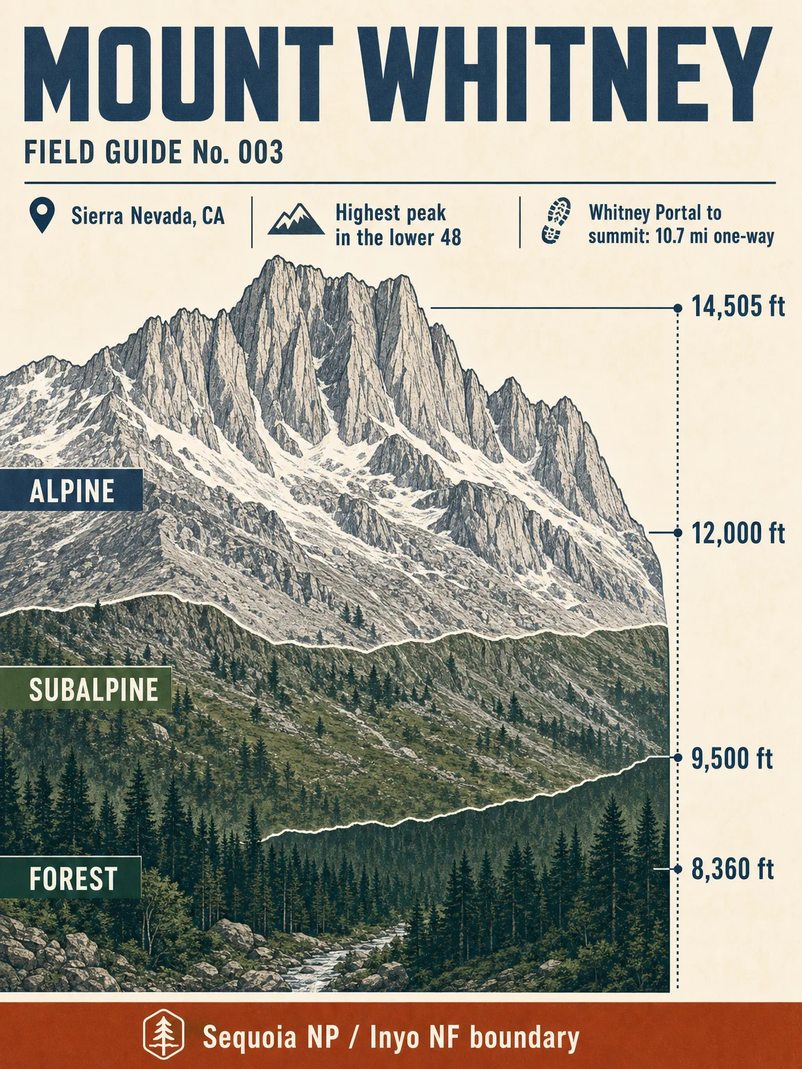

Mount Whitney is the high point of the contiguous United States: 14,505 ft at the summit, with the popular Whitney Portal approach starting at 8,360 ft on the east side of the Sierra Nevada. 1
Swipe notes
- Cross-section. The card reads Whitney as a granite Sierra crest rather than a volcanic cone: the peak sits on the Sequoia National Park / Inyo National Forest boundary, and the shortest popular route from Whitney Portal is 10.7 miles one way. 1
- Vegetation zones. The route bands use the NPS vegetation framework for Sequoia and Kings Canyon: montane forest below the high conifers, subalpine forest around 9,500-12,000 ft, then alpine habitat above treeline. The percentages are route-span estimates calculated from Whitney Portal to the summit. 234
- Flora field cards. Red fir and lodgepole pine anchor the upper montane forest; foxtail pine and whitebark pine define the treeline story; sky pilot and oval-leafed buckwheat represent the exposed alpine zone. 345
- Wildlife by elevation. The high country panel uses NPS-listed alpine and subalpine species such as pika, marmot, Clark's nutcracker, mountain bluebird, gray-crowned rosy-finch, mountain yellow-legged frog, and Sierra Nevada bighorn sheep; the forest row uses common park mammals and birds from the montane zone. 678
- Season and difficulty. The main trail is usually snow-free from July to late September, with a quota season from May 1 to November 1. Day-use summit attempts are commonly described as 22 miles round trip, about 12-14 hours; the Mountaineer's Route adds Class 3 alpine terrain, route-finding, and snow gear when conditions require it. 91011
This issue stays in the existing five-card format: cross-section, vegetation zones, flora, wildlife, and season / difficulty.
References
- 1
- 2
- 3
- 4
- 5
- 6
- 7
- 8
- 9Mount Whitney - Inyo National Forest
fs.usda.gov
- 10The Mountaineer's Route - Mountain Project
mountainproject.com
- 11Mountaineer's Route - SummitPost
summitpost.org
Comments