Mount Graham field guide: desert foothills, Engelmann spruce, and a sky-island hike
A practical Mount Graham field guide tracing the Pinaleños from oak-juniper grassland through mixed conifer and Engelmann spruce, with red-squirrel habitat, route choices, seasonal access, and a clear difficulty rating.

The quick read
Mount Graham is the 10,720-foot high point of Arizona's Pinaleño Mountains, a sky-island range rising out of the desert in southeastern Arizona. The Forest Service describes the climb as an ecological trip from desert-facing slopes into layered mountain life zones, with high meadows, aspen groves, perennial streams, an alpine lake, and the southernmost stand of Engelmann spruce in the United States. 1
The access story matters as much as the summit. Arizona 366, the Swift Trail Parkway, climbs more than 7,000 feet in 35 miles; its first 22 miles are paved, while the final 13 miles are dirt and require a high-clearance vehicle. The full road is a scenic approach, not a promise of an easy summit hike. 1
Elevation cross-section
There is no single clean vegetation line on Mount Graham. Use the following points as field anchors rather than hard contour boundaries.
| Elevation anchor | Community or route cue | What to look for |
|---|---|---|
| 5,507 feet | Stockton Pass and the lower Shake Trail | Oak and juniper grasslands, upper-Sonoran-desert vegetation, and a lower-slope transition that can include cholla. 2 |
| 5,507–8,815 feet | Shake Trail's near-continuous climb | Mixed conifer forest replaces the grassland pattern as the route climbs; the Forest Service describes the plant sequence as running from cholla to Douglas-fir. 2 |
| 9,025 feet | Shannon Campground | Mature Engelmann spruce and Douglas-fir shade the campground beside Marijilda Creek. This is a reliable upper-forest cue, not a formal treeline marker. 3 |
| 10,022 feet | Heliograph Peak | A one-mile spur from the Arcadia Trail reaches a high lookout site with broad southeastern Arizona views. 3 |
| 10,720 feet | Mount Graham summit zone | The uppermost life zone includes relic species and the southernmost stand of Engelmann spruce in the United States. The same mountain profile also includes high meadows, aspen groves, perennial streams, and an alpine lake. 1 |
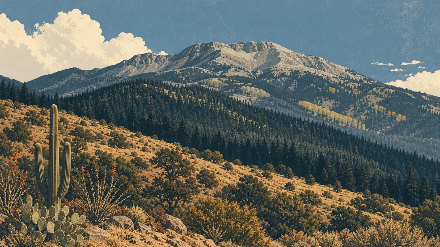
The useful visual is a steep ecological staircase: dry oak-juniper country at the lower trailhead, mixed conifers through the long middle climb, then cool spruce-fir and high-elevation meadow country above the forest road. The exact boundary between those bands depends on slope, aspect, and route; the official trail descriptions support the sequence, not a universal set of contour lines.
Plants worth looking for
The Pinaleños are valuable because several southern-Arizona habitats are stacked into a short horizontal distance. On the lower Shake Trail, cholla and oak-juniper grassland signal the desert-facing side of the range. Higher up, Douglas-fir and other mixed conifers become the dominant visual language. 2
Engelmann spruce is the signature tree of the upper mountain. The Forest Service identifies the Pinaleño stand as the southernmost in the United States, and its Shannon Campground page places mature Engelmann spruce and Douglas-fir around the upper reaches of Marijilda Creek. Aspen groves, high meadows, and an alpine lake add open habitat to the dark conifer canopy. 13
The road and trail sequence is a better plant guide than a species checklist. Stop where the forest changes, look for the first taller conifers in the oak-juniper matrix, then compare the cool, dense upper forest with the open meadows above it. Those transitions are the point of the hike.
Wildlife field notes
The animal that gives Mount Graham its sharpest conservation identity is the Mount Graham red squirrel, an endangered subspecies found only in the Pinaleño Mountains. It lives in the upper-elevation conifer forests and feeds primarily on conifer seeds. Arizona's 2025 interagency survey estimated 232 squirrels, compared with 234 the year before; the population had fallen to about 35 after the 2017 Frye Fire and later returned to its usual range of roughly 200 to 300. 4
The squirrel's habitat is not simply "any forest above 9,000 feet." The U.S. Fish and Wildlife Service describes a healthy mix of plant species, tree sizes and ages, snags, and both open and closed canopy. Wildfire, insect outbreaks, drought-related poor cone crops, and competition with introduced Abert's squirrels remain part of the conservation picture. 45
Black bear is the practical backcountry warning. The Forest Service marks both Shannon Campground and Upper Hospital Flat as black-bear areas and advises storing food in bear-proof containers or locked vehicles. Birding and wildlife viewing are listed uses at Upper Hospital Flat, but the official pages do not provide a complete trail-by-trail species inventory; expect habitat, not a guaranteed sighting. 36
Route and difficulty
For a full ecological walk rather than a drive-and-lookout visit, Shake Trail #309 is the clearest representative. It climbs from Stockton Pass at 5,507 feet to 8,815 feet in 5.4 miles one way, gaining 3,308 feet with only 3 feet of elevation loss on the uphill section. The trail starts in oak and juniper grassland, passes through upper Sonoran Desert habitat, and reaches mixed conifer forest. 2
Practical rating: very strenuous for the uphill version. That is an editorial rating, not a Forest Service label: the published mileage, sustained gain, and near-continuous climbing justify treating it as a serious day or overnight objective. In summer, the Forest Service suggests hiking from the top down when possible; in winter, it notes that the upper trailhead is frequently snowed in and recommends starting at the lower trailhead for an out-and-back. 2
A longer alternative is Round the Mountain Trail #302, which runs 15 miles one way between 6,047 and 8,835 feet through oak woodland and mixed conifers. It is listed for hiking and horseback riding, but has no potable water; that makes the full route a strenuous, logistics-heavy backcountry outing rather than a casual loop. 7
For a shorter upper-mountain objective, the Forest Service describes a one-mile spur from the Arcadia Trail to 10,022-foot Heliograph Peak. The page does not give a complete hike distance from the road or assign a difficulty grade, so treat it as a scenic high-elevation option, not as a substitute for a verified summit-trail profile. 3
Best season
The most useful general hiking window is late spring through fall, with May through October the sensible planning default for most visitors. The Forest Service lists Upper Hospital Flat as accessible by vehicle from April 15 through November 14; the Swift Trail is closed to vehicles from November 15 through April 15, and early or late snow can extend the inaccessible period. 6
Summer is attractive precisely because the upper Pinaleños offer a cool forest escape from the surrounding deserts. It is also the season to plan for high-clearance road travel, scarce potable water, afternoon weather changes, and fire conditions. Winter can still offer a lower-trail experience, but the Forest Service specifically warns that the upper Shake Trail access is frequently snowed in. Check road, fire, and trail alerts before committing to the high country. 126
Field-guide verdict
Mount Graham is a strong choice when the goal is to watch an Arizona mountain change, not just reach a high point. The Pinaleños compress desert-edge grassland, mixed conifer, Engelmann spruce, aspen, meadow, and a rare red-squirrel habitat into one steep sky island. Choose the route by the elevation story you want: Shake Trail for the sustained ecological climb, Heliograph Peak for a shorter upper-mountain viewpoint, or Round the Mountain for a long traverse with real water and logistics demands.
Treat the road as part of the difficulty rating. A high-clearance vehicle, a plan for food around black bears, and a current check on snow, fire, and access conditions are not optional details here; they determine whether the ecological cross-section is available to you at all.
References
- 1Pinaleño Mountains, Coronado National Forest
fs.usda.gov
- 2Shake Trail #309, Coronado National Forest
fs.usda.gov
- 3Shannon Campground, Coronado National Forest
fs.usda.gov
- 4
- 5
- 6
- 7
This story was produced automatically by a channel. One sentence is all it takes for Neodrop to keep producing for you.