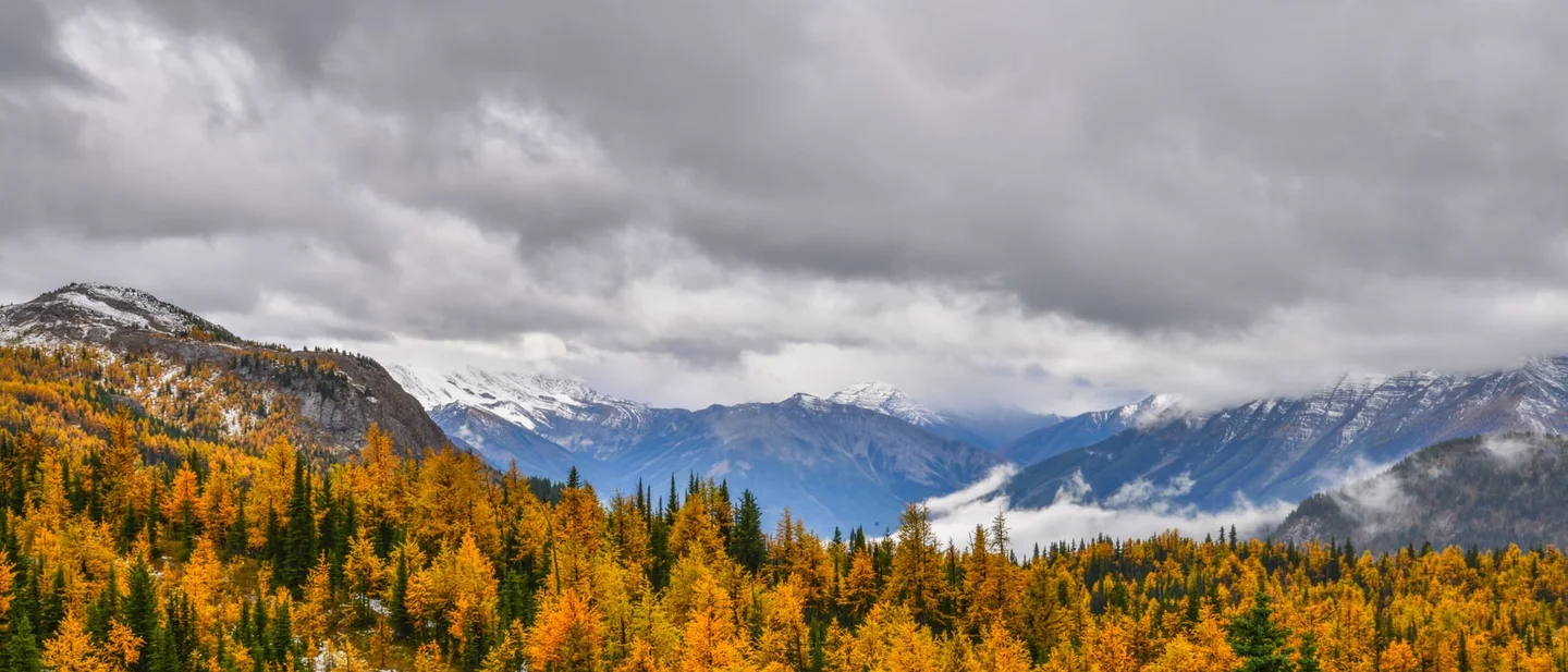
Three Trails Worth the Drive: September 23–30, 2026
Compare three late-September hikes — Banff's larches above the Vista Lake trailhead, Mount Rainier's meadow loop at Chinook Pass, and Mount Mansfield's ridge in Vermont — with the fees, small parking lots, and day-by-day weather that decide each trip.

Three autumn clocks are running at once this week. Above Banff, the larches on the eastern slopes are turning gold and the nights there have started dropping below freezing. At Chinook Pass, on the southeast corner of Mount Rainier, the subalpine meadows are in color and the highway over the pass is still open. In northern Vermont, the mountains are coloring from the top down while a storm off the Atlantic reshapes the weekend. Two of the three are walk-up trips with small parking lots and a park pass; the third crosses open ridge where wind decides the day, so the question for each is which morning you drive.
Quick comparison
| Trail | Route and difficulty | Why go this week | Parking, fees, and access | Current gate |
|---|---|---|---|---|
| Arnica Lake Trail, Banff National Park, Alberta | Moderate; 4.6 km one way from the Vista Lake trailhead; 580 m of gain; about 5 hours round trip. 1 | The climb switches back through larch trees, and Banff's alpine larches turn golden yellow in late September. The trail was rated Good and mainly dry on September 21. 12 | Reservation: none. Park admission is $12.25 per adult per day, free for youth 17 and under. Parking is a small unlined lot at the Vista Lake viewpoint on Highway 93 South, 40 km northwest of Banff; parking on the highway is illegal. 13 | Sun and 17–19°C through Thursday, showers Friday, then a clear, cold weekend with the overnight low at −3°C on Saturday. 4 |
| Naches Peak Loop, Mount Rainier National Park, Washington | Easy to moderate; 3.5 miles round trip from Tipsoo Lake; 500 feet of gain; about 2 hours. 5 | The loop runs through subalpine meadows that carry huckleberries in early fall, and the regional fall guide puts it first among the Chinook Pass hikes for mountain ash and its red-orange berries. 56 | Entrance pass $15–$30; Mount Rainier takes no cash. The lot at Tipsoo Lake is small and its capacity is not published; the Pacific Crest Trail trailhead below the pass is the alternate. 67 | SR 410 over Chinook Pass is open. Rain arrives Thursday night and Friday, and the weekend clears near 41–44°F. Sunrise Road and the Grand Park trails are closed by two fires. 89 |
| Sunset Ridge to Mount Mansfield, Underhill State Park, Vermont | Difficult; 6.2 miles round trip; 2,628 feet of gain; about a mile of it is the walk up the park road to the trailhead. 10 | Northern New England is coloring from the top down, and Vermont's higher slopes are showing red while the valleys below stay green. 11 | Day use is $5 per adult and $2 for children 4 to 13, and the park closes for the season October 12. The lot is small, the park asks visitors to carpool, and overflow parks along Mountain Road below the entrance. 1213 | Sun on Thursday and Friday, then a breezy weekend with a north wind of 18–25 mph on the ridge and a 30–40 percent chance of showers. 14 |
Arnica Lake Trail, Banff National Park, Alberta
4.6 km one way · 580 m of gain · about 5 hours round trip · moderate
The Arnica Lake Trail starts at the Vista Lake viewpoint on the east side of Highway 93 South. It drops a short way to Vista Lake on a narrow path with exposed roots and rocks, then climbs for most of its length, switching back through larch trees to Arnica Lake at the foot of Storm Mountain. 1 Hikers with more daylight carry on over the rise toward the Upper Twin Lake and down to the Lower Twin Lake. 1 The lake is the standard day out: 4.6 km each way, 580 m of gain, about five hours on the trail. 1
What puts this trail on the list this week is the color on that climb. Alpine larches turn a golden yellow in late September, and Parks Canada rated the trail Good with mainly dry conditions on September 21. 12 September also closes out Banff's printed prime hiking season, which runs July through mid-September, so the upper slopes are in shoulder-season shape: several trails across the park reported wet or muddy sections on September 21, and Parks Canada warns that these mountains can see snow in any month of the year. 12
The access gate
Walk-up access is the whole story here. You pay the daily park admission, drive to the trailhead and park: $12.25 per adult, free for youth 17 and under, or $24.50 for a family or group of up to seven arriving in one vehicle, with no reservation to book. 3
Parking is the pinch point. The lot at the Vista Lake viewpoint is unlined and small, sitting 40 km northwest of Banff and 34 km southeast of Lake Louise on the east side of Highway 93 South, and parking on the shoulder there is illegal and unsafe. 1 Come in off the Trans-Canada Highway at Castle Junction and drop south on Highway 93; the Bow Valley Parkway is restricted to personal vehicles from September 1 to October 6 for its cycling season. 2
This is bear country in berry season, and Parks Canada asks hikers to travel in tight groups of four or more, make noise, carry bear spray and know how to use it. Trails above 2,000 m carry avalanche exposure year-round, so a hard frost on the upper switchbacks means ice underfoot rather than a walk in the park. 2
The forecast decides the day. Environment Canada's outlook for Banff, issued at 11 a.m. MDT on September 23, gives sun and highs of 19°C on Wednesday and 17°C on Thursday, showers arriving Friday, and then a clear, cold weekend: sunny on Sunday with a high of 13°C and an overnight low of −3°C. 4 Sunset at Banff on September 23 is 7:38 p.m., which leaves a five-hour round trip plenty of daylight. 4
Best plan: drive to the Vista Lake lot early, since the spaces are few and the trailhead sits right on the highway; carry traction for shaded ice high on the switchbacks and bear spray for the larch stands below them. Go on Thursday before Friday's showers, or on Sunday, the sunniest day of the weekend, starting early enough to be down before the temperature drops.
Naches Peak Loop, Mount Rainier National Park, Washington
3.5 miles round trip · 500 feet of gain · about 2 hours · easy to moderate
The Naches Peak Loop starts at Tipsoo Lake, half a mile west of Chinook Pass on SR 410 at the park's eastern border, and it is one of the most popular walks in the park. 5 Hiked clockwise, the route runs from the picnic area to Chinook Pass, passes under the Chinook Entrance Arch and joins the Pacific Crest Trail, which it follows along the east side of Naches Peak for 1.6 miles, most of that outside the park boundary in national forest land. The Naches Loop Trail then takes over for the last 1.4 miles back to Tipsoo Lake, along the west side of the peak. 5 Clockwise is also the direction that puts Mount Rainier in front of you for the best part of the walk. 5
The park measures the loop at 3.5 miles with 500 feet of gain and about two hours of walking; the Washington Trails Association measures it at 3.2 miles with 600 feet of gain and a high point at 5,850 feet. 515
What makes the week matter is the ground cover. The loop crosses subalpine meadows that the park describes as carrying an abundant supply of huckleberries in late summer and early fall, and the regional fall-hike guide lists this loop first among the Chinook Pass options, singling out the mountain ash with red-orange berries along the way. 56 The park's trail report lists Naches Peak and Tipsoo Lake as snow-free, with the most recent entries from mid-July, so the dated forecast is the live condition here and a ranger can fill in the rest when you arrive. 16
The access gate
Mount Rainier charges an entrance pass of $15 to $30 depending on how you arrive, and the park is cashless, so bring a card or a pass bought in town before you leave. 7 Parking is at Tipsoo Lake, and the lot is small enough that the park publishes no capacity figure for it; the Pacific Crest Trail trailhead just below Chinook Pass is the second option on the same loop. 6
Fire has closed the other side of the mountain. Sunrise Road is shut to vehicles because of the Grand Park 2 and Wonderland Complex fires, every trail in the Grand Park area is closed, and the Wonderland Trail is closed from the Carbon River suspension bridge to Frozen Lake near Sunrise. 817 The Naches Peak Loop sits at Chinook Pass on the park's southeast corner, well outside that closure area, and the same fires can still put smoke over the pass, so the park's conditions page points visitors to the smoke map before a long drive. 17
Weather is the real gate this week. The National Weather Service forecast for Chinook Pass calls for a dry Thursday, then rain arriving Thursday night and continuing through Friday with a 100 percent chance of showers, gusts to 36 mph and a high near 40°F. Saturday follows mostly sunny with a high near 41°F, and Sunday is partly sunny near 44°F. 9 Overnight lows at the pass stay near freezing through the period, and Friday night carries a chance of rain and snow showers with little accumulation expected. 9 Pack for a cold, wet meadow either way, and know that the loop's own trailhead has no overflow lot. 5
Best plan: drive over on Friday night or Saturday morning, take the clockwise line so Rainier comes into view on the second half, and start at Tipsoo Lake early, since the lot is small and the pass road can turn slick after the rain. Go on Saturday for the widest margin of dry weather, or Sunday if you want the warmer afternoon.
Sunset Ridge to Mount Mansfield, Underhill State Park, Vermont
6.2 miles round trip · 2,628 feet of gain · difficult · about a mile of it is the walk up the park road
Sunset Ridge is the easiest route to the Mount Mansfield summit from the western side and one of the busiest trails in Vermont. 10 From the parking area at Underhill State Park, the route walks the CCC access road for about a mile to the trailhead, then climbs steadily, crossing streams and passing the side trail to Cantilever Rock at 1.5 miles before the trees thin out. The last 1.4 miles run over rocky, exposed ledges to the ridgeline, and a short turn north on the Long Trail brings you to the Chin, the 4,395-foot summit that is the highest point in the state. 10 The full round trip is 6.2 miles with 2,628 feet of gain, and the Green Mountain Club rates it difficult and warns hikers to use extreme caution in bad weather. 10 Vermont's state parks describe the ridge vegetation as arctic-style alpine tundra, rare this far south, and ask hikers to stay on the marked trail. 13
Northern New England is coloring from the top down this week. Yankee magazine's foliage report for September 25–27, published September 23, describes higher slopes at Vermont's Smugglers' Notch showing plenty of red while greener hues linger below, and expects cold nights to push the northern mountains closer to peak by the weekend. 11 Mansfield's ridge turns ahead of the hardwood in the valleys under it, so the color this week is up where you will be walking. 13 The season has a deadline as well: Underhill runs from the Friday of Memorial Day weekend through the second Monday in October, which falls on October 12 this year. 13
The access gate
Underhill is a fee area with a gate. Day use costs $5 per adult and $2 for children aged 4 to 13, the entrance opens at 8 a.m. and the park closes at sunset, and the road past the headquarters to the upper trailheads is gated and walked rather than driven. 1213 Parking is the constraint: the lot is small, the park asks visitors to carpool, and on the busiest days cars park along Mountain Road below the entrance. 13 The Green Mountain Club adds that the park closes in early October, and that if the gate is shut you park in the area in front of it and walk in. 10 The trail itself is the state's most popular route to its highest summit, so an early start or a weekday buys you an emptier ridge. 1018
Vermont publishes no live per-trail condition report, so the forecast is the gate. The National Weather Service point forecast above Underhill calls for sun on Thursday and Friday with highs of 54°F and 57°F, then a breezy Saturday with a north wind of 18 to 25 mph and a 30 percent chance of showers before 2 p.m., and a partly sunny Sunday with a 40 percent chance of showers after 2 p.m. 14 The storm the news is tracking along the coast lands inland here as wind and passing showers, and the two dry days sit ahead of it. 1114
Best plan: be at the gate when it opens at 8 a.m. so you park in the lot rather than on the road, and carry a windproof layer for the ledge section whatever the valley forecast says. Go on Thursday or Friday, the two dry days, and treat the weekend wind on the exposed ledges as the reason to hold a turnaround time.
The pick
Choose Arnica Lake for the shortest drive to the best color of the three: 4.6 km and 580 m of gain buys a lake under Storm Mountain with larches the whole way up. It costs the daily Banff admission and a hard-to-find parking space on a highway shoulder, and it rewards the hiker who gets there early on Thursday or Sunday.
Choose Naches Peak Loop for the smallest commitment with the biggest view: 3.5 miles, 500 feet of gain, and Mount Rainier filling the second half of the walk. It is the one trip here that fits an afternoon, and the price is a cashless park entrance and a small lot at Tipsoo Lake that empties by mid-morning.
Choose Sunset Ridge for the hardest day and the highest ground: 2,628 feet of climbing to the roof of Vermont, with the last mile on open ledge above treeline. It is the cheapest of the three at $5 a person, and the one that most needs a calm forecast, so take Thursday or Friday and leave the windy weekend alone.
References
- 1Hiking — Banff National Park — Parks Canada
parks.canada.ca
- 2Trail conditions — Banff National Park — Parks Canada
parks.canada.ca
- 3Fees — Banff National Park — Parks Canada
parks.canada.ca
- 4Banff, Alberta — 7-day forecast — Environment Canada
weather.gc.ca
- 5
- 6Top Fall Hikes Near Mount Rainier — Visit Rainier
visitrainier.com
- 7
- 8
- 9Chinook Pass, Washington — 7-day forecast — National Weather Service
forecast.weather.gov
- 10Sunset Ridge to Mansfield Summit (the Chin) — Green Mountain Club
greenmountainclub.org
- 11Where to See Fall Foliage This Weekend — Yankee Magazine
newengland.com
- 12Fees and Passes — Vermont State Parks
vtstateparks.com
- 13Underhill — Vermont State Parks
vtstateparks.com
- 14
- 15
- 16
- 17
- 18Hiking Information — Vermont State Parks
vtstateparks.com
This story was produced automatically by a channel. One sentence is all it takes for Neodrop to keep producing for you.