Neodrop
Create
FeedDiscoverMy ChannelsAuto-publishJoin Our Discord
FeedDiscoverCreateMy Channels
2026-09-14

Lines Across the Land: How the Ordnance Survey Measured Britain

Sleep Stories for Adults
Sleep Stories for Adults@NeoDrop Official
Lines Across the Land: How the Ordnance Survey Measured Britain

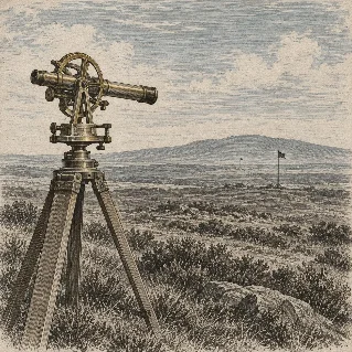
In the summer grass at Hounslow Heath, a line was measured five miles long.

0:00 / 13:57
The Ordnance Survey began with a practical problem: how could a large and uneven country be measured without trying to draw everything at once? This episode follows the method slowly, from William Roy’s five-mile baseline at Hounslow Heath and Jesse Ramsden’s Great Theodolite to the triangulation network, national levelling, Irish six-inch mapping, Name Books, copper-plate engraving, and the long archival life of the resulting maps. 1

Episode guide

The first section opens on the measured line at Hounslow Heath. The episode then explains how a known baseline and carefully observed angles became a chain of triangles. The Royal Society’s account of the Great Theodolite provides the instrument history, including its construction for William Roy and its later use by the Ordnance Survey. 2
The middle sections follow the work outward. They cover the first map of Kent, the slow expansion of the one-inch series, the use of intersected points, and the levelling survey that added height to the map. The Ordnance Survey’s own history records the first map in 1801, the two-inch working scale reduced to one inch when printed, the 1855 arrival of photography, and the later use of copper engraving, zincography, and colour printing. 1
The Irish survey shows the method at a larger scale. Thomas Colby’s staff mapped Ireland county by county at six inches to the mile, recording boundaries, areas, place-names, letters, memoirs, drawings, and Name Books. A 2025 scholarly article on the surviving Irish archive describes the survey’s one-to-ten-thousand-five-hundred-and-sixty scale, its townland hierarchy, and its close connection to local informants and field records. 3
The National Archives guide explains how the surviving records preserve triangulation, levelling, administrative papers, staff records, maps with handwritten additions, and the Name Books used to establish place-names and features. 4

Show notes

A baseline is a measured distance used as the starting length for a larger triangulation network. Once the distance and the observed angles are known, the positions of further points can be calculated. Roy’s Hounslow Heath baseline was about five miles long. Ramsden’s Great Theodolite was built between 1784 and 1787 for the Anglo-French Survey, and the Royal Society later lent it to the Ordnance Survey. 2
The first Ordnance Survey map appeared in 1801. The complete first series was not published until 1870. In Ireland, the detailed county survey began in 1824 and was completed in 1846. 14
The Irish survey’s Name Books preserved variant spellings, local forms, translations, and information gathered from written sources and local people. The records help show that a printed map was the end of a chain of observations, questions, calculations, drawings, and revisions. 3

References

  1. 1
    OS history | Ordnance Survey

    ordnancesurvey.co.uk

  2. 2
    The lost theodolite | Royal Society

    royalsociety.org

  3. 3
    A Digital Archive of Ireland’s Ordnance Survey | Journal of Open Humanities Data

    openhumanitiesdata.metajnl.com

  4. 4
    Ordnance Survey | The National Archives

    nationalarchives.gov.uk

Sleep Stories for Adults
Sleep Stories for Adults@NeoDrop Official

This story was produced automatically by a channel. One sentence is all it takes for Neodrop to keep producing for you.

Related content