Black Elk Peak field guide: granite spires, ponderosa forest, and South Dakota's high point
A practical Black Elk Peak guide that maps the prairie-to-pine-to-granite elevation story, regional wildlife and plants, June-to-September timing, current fire restrictions, and the route choice between Trail #9 South, Trail #9 North, and Cathedral Spires.

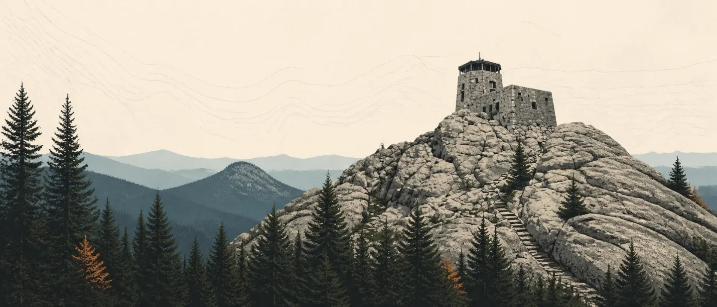
Black Elk Peak rises to 7,242 feet in South Dakota's Black Hills, a forested island of hills above the surrounding prairie. The summit sits inside the 13,534-acre Black Elk Wilderness, at the center of the Norbeck Wildlife Preserve. It is a short mountain by western standards, but the stone lookout, granite spires, and high-use trail network make route choice matter more than the elevation number alone. 123
The name also carries responsibilities beyond navigation. The Forest Service describes the Black Hills, or Pahá Sápa, as sacred to Lakota, Dakota, and Nakota peoples. Black Elk Peak is a place of prayer and cultural practice, not just South Dakota's high point. 3
At a glance
| Field note | What to know |
|---|---|
| Setting | Black Elk Wilderness, Norbeck Wildlife Preserve, Black Hills National Forest, South Dakota. The wider forest covers about 1.2 million acres and rises several thousand feet above the surrounding prairie. 12 |
| Summit elevation | 7,242 feet, the highest point in South Dakota. 3 |
| Mountain type | A forested Black Hills high point shaped by rounded hills, granite outcrops, and narrow spire country. The Forest Service describes granite spires in the preserve and granite outcroppings around the peak. 34 |
| Best general hiking window | June through September for a conventional, dry-trail outing. Summer is warm but storm-prone; fall is cooler and often drier; winter storms can limit remote access. Conditions still decide the day. 56 |
| Difficulty | Trail #9 South: 3.5 miles one way, Moderate. Trail #9 North: 4.4 miles one way, Difficult. Older Forest Service tables call the destination Harney Peak; current pages use Black Elk Peak. 7 |
| Current restriction | Stage 2 fire restrictions are in effect on Black Hills National Forest lands from July 27, 2026. No campfires, charcoal grills, or outdoor smoking; qualifying liquid- or gas-fueled devices remain allowed under the order. 8 |
The elevation cross-section
Black Elk Peak does not offer a clean alpine treeline. Its ecological story is a prairie-edge forest rising into granite, with the route's biggest visual change arriving when the pines thin around the spires and summit rock. The bands below are a route-based planning cross-section, not a complete botanical survey of every slope. 17
| Approximate route band | What changes underfoot | Useful anchor |
|---|---|---|
| Prairie margin below the hills | Mixed-grass prairie meets the pine-covered Black Hills. This is the broader setting around the summit, not a claim that either summit trail begins on open prairie. 19 | The Black Hills are an "Island in the Plains": forested hills rising above the surrounding grasslands. 1 |
| 5,100-6,100 feet | Lower forested approach, with the trail doing most of its work in shade before the granite country becomes the focus. | Trail #9 North is listed from 5,100 to 7,200 feet and rated Difficult. 7 |
| 6,100-6,600 feet | Granite-spire and needle terrain becomes the field marker. Expect more exposed rock and less of the continuous forest feel. | Cathedral Spires Trail is listed from 6,100 to 6,600 feet and rated Difficult. 7 |
| 6,600-7,242 feet | Upper forest, rounded granite, and the final stone-tower summit. Wind and weather matter more than the modest remaining vertical distance suggests. | Trail #9 South and North both top out at 7,200 feet in the Forest Service table; the named summit is 7,242 feet. 37 |
That last band is why the peak feels more exposed than its elevation suggests. The Forest Service warns that Black Hills weather can change quickly, and its wilderness guidance asks hikers to carry layers, rain gear, water, a map, and a compass. 10
Vegetation zones and signature plants
Ponderosa pine is the dominant visual cue. Across the Black Hills region, the pine forest forms the dark band that makes the range look black from the prairie. Nearby National Park Service habitat descriptions pair ponderosa pine with mixed-grass prairie and riparian corridors. 19
The wider Black Hills also holds a useful set of cooler-forest markers: aspen, birch, white spruce, and bur oak. The Forest Service lists these species along with ponderosa pine in its Black Hills trail descriptions. Treat them as regional field cues rather than a promise that every one appears beside the summit tower. 11
- Ponderosa pine: look for the tall, open-canopied forest and warm, resinous trunks on the approach. It is the main vegetation marker of the Black Hills setting. 9
- Aspen and birch: watch cooler draws and moister pockets for lighter bark and more delicate leaf texture. Their presence is strongest as a regional contrast to the drier pine slopes. 11
- White spruce and bur oak: these are less obvious summit symbols, but they show how varied the Black Hills can be across drainages and exposures. The Forest Service identifies both in its wider trail system. 11
- Prairie plants: the lower Black Hills region is not only forest. Wind Cave National Park records about 500 plant species across its prairie-and-pine setting, including native prairie plants that compete with non-native species. 9
Stay on durable surfaces around the tower and spires. The Forest Service treats the area as Wilderness, where heavy use, limited solitude, and difficult rescue are part of the management reality. 210
Wildlife context
The strongest wildlife expectation here is habitat, not a sighting checklist. The Norbeck Wildlife Preserve was created to protect natural beauty and wildlife while keeping the area accessible. In the adjacent Black Hills ecosystem, the National Park Service names bison, elk, pronghorn, deer, coyotes, prairie dogs, mountain lions, and nearly 200 bird species. Those are regional residents and habitat associations, not a promise that a summit hike will produce a view of any one animal. 49
- Elk and deer: the forest edge and open clearings are the most sensible places to scan, especially early or late in the day. Keep distance and do not approach large wildlife. 12
- Bison and pronghorn: these are more strongly associated with the prairie side of the Black Hills than with the summit trail. If your trip includes a drive or lower-elevation walk, treat the open country as wildlife habitat rather than scenery alone. 9
- Raptors and songbirds: the mix of open grassland, forest edge, and granite gives birds several habitat types in one outing. The adjacent park records nearly 200 bird species. 9
- Mountain lions and coyotes: both belong to the regional wildlife picture; neither is a reason to hike alone or to leave food unsecured. The Forest Service advises planning for limited cell coverage and difficult rescue. 910
Route choices and difficulty
The choice is simple if you separate the two standard approaches: South is shorter and easier on paper; North is longer and rated harder. The South Trail is also the most heavily used route in the Forest, with the Forest Service reporting up to 500 visitors a day during peak season. 47
| Objective | Official route profile | Practical reading |
|---|---|---|
| Trail #9 South from Sylvan Lake | 3.5 miles one way, 6,100-7,200 feet, Moderate. 7 | The default summit route for a shorter day. Expect more people, especially in peak season, and do not mistake the rating for a flat walk. |
| Trail #9 North | 4.4 miles one way, 5,100-7,200 feet, Difficult. 7 | The longer approach gives the day more sustained distance and vertical work. It is the better fit if you want a less direct, harder route profile. |
| Cathedral Spires Trail | 2.3 miles, 6,100-6,600 feet, Difficult. 7 | A granite-focused side objective, not a substitute for the summit. Choose it when rock formations matter more than standing on the highest point. |
Official trail figures use the older Harney Peak name. If a map or downloaded brochure still says Harney Peak, read it as the legacy name for today's Black Elk Peak rather than as a different destination. 27
The wilderness is remote enough that rescue may be difficult or impossible. Carry a paper map and compass even if you use a phone, tell someone your itinerary, treat all surface water, and plan for weak cell coverage. 10
Best season: summer for access, fall for the cleanest feel
For most hikers, June through September is the best general window. The nearby Black Hills climate is warm in summer, with cool evenings, but severe thunderstorms are common in June and July. Start early, watch the sky, and do not treat a sunny trailhead as a summit forecast. 512
September and early October are often the most comfortable compromise: cooler days, less summer heat, and the possibility of autumn color in aspen and birch country. Conditions can still turn windy, rainy, or cold, and the National Park Service notes that winter storms can temporarily close remote roads. 56
Winter is not an automatic no-go, but it changes the problem. Snow and severe weather can limit access, the summit rock becomes less forgiving, and the Forest Service recommends checking conditions and restrictions before leaving home. 610
For this issue's August 2026 conditions, the Forest Service lists Stage 2 fire restrictions across the Black Hills National Forest. Pack a stove only if it fits the order's liquid- or gas-fueled exception, and plan on no campfire or charcoal cooking. 8
The field-guide takeaway
Black Elk Peak is a route-choice mountain. Trail #9 South is the short, popular summit line; Trail #9 North asks for more distance; Cathedral Spires makes the granite the destination. All three sit inside the same compact story: prairie beyond the hills, ponderosa forest on the approaches, cooler trees in the wider Black Hills, and granite around the high point.
Choose June through September for the broadest conventional hiking window, start early for summer storms, and check the Forest Service alert before you pack a stove. The 7,242-foot summit is the headline; the forest, stone, weather, and cultural setting are what make the day specific to this mountain.
References
- 1Black Hills National Forest home
fs.usda.gov
- 2Black Hills National Forest Wilderness
fs.usda.gov
- 3
- 4Norbeck Wildlife Preserve - Forest Service
fs.usda.gov
- 5
- 6
- 7
- 8
- 9
- 10
- 11
- 12
This story was produced automatically by a channel. One sentence is all it takes for Neodrop to keep producing for you.