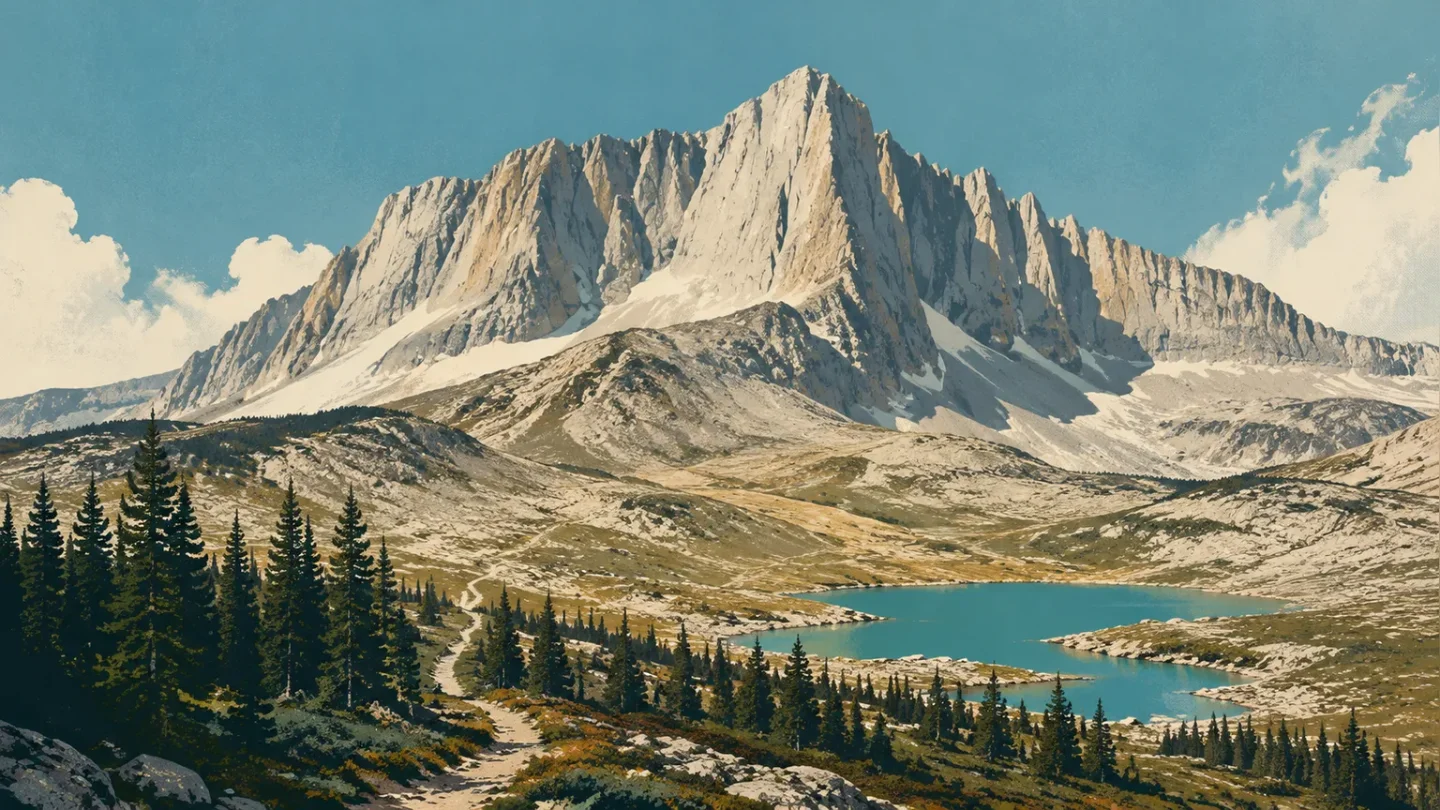
Beartooth Mountains field guide: granite plateaus, alpine lakes, and a trail from forest to tundra
A practical Beartooth Mountains guide that maps the canyon-to-alpine elevation story, names high-country plants and wildlife cues, and compares Glacier Lake, Hellroaring Plateau, Mount Maurice, and Lake Fork by season and difficulty.

The quick read
The Beartooth Mountains are built for reading in layers. Granite Peak rises to 12,799 feet, the highest point in Montana, while the Beartooth Highway reaches 10,947 feet and the East Summit viewing area sits at 11,029 feet. Between those markers is a high plateau of lakes, talus, wind-shaped ground, and a short alpine summer. 12
The best way to experience the range as a hiker is not to treat Granite Peak as a casual summit objective. Use the highway and its trail network to choose your scale: a 2.2-mile, 1,700-foot climb to Glacier Lake, a 2.5-mile plateau walk to a steep talus slope above Shelf Lake, or the longer Lake Fork route toward an 11,000-foot pass. Those numbers make the difficulty legible before the scenery starts negotiating with your plans. 345
Elevation cross-section
Think of the Beartooth profile as a canyon-to-plateau staircase, not a neat set of hard biological lines. The official trail descriptions show the transitions through route shape and landform; the alpine wildflower page supplies the high-elevation plant community.
| Elevation anchor | Field zone | What changes here |
|---|---|---|
| Rock Creek Canyon to Line Creek Plateau | Forested lower approach | Mount Maurice Trail climbs 3,200 feet over 7 miles from the canyon to Line Creek Plateau. The route is the clearest official example of a forest-to-plateau gain without pretending that one contour line defines the treeline. 6 |
| Around 9,700–10,000 feet | Lake basins and high plateau | Glacier Lake sits at 9,700 feet, while its trail climbs above 10,000 feet before reaching the lake. Expect exposed water, talus, and a landscape with little visual shelter. 3 |
| 10,947 feet | Beartooth Pass | The highway reaches Beartooth Pass, where the road itself becomes a high-alpine access line. Snow can remain at these elevations into early or mid-July. 7 |
| 11,029 feet | East Summit alpine environment | More than 250 vascular plants have been recorded in the East Summit alpine environment. Snowmelt drives the visible flower season, usually from June through August, even though summer can still bring freezing temperatures. 2 |
| 12,799 feet | Granite Peak skyline | Granite Peak is Montana's highest peak and the range's cleanest vertical reference. The trails below are the practical hiking cross-section; they should not be read as a summit route. 1 |
The rock explains the abruptness. The Forest Service describes ancient granite and gneiss uplifted along reverse faults during the Laramide Orogeny, then reshaped by alpine glaciers beginning about 1.6 million years ago. Cirques, arêtes, horns, hanging valleys, U-shaped valleys, moraines, and kettle lakes are not separate attractions here; they are the reason the plateau looks broken into so many sharp edges and blue pockets. 8
Plants worth looking for
The high Beartooth is a short-season garden pressed against granite and wind. At East Summit, the Forest Service records more than 250 vascular plants. That diversity is easy to miss if you scan only for a famous viewpoint; it is easier to see when you stop at the edge of snowmelt and look down rather than out. 2
A useful watch list includes:
- Alpine forget-me-not (Mertensia alpina) and Arctic gentian (Gentiana algida), compact flowers that make the late snow-free season worth the wait.
- Alpine avens (Geum rossii) and American bistort (Polygonum bistortoides), low plants suited to short growing seasons and exposed ground.
- Sky pilot (Polemonium viscosum), moss campion (Silene acaulis), and stonecrop (Sedum lanceolatum), names that fit the place: small, close to the ground, and built for weather.
- Douglasia (Douglasia montana), a Montana alpine specialty named on the Forest Service's East Summit plant list. 2
The practical rule is simple: do not step off the durable surface to improve a flower photograph. On a plateau that looks empty from a distance, the plants are the layer doing the hard work.
Wildlife field notes
The official Forest Service warning is the most useful wildlife fact for trip planning: every hike leaving Beartooth Pass enters bear country, and the Greater Yellowstone Area has a healthy bear population. Carry bear spray and know how to use it; food storage rules also apply in the Absaroka-Beartooth Wilderness. 17
At the high edge, keep a quieter watch list: mountain goat on steep rock, American pika around talus, and white-tailed ptarmigan in alpine ground. Montana's official Field Guide maintains species records for each; these are habitat cues for a careful observer, not a promise of sightings or a complete Beartooth inventory. 91011
One animal appears in a less romantic Forest Service note. Visitors to the Glacier Lake trailhead have returned to find that marmots had damaged car wiring and brake lines. It is not described as inevitable, but it is specific enough to change your parking decision: protect the vehicle before you start climbing. 3
Route choices and difficulty
There is no single useful difficulty rating for the Beartooth Mountains. The same high country can be a scenic drive, a steep day hike, or a multi-day wilderness route. The ratings below are editorial, based on the Forest Service's published distance, elevation gain, terrain, road access, and snow notes—not standardized agency labels.
| Route | Published profile | Practical rating |
|---|---|---|
| Glacier Lake Trail #3 | 2.2 miles; 1,700 feet of gain; Glacier Lake at 9,700 feet; trail climbs above 10,000 feet. Short, steep, hiking-only route. 3 | Strenuous for its length. Best for hikers who want a fast transition into high alpine terrain and can handle steep ascent, altitude, weather, and exposed trail. |
| Hellroaring Plateau Trail #11 | 2.5 miles; 800 feet of gain; follows an old road across the plateau and ends at a steep talus slope above Shelf Lake. The access road is rocky and pothole-ridden; high clearance is advised. 4 | Moderate to strenuous. The walking distance is modest, but the final talus and rough approach road make it a poor choice for a casual, low-consequence outing. |
| Mount Maurice Trail #6 | 7 miles; 3,200 feet of gain; climbs from Rock Creek Canyon to Line Creek Plateau. 6 | Strenuous. Choose it for the elevation story: a long lower-to-upper climb with no shortcut hidden in the mileage. |
| Lake Fork Trail #2 | 9.5 miles to Sundance Pass; 3,800 feet of gain; pass just over 11,000 feet. The full pass route is usually not completely open until mid-July because of snow. 5 | Very strenuous as a full out-and-back or pass objective. The lower lakes offer a more flexible turnaround; the pass commits you to distance, gain, weather, and late-season snow. |
For most readers, Glacier Lake is the cleanest first test. It gives you a genuine high-elevation cross-section without requiring a long pass day. Hellroaring is the better choice if the plateau and talus are the point. Lake Fork is the route for hikers who want the full commitment and are willing to let snow conditions dictate the turnaround.
Best season
The broad access season is Memorial Day to October 15, weather dependent, because that is the Forest Service's published operating window for the Beartooth Highway. It is not the same as a reliable high-country hiking season. Snow usually remains at higher elevations until early or mid-July, and May, June, late September, and October can bring winter temperatures and snow. 7
For a first trip, mid-July through August is the most forgiving target: high routes are more likely to be open, and East Summit's flowers are in their stated June-to-August viewing period. Wind, freezing temperatures, afternoon changes, and sudden road conditions remain part of the deal. The Forest Service also lists high fire danger on the Beartooth Ranger District, so check current road, fire, and trail alerts rather than treating the calendar as a guarantee. 12
Field-guide verdict
The Beartooth Mountains reward a slower reading than their road-trip reputation suggests. The granite-and-gneiss backbone was lifted, cut by glaciers, and then colonized by plants that have only a few warm weeks to flower. Granite Peak gives the skyline its number; the plateau, lakes, talus, and small alpine plants give the number meaning.
Choose the route by what you want to learn. Glacier Lake is the steep, efficient introduction. Hellroaring Plateau puts you beside talus and high lakes with less distance but rougher edges. Mount Maurice shows the canyon-to-plateau climb. Lake Fork is the serious pass day, with snow often setting the calendar for you.
Bring warm layers even in summer, carry bear spray, secure the car from marmots, and check the road before leaving Red Lodge or Cooke City. In the Beartooths, access is not a footnote to the hike; it is the first elevation band.
References
- 1
- 2East Summit Area, Beartooth Scenic Byway
fs.usda.gov
- 3
- 4
- 5
- 6
- 7
- 8
- 9Mountain Goat, Montana Field Guide
fieldguide.mt.gov
- 10American Pika, Montana Field Guide
fieldguide.mt.gov
- 11White-tailed Ptarmigan, Montana Field Guide
fieldguide.mt.gov
This story was produced automatically by a channel. One sentence is all it takes for Neodrop to keep producing for you.