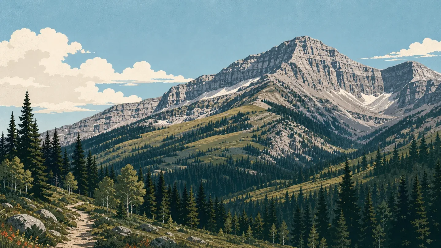
Mount Timpanogos field guide: aspen groves, high meadows, and an exposed Wasatch summit
A practical guide to Mount Timpanogos tracing Utah's Wasatch elevation story from aspen, fir and spruce through rocky alpine meadows to an exposed 11,753-foot summit, with route choices, mountain-goat guidance, seasonal snow and access constraints.

The quick read
Mount Timpanogos rises to 11,753 feet (3,582 m) in Utah's Wasatch Range. The summit day is long rather than technically complex: the two standard approaches are about 14 miles round trip, with roughly 4,448 to 4,875 feet of elevation gain and an average planning time of 8 to 12 hours. 1
The ecology changes in a clean sequence. Aspen, fir and spruce shade the lower approach; waterfalls and wildflowers pull the trail toward open ground; Hidden Lakes and rocky high alpine meadows replace the forest; above the saddle, the ridgeline is fully exposed. The Forest Service classifies the Timpooneke route to Emerald Lake as a high-elevation alpine trail with 10 to 30 percent grades, and says snow can cover it until mid-summer. 23
Overall difficulty: very strenuous. The deciding factors are the distance, the gain, the altitude and the exposed upper ridge. Snow conditions and afternoon thunderstorms can change the margin on the same calendar date, so a clear summer forecast is not the same thing as an easy route. 1
Elevation cross-section
The public route pages provide useful elevation anchors and named terrain transitions, not a complete contour profile. Read the sequence below as a field guide to what changes underfoot, not as a map of exact vegetation boundaries.
| Elevation or route anchor | Field zone | What to read on the ground |
|---|---|---|
| About 7,400 feet | Lower Wasatch forest | At the nearby Altamont site, the Forest Service describes dense stands of aspen, fir and spruce beside the Mount Timpanogos Wilderness. This is the shaded, tree-defined end of the profile. 4 |
| Aspen Grove start | Forest, falls and switchbacks | The Aspen Grove route begins with an easy mile to the first falls, then becomes mostly moderate with short steep sections and numerous switchbacks. Small waterfalls and wildflowers mark the climb before the trail opens. 3 |
| About 4.3 miles from Aspen Grove | Hidden Lakes transition | Hidden Lakes are the point where the route gives up much of its forest character. From there, the trail crosses rocky, high alpine meadows toward Emerald Lake. 3 |
| 5.8 miles on Timpooneke Trail #053 | High alpine route | The Forest Service lists the route to Emerald Lake at 5.8 miles and classifies it as a high-elevation alpine environment. Snowfields can linger into mid-summer, making the upper transition a condition check rather than a fixed seasonal line. 2 |
| 11,753 feet | Exposed summit and ridge | The summit is the end of a high-gain day, not the end of a protected forest trail. The ridgeline is completely exposed above the saddle, with no tree cover to soften wind, sun or storm exposure. 1 |
In shorthand, the route reads: aspen and conifer shade -> cascades and switchbacks -> Hidden Lakes -> rocky alpine meadow -> lingering snow -> exposed Wasatch ridge. That compressed transition is the mountain's main ecological lesson: a few miles of trail connect several growing seasons, from tall trees to plants that have only a short window above the trees.
Vegetation zones and signature plants
The lower forest is not a generic green backdrop. The Forest Service's nearby Wasatch sites name aspen, fir and spruce as the dominant trees around 7,400 feet, while its Battle Creek page, on the west face of Mount Timpanogos, adds water birch, maple, Douglas fir, oak and cottonwood to the mid-elevation mix. 45
For flowers, the same west-face Forest Service page lists western coneflower, clematis, penstemon and balsam root. Those are useful Wasatch field marks for the forest and meadow portions of the mountain, but the page describes a nearby access trail rather than a complete inventory of the summit route. Bloom timing and presence will vary with snowmelt, aspect and the year's moisture. 5
The high route is easier to identify by form than by a guaranteed species list. Above Hidden Lakes, the Forest Service describes rocky high alpine meadows; the route page also warns that snow can remain until mid-summer. Look for low, open vegetation broken by rock and wet snowmelt rather than expecting a continuous carpet of flowers. 23
One lower-route caution is worth carrying into the field: the Forest Service notes poison ivy and stinging nettle in Battle Creek. That warning belongs to the west-face canyon, not every Timpanogos approach, but it is a reminder that the most familiar-looking part of the hike can still have contact hazards. 5
Wildlife field notes
The Forest Service identifies moose, mule deer, elk and mountain goats as regular wildlife in the Mount Timpanogos Wilderness. Treat that as habitat context, not a sighting promise. Forest cover, meadow edges and broken alpine terrain offer different opportunities for observation, but a quiet trail is not evidence that an animal is absent. 6
Mountain goats deserve the most specific preparation. Utah's Division of Wildlife Resources confirms that goats occur on Mount Timpanogos and says they can be active through much of the day, with more territorial behavior from nannies with kids in summer and more aggressive behavior from males during the November rut. 7
Mountain goat rule
- Give a goat roughly 150 feet or more of space.
- Keep dogs leashed and under control. The Forest Service also requires leashes at the Timpooneke trailhead because of wildlife harassment incidents. 67
- If a goat approaches, back away slowly. If it keeps coming, make yourself large and loud, or turn around when the animal is moving down the trail toward you.
- Never feed a goat or let it lick your skin. Utah DWR specifically warns that goats can be dangerous around steep terrain and cliffs. 7
The useful mental model is not "spot a goat, take a photo." It is "share the route with an animal that is comfortable on terrain where a hiker has less room to move." Distance protects both sides.
Route choices and difficulty
Both standard summit approaches are full-day objectives. The difference is where the work accumulates and what the lower route shows you.
| Route or objective | Published profile | Practical rating |
|---|---|---|
| Timpooneke summit approach | About 14.3 miles round trip, 4,448 feet of gain, and 8 to 12 hours on average. The Forest Service's route to Emerald Lake is 5.8 miles, has 10 to 30 percent grades and enters a high-elevation alpine environment. 12 | Very strenuous, long alpine day. The lower gain of the two summit routes does not remove the altitude, distance or exposed upper terrain. |
| Aspen Grove summit approach | About 13.9 miles round trip with 4,875 feet of gain. The route passes the first falls, Hidden Lakes and rocky high alpine meadows before Emerald Lake. 13 | Very strenuous, steeper overall day. It is slightly shorter on paper but carries more gain. |
| Battle Creek Trail #050 | A 2.4-mile mid-elevation forest trail accessing the west face, with a waterfall, cascades and connections to Curly Springs and Dry Canyon. The tread near the falls is exposed and narrow. 5 | Moderate lower objective, not a summit substitute. Choose it for a shorter forest and plant profile, not for the 11,753-foot summit. |
The route rating here is a synthesis of the published distance, gain, grade, time and exposure. It is not a claim that every hiker will experience the same difficulty. Fitness, acclimatization, snow and weather can move the practical rating in either direction.
Best season and access
The cleanest hiking window is July and August, after the year's main snowmelt. The visitor guide recommends those months, while both Forest Service route pages warn that snow can remain until mid-summer and create extremely hazardous spring and early-summer conditions. The Forest Service specifically says sliding down the snowfield above Emerald Lake is dangerous and not recommended. 123
For the Timpooneke trailhead, the current Forest Service page lists timed entry permits from July through October on Saturdays, Sundays and holidays between midnight and noon, with a recreation pass required. It lists day-use fees of $10 per vehicle for three days, $20 for seven days or $60 for the season. Parking is restricted to designated stalls and turnouts; when those fill, parking may extend as far as Pine Hollow or Salamander Flat, adding 1.5 to 2 miles one way. Ticketing and towing are strongly enforced. 6
The access road is narrow and winding, and the Forest Service notes that Saturdays and holidays can be prohibitively busy. Weekdays are the cleaner choice for both parking and trail flow. The hike enters the Mount Timpanogos Wilderness, where the Timpooneke route page requires groups to remain under 15 people. 26
The summit ridgeline is fully exposed, so the weather decision does not end at the trailhead. Thunderstorms can turn a scenic high point into a retreat problem once the route leaves tree cover. The planning implication is straightforward: use the snowpack, forecast and ridge exposure to decide whether the summit is appropriate that day, rather than treating July or August as an automatic green light. 1
Field-guide verdict
Mount Timpanogos is a strong choice for hikers who want to watch a Wasatch ecosystem change in one long day. The lower route gives you aspen, fir, spruce, waterfalls and named meadow flowers; the upper route gives you rocky alpine ground, lingering snow, mountain-goat habitat and an exposed summit ridge. The transition is legible, but the mileage and gain are real. 24
Choose Timpooneke when a slightly lower gain and the northern approach fit your day. Choose Aspen Grove when its waterfalls, Hidden Lakes and steeper overall profile are the draw. Choose Battle Creek when the goal is a shorter west-face forest walk and plant inventory. None of the three removes the need to check current conditions; they simply place the decision at different points on the elevation cross-section.
References
- 1Mount Timpanogos Hike - The Ultimate Guide
utahvalley.com
- 2Timpooneke Trail #053
fs.usda.gov
- 3Mount Timpanogos Trailhead (Aspen Grove)
fs.usda.gov
- 4Altamont Group Campground
fs.usda.gov
- 5Battle Creek Trail #050
fs.usda.gov
- 6Timpooneke Trailhead
fs.usda.gov
- 7
This story was produced automatically by a channel. One sentence is all it takes for Neodrop to keep producing for you.