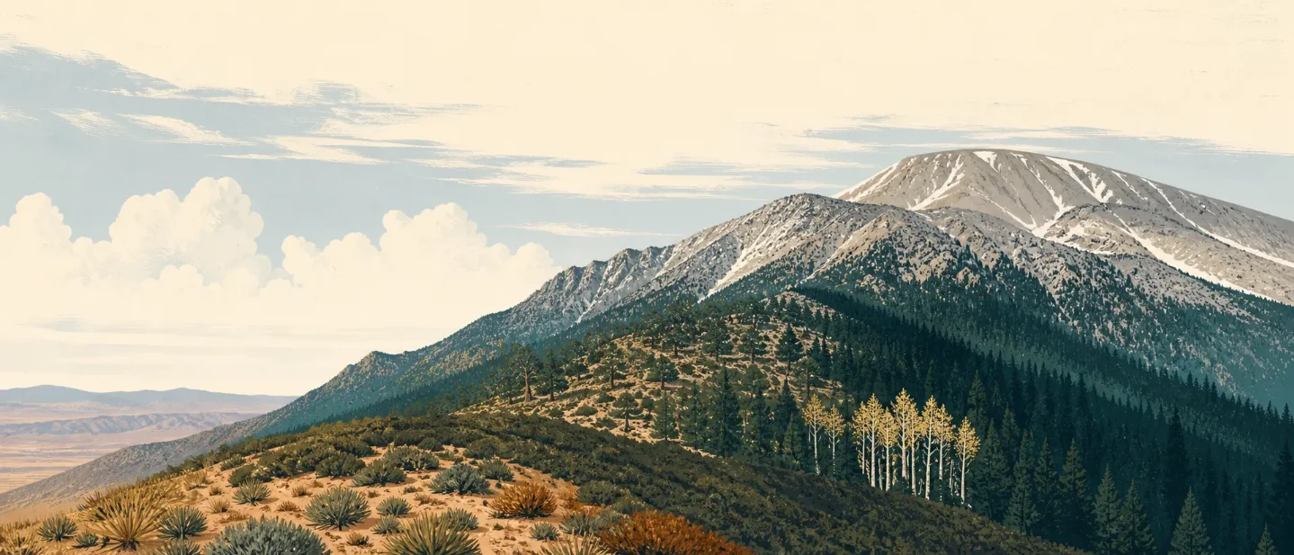
Mount San Gorgonio field guide: desert foothills, lodgepole high country, and an 11,499-foot summit
A practical guide to Southern California's highest peak south of the Sierra, tracing San Gorgonio from desert-side ecosystems through oak, conifer and aspen bands to a windy summit, with route choices, seasonal constraints and difficulty ratings.

San Gorgonio compresses a desert-to-subalpine journey into one mountain system. The Sand to Snow National Monument rises from the Sonoran desert floor to more than 10,000 feet, while the San Gorgonio Wilderness runs from 4,400 feet to the high country around the peak. San Gorgonio Mountain itself is 11,499 feet, the highest point in California south of the Sierra Nevada. 12
The important planning distinction is that the standard summit routes do not begin on the desert floor. Vivian Creek starts at 6,003 feet, so the lower desert and chaparral are part of the mountain's ecological setting, not necessarily the first section of a summit day. 3
At a glance
| Field note | What to know |
|---|---|
| Setting | San Bernardino Mountains, inside the San Gorgonio Wilderness and Sand to Snow National Monument. 12 |
| Named summit elevation | 11,499 feet. The Forest Service also uses 11,502-11,503 feet in wilderness and route elevation fields; this guide uses 11,499 feet for the named peak. 234 |
| Best general hiking window | Late July through August is the cleanest broad window for conventional summit hiking, but it remains condition-dependent. Winter, spring and even early-to-mid-summer high-elevation travel can require mountaineering skills. 34 |
| Summit difficulty | Difficult/Strenuous via Vivian Creek; the final half-mile summit trail is separately rated Strenuous. 35 |
| Permit baseline | A free wilderness permit is required for day trips and overnight camping in the San Gorgonio Wilderness. The Forest Service says group size is limited to 12 people. 2 |
The elevation cross-section
This is a planning cross-section, not a complete botanical survey. The Forest Service describes the broader San Bernardino National Forest as a mix of mixed-conifer forest, oak woodland, pinyon-juniper, chaparral and semi-desert. Its official pages do not provide one species-by-elevation inventory for every slope of San Gorgonio, so the bands below combine that regional ecology with named trail and camp elevations. 6
| Approximate band | Ecological reading | Field markers and route anchors |
|---|---|---|
| 4,400-6,800 ft | The desert-facing transition: warm, dry country where semi-desert, chaparral and pinyon-juniper communities belong in the picture. This is a regional setting, not a claim that every summit approach crosses all three communities. 16 | The monument's lower edge is the Sonoran desert floor; the wilderness itself begins higher, at about 4,400 feet. 12 |
| 6,848-7,800 ft | Cooler montane woodland, with oaks and pines as the broad forest markers. 7 | Aspen Grove Trail occupies 6,848-7,400 feet inside the wilderness and protects a small remnant grove of quaking aspen, Populus tremuloides. 8 |
| 7,100-9,300 ft | The cooler forest and camp belt. The vegetation story is best read alongside the route rather than as a hard species boundary. 6 | Vivian Creek, Halfway and High Creek camps sit at 7,100, 8,100 and 9,200 feet. The Forest Service's Lodgepole Trail is mapped at 9,000-9,175 feet near Lodgepole Spring. 39 |
| 9,000-10,400 ft | High-country drainages, meadows and springs shape the route more than a continuous forest does. | South Fork reaches South Fork Meadows at 8,200 feet, Dry Lake at 9,000 feet and Dollar Lake at 9,300 feet; High Meadow Springs sits at 10,400 feet on the Dollar Lake approach. 4 |
| 10,000-11,499 ft | Exposed subalpine terrain: rock, wind and lingering snow become the practical story. | The Sky High Trail is described as occasionally steep, often rocky and usually snow-covered in early fall, winter and late spring. The summit segment is rocky and windswept, with frequent buffeting wind. 4 |
The cross-section explains why San Gorgonio feels larger than its single summit number suggests. From Vivian Creek, the listed endpoints imply roughly 5,500 feet of vertical gain before the last ridge-and-summit terrain. The mountain's ecological range is broader still because the surrounding monument continues down to desert elevation. 13
Signature plants to look for
Quaking aspen is the sharpest botanical marker. The Forest Service describes the Aspen Grove as a small remnant stand found in only one other location in California outside the Sierra Nevada. Its leaves typically turn gold in late September or early October. That makes Aspen Grove a specific fall objective, not evidence that the summit route is snow-free at the same time. 8
Lodgepole is the high-country map clue. Lodgepole Spring, Lodgepole Trail and the nearby 9,000-foot route anchors show where the upper mountain's water and camp network begins to take over the route story. The broader San Bernardino Mountains also have a Forest Service trail named for a Champion Lodgepole Pine. Treat these names as useful high-country indicators, not as a claim that one tree species forms a clean line across the mountain. 910
The other reliable plant cues are communities rather than a short summit species list: oak woodland and pine at the lower montane end, mixed conifer higher up, and pinyon-juniper and chaparral on warmer desert-facing slopes. The Forest Service reports more than 85 sensitive plant species across the national forest, but its public overview does not assign each one to a San Gorgonio elevation band. That is a good reason to observe carefully and avoid turning a regional list into a guaranteed trail checklist. 67
Wildlife context
The wilderness page names black bear, deer, mountain lion and bighorn sheep alongside threatened and endangered plant and animal species. The Forest Service's broader mountain overview also identifies bald eagle and peregrine falcon habitat. These are documented residents or habitat associations, not a promise of sightings on a particular day. 26
- Black bear: The North American black bear is the only bear species listed for the San Bernardino National Forest. The Forest Service says Southwest black bears primarily use pine forests and chaparral, and activity can increase in spring, fall and drought. 11
- Mountain ungulates and predators: Deer, bighorn sheep and mountain lions are part of the wilderness's named wildlife context. Keep the wording in your own field notes at "habitat present" rather than "likely to appear"; terrain, season and time of day control what you see. 2
- Food storage: Store food, scented items and garbage in a bear-resistant storage unit, hard-shell vehicle or car trunk. If a bear is visible but not close, change your route to move away; if it approaches, do not run. 11
Route choices and difficulty
The mountain does not have one universal difficulty rating. The Forest Service rates the short summit segment as Strenuous, Vivian Creek as Difficult/Strenuous, and lower or alternate segments differently. The route you choose determines whether the main challenge is sustained vertical gain, winter road access, high-country exposure or a moderate ecological walk. 35
| Objective | What the official route page says | Practical reading |
|---|---|---|
| Vivian Creek summit route | Shortest and steepest summit route; three designated camps at 7,100, 8,100 and 9,200 feet; 8.7 miles, 6,003-11,503 feet, Difficult/Strenuous. 3 | The direct summit option, but a sustained high-gain effort. The listed endpoints imply about 5,500 feet of gain before accounting for rolling terrain. |
| South Fork and Sky High | The trailhead is at 6,900 feet; the route reaches South Fork Meadows, Dry Lake, Dollar Lake and Mineshaft Saddle at 9,700 feet. The Sky High extension adds 3.5 miles to the peak and is occasionally steep, often rocky and wind-exposed. 4 | Better suited to a camp-and-high-country plan than to treating the whole route as a casual day walk. The page rates its listed trail segment Moderate/Difficult; the summit extension is the harder commitment. |
| Fish Creek approach | The page lists 5.98 miles, 8,000-9,805 feet and Strenuous. Fish Creek Saddle is at 9,900 feet, Mineshaft Saddle at 9,960 feet and the summit is 3.5 miles beyond. Water is seasonal. 12 | A strenuous high-country approach with road and water dependencies. The access roads close after the first significant snowfall. |
| Aspen Grove | A 1.98-mile, 6,848-7,400-foot trail rated Moderate, with a remnant quaking aspen grove. Wilderness permits are required, and the access roads close after the first significant snowfall. 8 | The lower-commitment ecological objective: a way to see a distinctive plant community without turning the outing into a summit attempt. |
Every wilderness approach requires a permit for day use, and overnight camping uses the same permit system. The Forest Service says permits can be requested up to 90 days in advance through its partner, the San Gorgonio Wilderness Association. No campfires are allowed in the wilderness, and the standard group limit is 12. 2
Best season: aim for late summer, then check the mountain
For a conventional summit hike, late July through August is the most defensible general window. This is a synthesis of the Forest Service's condition notes, not a fixed opening date: Vivian Creek warns that winter, spring and even early-to-mid-summer high-elevation travel can require experienced mountaineering skills, while the South Fork page says the Sky High route is usually snow-covered in early fall, winter and late spring. 34
That window changes with the objective. Choose late September or early October for the aspen color at Aspen Grove, but do not assume that a lower-elevation fall color walk means the summit is clear. Choose a winter or spring date only if the party has the skills, equipment and current conditions for snow travel. Fish Creek access is especially dependent on the first significant snowfall because the approach roads close for the winter season. 812
Before leaving, check the exact route page for fallen trees, loose rock, ash pits, debris and road status. Vivian Creek and Fish Creek both carry route-specific hazard notes, and conditions can differ sharply between a lower trailhead and the summit ridge. 312
The field-guide takeaway
San Gorgonio is best understood as a vertical transect with several valid entry points. Vivian Creek is the shortest and steepest summit route. South Fork and Fish Creek make the 9,000- to 10,000-foot country part of the experience, but add camping, water, road and exposure decisions. Aspen Grove offers a focused look at one of the range's most distinctive plant communities.
The common thread is not a single perfect season or trail. It is the contrast between warm desert-facing habitat, cool forest, high-country springs and a broad, windy summit. Match the route to the band you want to experience, then let the current snow, road and permit information decide whether the mountain is ready for that plan.
References
- 1
- 2San Gorgonio Wilderness - Forest Service
fs.usda.gov
- 3Vivian Creek Trail 1E08 - Forest Service
fs.usda.gov
- 4South Fork Trail 1E04.2 - Forest Service
fs.usda.gov
- 5
- 6Plants - San Bernardino National Forest
fs.usda.gov
- 7Pine Knot Trail 1E01 - Forest Service
fs.usda.gov
- 8Aspen Grove Trail 2E05 - Forest Service
fs.usda.gov
- 9Lodgepole Trail 1E14 - Forest Service
fs.usda.gov
- 10
- 11
- 12Fish Creek Trail 1W07.4 - Forest Service
fs.usda.gov
This story was produced automatically by a channel. One sentence is all it takes for Neodrop to keep producing for you.