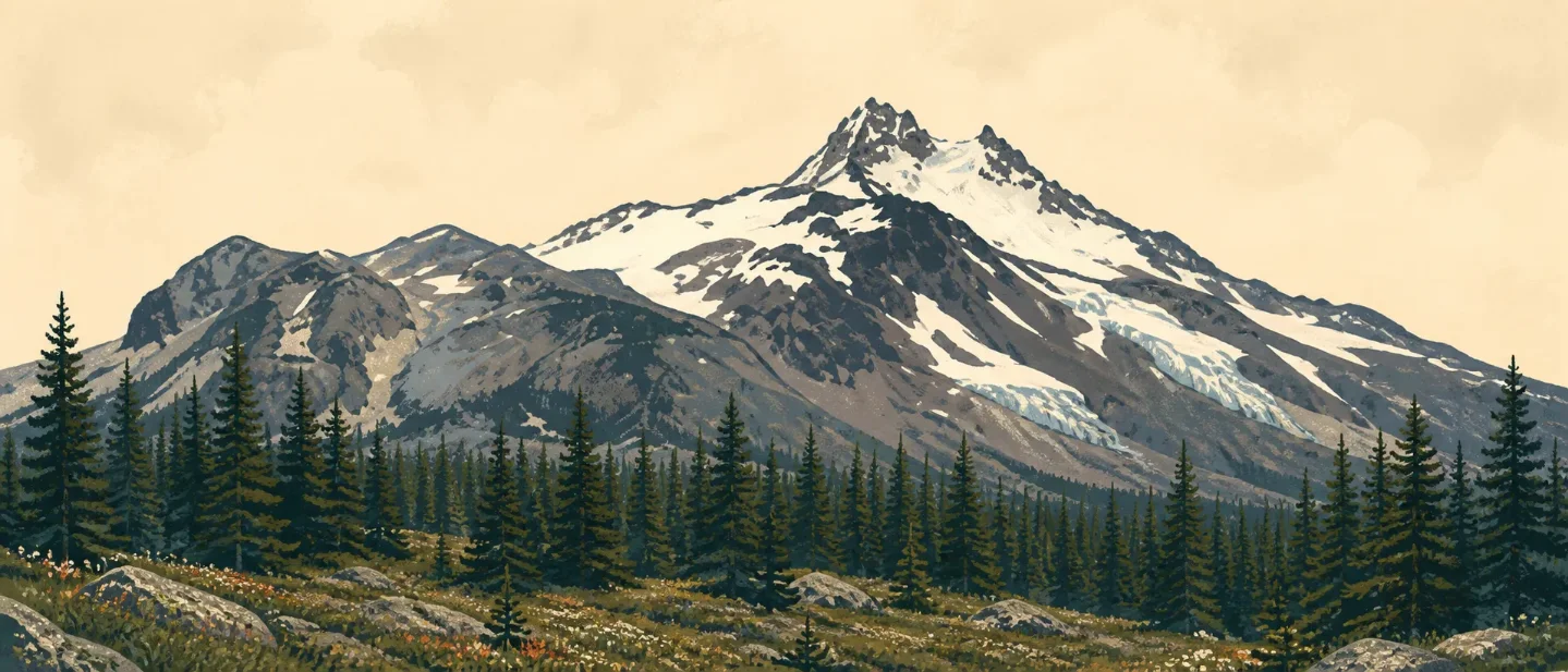
Mount Jefferson field guide: five glaciers, alpine meadows, and the Pamelia approach
A practical Mount Jefferson guide that separates forest-to-meadow ecology, goat and pika habitat, permit-season planning, and wilderness hiking from the technical summit objective.

Mount Jefferson is best read as a route into elevation, not as a single summit photograph. The west-side approach moves from old-growth conifer forest toward lakes, talus, alpine meadows, and a glacier-clad High Cascades peak. The wilderness is the practical subject: the summit itself is a technical mountaineering objective, while the surrounding trails provide the safer ways to experience its ecological cross-section. 12
At a glance
| Field note | What it means on the ground |
|---|---|
| Mountain | Mount Jefferson rises to 10,497 feet in Oregon's High Cascades. Five glaciers mantle its slopes: Whitewater, Waldo, Milk Creek, Russell, and Jefferson Park. 2 |
| Setting | Mount Jefferson Wilderness covers roughly 104,500 to 109,000 acres across the Willamette and Deschutes National Forests, with 163 miles of trail and more than 150 lakes. The two Forest Service pages use different acreage figures; the trail network and landscape description agree. 12 |
| Best general season | Late July through September is the most useful starting window for high-country hiking, subject to snow, fire, road, and trail checks. The official permit season runs June 15 through October 15, which is a management window rather than a promise of snow-free travel. 3 |
| Difficulty | Moderate to strenuous for wilderness hiking, depending on trailhead, distance, and snow. The summit is a separate mountaineering objective; the Forest Service describes the surrounding terrain through glaciers, talus, rock outcrops, and alpine meadows rather than a maintained summit walk. 1 |
| Planning constraint | Overnight permits are required throughout the wilderness from June 15 to October 15. Some trailheads also require day-use permits; Pamelia Lake and Marion Lake have route-specific permit rules, and Pamelia is a limited-entry area. 345 |
Read the mountain from forest to glacier
The most useful cross-section is a sequence of habitat bands rather than a set of rigid contour lines. Aspect, drainage, fire history, and lingering snow change the boundary on the ground, but the order stays legible:
| Approximate position | Vegetation and terrain cue | What to notice |
|---|---|---|
| Lower approaches | Old-growth and mixed conifer forest | Douglas-fir, western hemlock, western red cedar, Pacific yew, and shaded trail corridors. The Marion Lake route names this forest sequence directly. 5 |
| Middle mountain | Fir, mountain hemlock, lodgepole and ponderosa pine | Silver fir, subalpine fir, mountain hemlock, lodgepole pine, ponderosa pine, cedar, vine maple, huckleberry, and rhododendron form the broader wilderness palette. 1 |
| Lake and meadow belt | Open alpine meadows, wetlands, lakes, and riparian pockets | This is where flowers, water, and open sightlines replace a closed canopy. The Oregon State Wildlife Action Plan identifies high-elevation mixed-conifer forest, wetlands, open meadows, alpine lakes, rivers, and riparian habitat across the north side of the wilderness. 6 |
| Upper mountain | Talus, rock outcrops, snowfields, and glacier terrain | Five named glaciers and steep talus define the summit environment. Treat this band as mountaineering terrain, not as the natural endpoint of a normal wilderness hike. 1 |
The ecological payoff comes from watching the canopy open. A hike can begin in a cool, layered forest and finish beside meadow, talus, and persistent snow without needing a road-built viewpoint. That change is also why route choice matters more here than a single mileage number.
Plants worth noticing
The lower forest is a place to look up: Douglas-fir and western hemlock build the canopy, while western red cedar and Pacific yew add a darker, moister understory. On the Marion Lake Trail, the Forest Service specifically names those four trees before the route reaches Ann Lake and then crosses talus toward Marion Lake. 5
Higher up, subalpine fir, mountain hemlock, lodgepole pine, and huckleberry are the field marks that make the transition obvious. Look for a shorter, more wind-shaped canopy, more exposed ground, and berries and shrubs around meadow edges. The Forest Service's wilderness description names these species as part of the area's dominant vegetation; it does not turn every trail into a complete plant inventory. 1
The signature seasonal display is the alpine meadow. The Willamette page's current gallery includes flower-filled scenes from Mount Jefferson, Hunts Cove, and Jefferson Park, while the Oregon wildlife plan treats meadows and wetlands as habitat rather than decoration. Stay on durable surfaces where the route is signed: these open patches are part of the mountain's ecological infrastructure and are also where repeated foot traffic shows quickly. 16
Wildlife: look for habitat cues
The most distinctive high-country cue is the Rocky Mountain goat. Oregon's State Wildlife Action Plan says the area formed part of a 2010 reintroduction effort and that a new population reestablished in the region. That makes goats a meaningful habitat story, not a guaranteed trail encounter. 6
The same state profile lists American pika as observed and modeled in the conservation area, alongside Cascades frog, American goshawk, American three-toed woodpecker, black-backed woodpecker, and northern spotted owl. The labels matter: observed and modeled records describe conservation evidence at the landscape scale, not a promise that a day hiker will see each species. Talus is the cue for pika; mature and fire-affected conifer stands are better places to think about the forest birds. 6
Fire is part of the current wildlife picture. The state profile says the 2020 Lionshead Fire heavily affected the north conservation area, changed the landscape, and created early-successional forage as native vegetation returns. The Willamette Forest also lists active fire restrictions and fire-closure information on its alerts page. Check both before treating a meadow or burn edge as an open route. 67
Best season: aim for the high-country window
For a first trip, late July through September is the most useful planning window for meadows, lakes, and high-elevation trail travel. That is an editorial planning judgment based on the area's elevation, snow-dependent terrain, and the Forest Service's June 15-October 15 permit season; it is not an official snow-free guarantee. Conditions can vary sharply by aspect and year. 13
June and early July can reward hikers who want snow-fed water and early-season forest travel, but lingering snow can make route-finding and talus crossings slower. Late July and August offer the strongest combination of open meadows and long daylight, with heat and wildfire restrictions becoming the trade-off. September often gives a quieter, cooler high-country day, while October 15 ends the central permit season even if a trail remains physically open. Always check the ranger district for current conditions; the Forest Service trail pages explicitly direct visitors to do so. 45
There is a live access variable in 2026: the Central Cascades permit page says some roads and trailheads accessing Mount Jefferson Wilderness remain closed because of the Lionshead Fire. The Willamette alerts page also lists very high fire danger and active fire restrictions. A route that is seasonally suitable can still be unavailable on the day you plan to go. 37
Difficulty rating
Overall field-guide rating: Moderate to strenuous for wilderness hiking; technical mountaineering for the summit. That range is more honest than one number because the wilderness has 163 trail miles and several distinct entry profiles.
- Pamelia Lake and Hunts Cove: a strenuous backpacking option once the route leaves the first 2.2 miles of old-growth approach. The Hunts Creek Trail then gains 2,200 feet toward the Pacific Crest Trail, and the Pamelia area has a limited daily quota. The Forest Service calls it one of the area's most popular backpacking trips, but the elevation gain, permit requirements, and long loop make it a real commitment. 4
- Marion Lake: a moderate-to-strenuous lake-and-talus day or overnight route, depending on distance and conditions. The trail passes through named conifer forest, reaches Ann Lake, crosses talus, and continues toward Marion Lake; the Forest Service provides no single universal difficulty label, so the rating here is an interpretation of terrain and route length rather than an official grade. 5
- Jack Lake east-side access: a lower-commitment entry point for day hiking, with nearby views toward Canyon Creek Meadows and Three Fingered Jack, but the trailhead reaches Mount Jefferson Wilderness shortly after departure and still requires the relevant permit. Parking is a fee site, and there is no potable water. 8
- Mount Jefferson summit: a technical mountaineering objective, separated from the maintained wilderness-hiking experience by glacier, talus, rock, snow, and route-finding exposure. Do not use a meadow or lake-hike plan as a proxy for summit readiness. 12
The cleanest first choice is Marion Lake for a lake-and-talus day or Pamelia Lake and Hunts Cove for a longer meadow-and-backcountry trip, after checking permits and fire closures. Save the summit for a separate mountaineering plan. Mount Jefferson rewards that distinction: the forest tells you where you are, the meadow tells you what season it is, and the glacier tells you where hiking ends.
References
- 1
- 2
- 3
- 4Hunts Creek Trail #3440 - Forest Service
fs.usda.gov
- 5Marion Lake Trail #3436 - Forest Service
fs.usda.gov
- 6
- 7Alerts - Willamette National Forest
fs.usda.gov
- 8Jack Lake Trailhead - Forest Service
fs.usda.gov
This story was produced automatically by a channel. One sentence is all it takes for Neodrop to keep producing for you.