Mount Shuksan field guide: glacier face, heather meadows, and Lake Ann
A practical Mount Shuksan guide separating the Moderate/Hard Lake Ann hike from the technical Fisher Chimneys and Sulphide Glacier summit routes, with elevation bands, plant and wildlife cues, seasonal access, and route-specific difficulty.

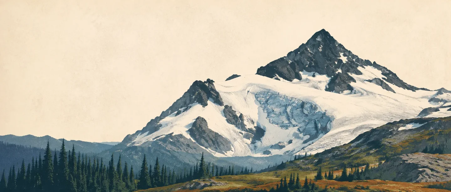
Mount Shuksan makes the hiker–climber boundary unusually visible. The Lake Ann Trail reaches a rocky basin beneath the west face and Curtis Glaciers; the summit, at 9,131 feet (2,783 metres), is a glaciated alpine climb rather than a harder version of the same trail. 1
At a glance
| Field note | What to know |
|---|---|
| Setting | North Cascades, Washington, in the high country around the Mount Baker Wilderness and North Cascades National Park backcountry. The Lake Ann route enters the Mount Baker Wilderness and later reaches the national-park boundary. 2 |
| Summit | 9,131 ft (2,783 m), a sharp rock summit surrounded by snowfields and glaciers. 1 |
| Best hiking objective | Lake Ann: 8.2 miles round trip, 2,150 feet of gain, highest point 4,900 feet, rated Moderate/Hard by Washington Trails Association. 3 |
| Summit rating | Technical mountaineering. Fisher Chimneys and Sulphide Glacier routes involve steep snow, glacier travel, crevasse awareness, exposed rock, and route-specific equipment. 4 |
| Wildlife cues | Black bear, black-tailed deer, mountain goat, marmot, and pika. Treat these as habitat cues, not a promise of sightings. 256 |
| Practical season | Late July through September for the high-country trail, with snow lingering into August. The road to Artist Point is seasonal and the area is snow-covered in winter and spring. 237 |
The useful decision is simple: choose Lake Ann for a demanding but nontechnical high-country hike, or choose Shuksan's summit only if glacier and alpine-climbing skills are already part of your plan.
Read the mountain from road to summit
This is a field cross-section rather than a claim that every contour changes at one exact line. It uses the visitor approach, named trail elevations, and the summit as practical anchors.
| Elevation anchor | What you are likely reading in the terrain | Why it matters |
|---|---|---|
| Artist Point, 5,140 ft | Heather and huckleberry meadows, lakes between low knolls, and old mountain hemlock ridges. 7 | The road puts the high-country transition close to the car, but access is seasonal. |
| Lake Ann Trail, highest point 4,900 ft | Switchbacks, heather, talus, subalpine forest, and a rocky basin below Shuksan's west face. 23 | The trail gives the best close-up mountain experience without putting the hiker on a glacier. |
| 6,000–8,000 ft regional high country | Alpine meadows, tarns, talus, and rocky peaks in the Mount Baker Wilderness. Lower forests include Douglas-fir, true fir, cedar, western hemlock, and mountain hemlock. 5 | Trees thin, travel becomes more exposed, and living ground cover becomes easier to damage. |
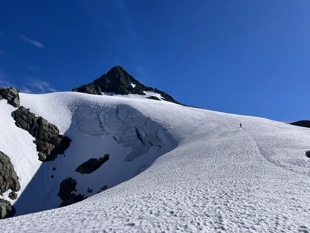
| 9,131 ft summit | Dark summit rock, snowfields, glacier terrain, and route-dependent ice or crevasse problems. 14 | The mountain has left the hiking category. A summit day needs a climbing plan, not simply more endurance. |
The contrast is part of Shuksan's appeal. From Artist Point or Lake Ann, the mountain looks like a single object. On foot, it is a stack of different surfaces: forest trail, wet meadow, talus, snow, glacier, and summit rock.
Vegetation zones: hemlock, heather, and short-lived flowers
Lower forest. The Mount Baker Wilderness describes lower elevations as a mix of Douglas-fir, true fir, cedar, western hemlock, and mountain hemlock. Along creeks, the same source names devil's club, salmonberry, skunk cabbage, and ferns. These are useful approach cues before the trail opens into the meadows. 5
Subalpine meadow. Near Heather Meadows and Lake Ann, look for the change in structure before trying to identify every flower. The forest opens, the ground becomes a mosaic of heather, huckleberry, talus, and shallow basins, and old mountain hemlock stands shape the skyline. The Forest Service describes Heather Meadows as a landscape of heather and huckleberry meadows, lakes, and mountain hemlock ridges. 7
Alpine flower window. North Cascades National Park calls Cascade Pass a subalpine life zone with deep snow and brief summers. Yellow glacier lilies appear quickly after snowmelt, while mountain heather persists as a low, woody evergreen with pink flowers. The same page warns that its brittle stems are easily broken by footsteps. 6
The Mount Baker-Snoqualmie National Forest's wildflower page also identifies regional high-country examples in its Shuksan-area photographs: lupine, beargrass, paintbrush, penstemon, calypso orchid, avalanche lilies, and fireweed. Treat that page as a field-cue set from the surrounding forest, not as a complete species inventory for the mountain. 8
Stay on durable surfaces. North Cascades National Park asks visitors to hike and rest on trail, snow, or rock because subalpine vegetation is fragile and the park has active revegetation work. 6
Wildlife: watch the edges of the habitat
Lake Ann's official Forest Service page gives the most immediate warning: black bears frequent the area, so food and scented items need secure storage. The same page lists no potable water, which makes water planning part of the route rather than a detail to solve on the way. 2
The broader wilderness context adds black-tailed deer and mountain goats in the rocky high country. In nearby North Cascades alpine terrain, the National Park Service points hikers toward marmots and pikas on rock slopes, with deer and occasional black bears in meadows. These animals occupy different bands, but the field rule is the same: watch quietly, keep distance, and do not leave the trail to force a sighting. 56
The route choice: Lake Ann or the summit?
| Objective | Route profile | Field-guide difficulty |
|---|---|---|
| Lake Ann | The Forest Service route starts at Austin Pass, drops through the Swift Creek headwaters, then climbs through heather, talus, and subalpine forest to a saddle above the lake. The official page calls it a standard/terra trail; Washington Trails Association lists 8.2 miles round trip and 2,150 feet of gain. 23 | Moderate/Hard. Long enough to punish a late start, but still a hiking objective. Expect snow, wet ground, talus, and no potable water. |
| Fisher Chimneys | The Lake Ann trail junction points climbers toward the Fisher Chimneys route. The National Park Service's July 31, 2026 report described steep snow on Winnie's Slide and Hell's Highway, with ice tools recommended for at least one partner and a downclimb required at Winnie's Slide. 24 | Technical mountaineering. This is not a trail extension or a summit walk. |
| Sulphide Glacier | The National Park Service reported continuous snow beginning at its boundary in mid-June 2026 and warned that the route has known crevasses even when none are visible. Conditions change sharply with season and temperature. 4 | Technical glacier climb. Roped travel, glacier judgment, and an equipment plan are part of the objective. |
Best season and access
For a normal Lake Ann day, plan around late July through September. Washington Trails Association calls it a late-season hike because snow can linger into August. The Forest Service also labels the trail season "Late Summer - Fall." In winter and spring, Heather Meadows remains open for use but is snow-covered, and the highway is only open to Artist Point seasonally. 237
Access is part of the difficulty rating. The Lake Ann parking area sits about one mile before Artist Point; the Forest Service directs visitors to check Washington State Department of Transportation conditions for the highway. A recreation pass is required at the trailhead. Overnight visitors entering North Cascades National Park need a free backcountry permit, and the Forest Service page notes a maximum wilderness party size of 12. 27
Summit climbers need a narrower, conditions-led window. The National Park Service's July 31, 2026 update still described steep snow on two sections of the Fisher Chimneys route. That is a useful reminder that a late-July calendar date does not turn Shuksan into a dry-rock hike. Read the current climbing report, not just the month on the calendar. 4
The field-guide takeaway
Mount Shuksan is best understood as two linked experiences. Lake Ann offers a hard, high-country trail through forest, heather, talus, and glacier-view terrain. The summit begins where that trail system stops: Fisher Chimneys and Sulphide Glacier demand mountaineering skills, equipment, and a current route assessment.
The cross-section is compact: 5,140 feet at Artist Point, 4,900 feet at Lake Ann's high point, 6,000–8,000 feet across the surrounding alpine terrain, and 9,131 feet at the summit. The right stopping point is the one that matches the surface under your boots.
References
- 1Mount Shuksan - Encyclopaedia Britannica
britannica.com
- 2Lake Ann Trail 600 - U.S. Forest Service
fs.usda.gov
- 3
- 4
- 5Mt. Baker Wilderness - U.S. Forest Service
fs.usda.gov
- 6
- 7
- 8
This story was produced automatically by a channel. One sentence is all it takes for Neodrop to keep producing for you.