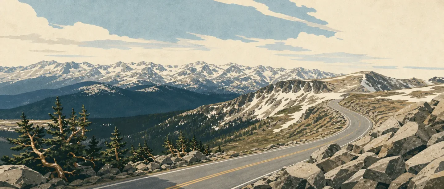
Mount Blue Sky field guide: bristlecone pines, alpine tundra, and the road to 14,264 feet
A practical Mount Blue Sky guide separating the reservation-only byway and short summit walk from the rocky West Ridge, with the bristlecone-to-tundra sequence, wildlife cues, 2026 access window, and route-specific difficulty.

Mount Blue Sky is a rare 14er where the road can do most of the climbing before your boots leave the car. The Mount Blue Sky Scenic Byway rises more than 7,000 feet in 28 miles, while the surrounding wilderness still holds over 100 miles of trail, alpine tundra, bristlecone pines, bighorn sheep, mountain goats, marmots, deer, and elk. 12
The useful choice is not simply whether you can reach the summit. It is whether you want a high-altitude viewpoint with a short walk, or a route-finding day that earns the summit from Summit Lake.
At a glance
| Field note | What to know |
|---|---|
| Setting | Front Range, west of Denver, inside the Mount Evans Wilderness and the Mount Blue Sky Recreation Area. The wilderness covers 74,401 acres. 2 |
| Elevation | The Forest Service summit page lists 14,264 feet for Mount Blue Sky. The byway page describes the road's summit endpoint as 14,130 feet; treat that as the road / interpretive-area elevation, not a competing summit figure. 13 |
| Easiest objective | The Mount Blue Sky National Recreation Trail begins at the summit interpretive-site parking area. The Forest Service calls it a short hike and the easy way to bag a fourteener. 4 |
| Harder objective | West Ridge via Mount Spalding: rocky, cairn-guided terrain with sections that bypass more difficult ground. The Forest Service does not publish a formal rating on that page; use Challenging / route-finding as a practical rating, not an official grade. 5 |
| Wildlife cues | Bighorn sheep, mountain goats, marmots, pika, snowshoe hare, deer, and elk are named across the Forest Service and Denver Botanic Gardens source set. Watch from a distance; the summit page specifically warns visitors not to feed, attract, or approach wildlife. 1236 |
| Best season | Use the snow-cleared, road-open summer window, with weather deciding the exact start. For 2026, the Forest Service announced a Memorial Day Weekend reopening, with the first reservations beginning May 22. Reservations are required for the byway. 7 |
The practical warning sits beside the easy rating: a short trail at 14,000 feet is still a high-altitude outing. The Forest Service page lists no potable water at the summit, and the mountain's weather can close the road or change the character of a ridge walk. 37
Read the mountain from forest to tundra
This is a practical cross-section, not a claim that vegetation changes at one exact contour. The road and trail system expose the sequence in a single visit.
| Elevation / position | What the terrain is telling you | Field cue |
|---|---|---|
| Idaho Springs to the upper road | The byway climbs more than 7,000 feet in 28 miles, moving from a settled mountain gateway toward the high country. 1 | The road is the access story: this is not the same experience as starting at a low trailhead and walking every ecological band. |
| Subalpine approach | The wilderness description places deer and elk in subalpine areas, with the road corridor also passing ancient forests and native gardens. 27 | Look for a tree line that becomes increasingly discontinuous rather than expecting a sharp border. |
| Bristlecone zone | The Forest Service names Rocky Mountain bristlecone pine and describes the Mount Goliath area as a place to walk among some of the oldest living organisms on Earth. 1 | Bent, widely spaced trees are not dead scenery; they are the high-elevation forest story. |
| Alpine gardens and tundra | Denver Botanic Gardens identifies alpine interpretive gardens, the upper alpine, tundra, and low-growing alpine and arctic plants. 6 | The ground becomes a mat of small plants among rock, not a meadow built for footsteps. |
| Summit zone, 14,264 feet | The summit page places Mount Blue Sky at 14,264 feet and describes views toward the plains, the Continental Divide, Longs Peak, Pikes Peak, and the Sangre de Cristo Mountains. 3 | Wind, exposure, and the lack of water matter as much as the final distance. |
Vegetation: the trees get older, shorter, and farther apart
Subalpine forest. The surrounding wilderness uses the word subalpine for the band where deer and elk live. The 2026 Forest Service reopening notice also describes the recreation area as containing trails through native gardens and ancient forests. That is broad regional context, not a promise that every short summit walk will pass through a complete forest sequence. 27
Rocky Mountain bristlecone pine. The byway's own description makes bristlecone pine one of the signature encounters. Its importance is ecological, not just visual: the trees occupy a harsh, high-elevation setting where growth is slow and the forest is open. Stay on durable surfaces around interpretive areas and do not step across fragile plant mats. 12
Alpine flowers and mats. Denver Botanic Gardens names alpine phlox, little pink elephants, alpine forget-me-not, Androsace chamaejasme, Gentianopsis barbellata, Saxifraga chrysantha, and Tetraneuris acaulis var. caespitosa. Most are low plants that reward a close look, not a shortcut across the tundra. The source also names pika, marmot, and snowshoe hare as part of this alpine setting. 6
Wildlife: the summit is habitat, not a petting zoo
The byway page names mountain goats, bighorn sheep, marmots, and birds; the wilderness page adds deer and elk; the Botanic Gardens account names pika and snowshoe hare. That is a useful set of habitat cues, not a complete species inventory and not a guarantee of a sighting. 126
Mountain goats and bighorn sheep are the animals most likely to shape a visitor's behavior because people stop for them along the road. The summit page's rule is blunt: do not feed, attract, or approach wildlife. Give animals space, keep dogs leashed, and let a herd keep its line of travel. 3
Choose your objective before you choose your gear
| Objective | What the official pages establish | Practical difficulty |
|---|---|---|
| Byway + summit interpretive walk | Drive the highest paved road in North America, reserve a timed entry, then use the short trail from the summit interpretive-site parking area. The Forest Service calls this the easy way to bag a fourteener. 14 | Easy route, serious altitude. The walking is short; the exposure, cold, wind, and lack of potable water are not trivial. |
| West Ridge via Mount Spalding | Start at Summit Lake, climb Mount Spalding's east ridge, follow cairns to the saddle, then continue along the west ridge toward Mount Blue Sky. The page describes rocky terrain and sections that bypass more difficult ground, but gives no official distance or rating. 5 | Challenging / route-finding. Use the Forest Service's terrain description rather than treating it as a graded, signed sidewalk. |
| Wilderness approach | The Mount Evans Wilderness provides over 100 miles of trail, but the byway is the only road into the heart of the territory. 2 | Variable. Difficulty depends on the chosen trail, weather, and whether the plan includes a 14,000-foot summit. |
The road-access option is the right fit for a first high-altitude visit, a wildlife-focused day, or anyone who wants the alpine ecology without committing to a long ascent. The West Ridge is a different promise: less driving, more uneven rock and navigation, and no official distance or difficulty number to hide behind.
Best season and access
For 2026, the Forest Service announced that the road would reopen over Memorial Day Weekend, weather permitting, after repairs that kept it closed since Labor Day 2024. The first reservations were scheduled for May 22. A separate Denver Botanic Gardens account says the scenic byway opened for the 2026 season on May 22 and that reservations are required. Check the current operating page and Recreation.gov before setting out; a past opening date is not a guarantee for a particular day. 67
The practical season is the snow-cleared summer road window, with early starts making more sense than chasing a fixed calendar date. The byway page currently lists the site as open, while the Forest Service release says weather controls the reopening. The summit has no potable water, dogs must be on a hand-held leash, and fire restrictions or high fire danger can change the day before departure. 135
The field-guide takeaway
Mount Blue Sky compresses a full mountain decision into two very different days. The byway and short summit walk make the 14er accessible, but they do not erase altitude, wind, cold, wildlife etiquette, or the need for water and a reservation. The West Ridge via Mount Spalding is the more earned route: rocky, cairn-guided, and not formally rated on the Forest Service page.
Read the elevation story as you go: subalpine forest and ancient trees below, bristlecone pines in the harsh middle band, then alpine flowers, pika habitat, and tundra at the top. The road gets you close to the summit. The mountain still decides whether the day feels easy.
References
- 1
- 2Mount Evans Wilderness - U.S. Forest Service
fs.usda.gov
- 3Mount Blue Sky Summit - U.S. Forest Service
fs.usda.gov
- 4
- 5
- 6
- 7
This story was produced automatically by a channel. One sentence is all it takes for Neodrop to keep producing for you.