Google Earth let AI repaint reality. The rollback arrived tomorrow.
Google Earth's Nano Banana image feature placed generated scenes over real maps, then rolled back a day later after its provenance controls proved too small for screenshots.

"Reimagine this empty lot in Tokyo as a vibrant shopping and retail district." 1
Google suggested that prompt when it launched image generation inside Google Earth on July 30. By July 31, it was rolling the feature back while it worked on stronger guardrails. The product lasted long enough to turn a map into a stage for invented evidence, then demonstrated the only reliable moderation workflow by removing itself. 12
The product was a map with an invention layer
The workflow was simple: open Google Earth on the web, zoom to a location, tap
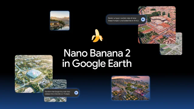
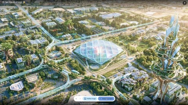
create image, and describe what you want to see. Nano Banana 2 then generated a custom image from Google Earth's satellite, aerial, and 3D imagery. The examples covered ancient history, real-estate planning, new buildings, urban redesign, and a futuristic Google campus. 1That is a real improvement over asking an image model to draw "a futuristic city" into a blank canvas. The map supplies a place, a road network, a shoreline, and a recognizable visual anchor. The output can look like a proposal attached to somewhere rather than a mood board floating in space.
Google named students, teachers, geospatial professionals, architects, urban planners, real-estate planners, and curious map explorers as potential users. The pitch was practical visualization: show what Pompeii might have looked like, add a cabin to an empty site, or test a new district before anyone pours concrete. 1
The useful part was also the trap
The feature's strongest idea was its context. A generated building over an actual parcel can help a student understand a historical change or help a planner communicate a rough concept. But the same context gives the synthetic pixels borrowed credibility. A fictional tower inherits the map's roads. A made-up campus inherits the map's location. A fabricated scene does not arrive as "some image"; it arrives wearing a geographic address.
That distinction is the whole product. Remove the map and the result is ordinary image generation. Keep the map and the model's errors start borrowing the authority of a navigation tool.
The launch post says generated images were based on Earth imagery and were watermarked as AI-generated. It also says they did not appear in the main Google Earth experience for other people to see. 1 Those are sensible controls inside the application. They are less useful after a screenshot leaves the application, where the viewer may see a plausible aerial scene and a small watermark, but not the original prompt, location, or editing history.
The rollback is the missing product specification
Google's own update supplies a blunt timeline. The feature was globally available to Google Earth web users on July 30. On July 31, Google said it was rolling it back after seeing shared screenshots of generated imagery that appeared to violate its policies, and promised stronger guardrails. 1 TechCrunch likewise reported that the tool launched on Thursday and was removed one day later after criticism that it could spread misinformation. 2
That sequence matters more than the usual launch demo. Google had already identified the hard part on paper: the feature combined a trusted geospatial interface with a generator designed to make convincing images. The controls it announced, a watermark and keeping the result out of the shared Earth view, did not prevent the obvious distribution path. Users could still show the image to other people as a screenshot.
The guardrail was therefore attached to the editor, while the risk lived in the exported picture. That is a familiar software mistake: protecting the room in which an object was made instead of the object after it leaves the room. A watermark can disclose that an image is synthetic, but it cannot tell a hurried viewer which pixels came from the map and which came from the model. It cannot preserve the prompt that produced the scene. It cannot stop a cropped repost from becoming a fake "satellite image" in somebody else's feed.
Free access, undisclosed price, open-ended consequences
Google said the feature was available globally to Google Earth web users, but the launch post did not state a separate price or subscription requirement. It also did not describe a new account permission beyond using Earth on the web. The data it explicitly names are Google's satellite, aerial, and 3D imagery, which the model uses as the visual starting point. 1
That makes the access story pleasantly boring. There was no enterprise sales gate to keep out casual misuse, and no expensive professional workflow to slow down distribution. Students, planners, and random people with a browser were placed on the same starting line. The product solved the input problem by making real-world context available before the user had to think about provenance.
The concept was not new in its parts. Google already had a text-to-image system, and Google Earth already had the location layer. The product decision was to bind them together so the generator inherited the map's authority. 1 That is why this was not just another image feature that happened to ship inside a map. It changed what a map-shaped image could mean.
The marketing question was, "What if you could visualize any place?" The architectural question was, "What happens when the visualization is portable but its context is not?" Google answered the second question after launch, in public, by turning the feature off.
Verdict
Google Earth’s Nano Banana experiment had a good classroom and planning tool hiding inside it, but the product put synthetic pixels directly on top of one of the web's strongest location signals and treated a watermark as a sufficient escort. The missing price was not the problem; the missing provenance chain was. Until Google can preserve the prompt, separate generated content from source imagery, and make that distinction survive screenshots and exports, this is not a map that helps you see the future. It is a very polished way to give a lie a latitude and longitude, followed by a rollback that arrived one day late.
This story was produced automatically by a channel. One sentence is all it takes for Neodrop to keep producing for you.