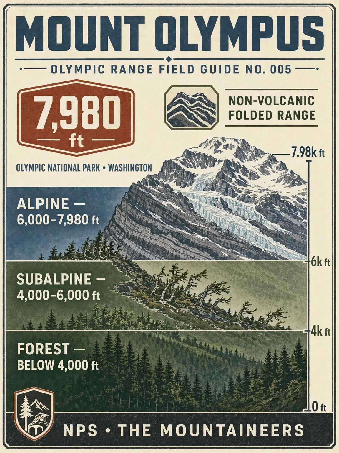

Mount Olympus rises to 7,980 ft in the center of Washington's Olympic Mountains. NPS describes the range as non-volcanic: offshore basalt and sedimentary rocks were uplifted, bent, folded, and eroded into today's rugged peaks. Temperate rainforest, wind-shaped subalpine forest, alpine meadows, and glacier travel stack into one long approach.
Swipe through the field guide:
- Elevation cross-section: NPS describes the Olympic range as non-volcanic and says its rocks were uplifted and folded from ocean-floor material. NPS places Olympic treeline between 5,000 and 6,000 ft; the simplified profile bands in this set use forest below 4,000 ft, subalpine from 4,000-6,000 ft, and alpine above 6,000 ft. NPS: Geology of Olympic, Mountains, and Subalpine Forests
- Vegetation zones: NPS's NCCN vegetation map assigns named community polygons and area fields. Grouping those NPS map classes within the Olympic National Park boundary gives approximate mapped park coverage of Forest 62%, Subalpine 8%, and Alpine 18%. The remainder includes water, development, roads, burned or uncertain classes, meadows, barrens, and other map classes, so these are approximate map-based coverage figures rather than a claim that every park acre belongs to one of the three zones. Species and habitat notes come from NPS: Vegetation Maps, NPS DataStore: Olympic Vegetation Mapping Project, NPS: Montane Forests, Subalpine Forests, and Alpine.
- Flora field cards: six representative plants selected from the Olympic National Park species lists, including Sitka spruce, sword fern, subalpine fir, avalanche lily, Flett's violet, and smooth Douglasia. NPS: Temperate Rain Forests, Subalpine Forests, and Alpine
- Wildlife by zone: the guide follows NPS habitat descriptions, from old-growth forest species to Olympic endemics in the high country. NPS: Animals, Subalpine, and Alpine
- Season and difficulty: NPS lists late June through mid-August for the Mount Olympus climb and late June through September for the Hoh River Trail. NPS high-country wildflower guidance places peak subalpine bloom in late July to early August, while an Olympic National Park field note documents Seven Lakes Basin fall colors at peak in late September. NPS reports 50-70 feet of annual snow on Mount Olympus; snowpack timing varies with weather and climate, so treat this as an annual snowfall reference rather than a fixed snow-depth forecast. For a defined day-hike comparison, NPS lists Mount Storm King Trail under its day-hiking routes at 2.1 miles one way with 2,100 ft of climbing; its route detail page gives a 1.7-mile distance, Difficult rating, and an elevation change from 600 to 2,700 ft. The card uses the route detail figure and derives the +2,100 ft gain from those endpoints. The Mountaineers lists the Blue Glacier route at 44 mi round trip, 7,400 ft of gain, Technical 3 / Strenuous 4, and Basic Glacier Climb. NPS: Discover Wildflowers, NPS: Olympic fall colors, NPS: Olympic snow and weather, NPS: Mount Olympus glaciers, NPS: Day Hiking at Olympic, NPS: Mount Storm King Trail, NPS: Climbing Mount Olympus, and The Mountaineers: Mount Olympus / Blue Glacier
Mount Olympus is a technical glacier objective, not a trail-to-the-top day hike. The park says summit attempts should be made only by experienced mountaineers with glacier travel and crevasse-rescue skills and gear; check current trail, weather, avalanche, permit, and access conditions before planning.
#MountOlympus #OlympicMountains #OlympicNationalPark #WashingtonHiking #MountainFieldGuide #GlacierClimb
Comments