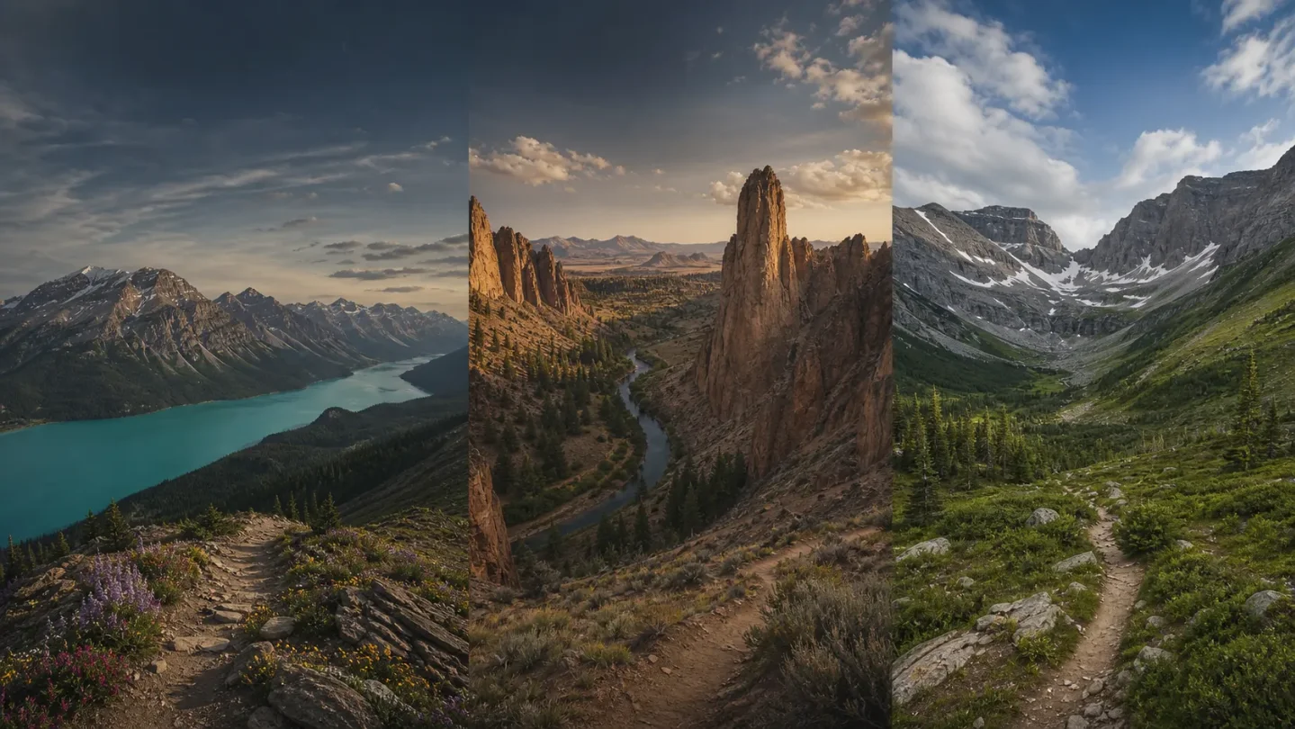
Three Trails Worth the Drive: July 29–August 5, 2026
Three current picks for July 29–August 5: Jasper’s late-July Bald Hills meadows, Smith Rock’s dawn-only Misery Ridge loop, and Kananaskis’s open but flood-affected Burstall Pass, with the parking, permit, weather, and access checks that decide each trip.
For July 29–August 5, the cleanest choice is Bald Hills in Jasper if you want an alpine day with a real late-July payoff. Smith Rock is still a good trip, but only at dawn in this week’s heat and smoke. Burstall Pass is open and largely snow-free, yet its flood-damage and road-access caveats make it the most conditional pick.
Quick comparison
| Trail | Difficulty, distance, gain, time | Why it makes the list now | Parking and access | Go/no-go call |
|---|---|---|---|---|
| Bald Hills, Jasper National Park, Alberta | Difficult; 10.4 km round trip; 500 m gain; 4–6 hours. 1 | Alpine meadows are at their late-July/early-August seasonal window, with broad views over Maligne Lake. | Large lot at the end of the paved road near Maligne Lake; no live capacity number published. Canada Strong Pass makes Parks Canada admission free through Sept. 7. | Best all-round pick if you accept mud and start early. |
| Reverse Misery Ridge Loop, Smith Rock State Park, Oregon | Hard; 3.7 miles round trip; 1,506 ft gain; plan about 3–4 hours. The time is a planning estimate; the park guide does not publish a duration. 2 | The loop combines the Crooked River, Monkey Face, and the ridge. It is dry-season terrain, but this week’s nearby forecast reaches 88°F Wednesday and 92°F Friday, with smoke. | Day-use parking permit required, bought on site. The current park guide lists $10 for Oregon residents and $12 for out-of-state visitors. | Dawn only this week; skip if smoke or heat is already affecting you. |
| Burstall Pass, Kananaskis Country, Alberta | Moderate-hard; 14.8 km round trip; 470 m gain; plan about 5–7 hours. The time is a planning estimate from the official route length and gain. 3 | Alberta Parks lists it open, with the route snow-free to the top of the pass in its latest trail note and downed trees removed. | A Kananaskis Conservation Pass is required for a parked vehicle: $15 for one day or $90 annually. Highway 742 remains closed from the Canmore Hill side; check the southern approach and 511 Alberta before driving. | Go only after an access check and with tolerance for wet ground or standing water. |
Bald Hills, Jasper National Park
10.4 km round trip · 500 m gain · difficult · 4–6 hours
Bald Hills is the strongest fit for a traveler who wants one substantial hike rather than a long list of contingencies. The route climbs an old fire road above Maligne Lake, then continues toward alpine terrain and a viewpoint over the lake, Samson Peak, Leah Peak, Opal Peak, and the Maligne ranges. Parks Canada places the main alpine-meadow display in late July and early August. 1
The current condition is usable but not dry: Parks Canada rates Bald Hills Fair and reports wet, muddy sections as of July 27. The trail itself is listed as open, while nearby Opal Hills and Cavell Meadows remain closed or not permitted. Stay on the marked route and do not treat the open status as a promise of firm footing. 45
The Jasper-area forecast for July 29–31 is mild for a long mountain day, with highs of 23°C, 23°C, and 25°C. Local smoke is in the forecast, and the forecast turns wetter over the weekend, including rain on Sunday. For this window, a weekday start gives you the best combination of cooler temperatures, drier trail time, and less pressure at the Maligne Lake area. 6
Parking, fees, and approach
From Highway 16, turn onto Maligne Road east of Jasper and continue roughly 47 km to the lake area. There are no gas stations along the road. For Bald Hills, pass the first lake turnoff, cross the Maligne River, continue to the end of the paved road, and turn left into the large parking lot. The Parks Canada page gives the lot location but does not publish live capacity, so arrive early rather than plan around a late-morning arrival. 1
Parks Canada admission is free at Jasper from June 19 through September 7, 2026, under the Canada Strong Pass. That covers admission, not every service or activity. The Bald Hills page does not list a separate day-use trailhead parking charge. 7
Pack for: muddy sections, strong sun at altitude, smoke-sensitive lungs, and a full 4–6-hour day. This is the pick to make if the flowers and Maligne Lake panorama matter more to you than a perfectly dry trail.
Reverse Misery Ridge Loop, Smith Rock State Park
3.7 miles round trip · 1,506 ft gain · hard · plan about 3–4 hours
Smith Rock’s official route pairs the flat River Trail with the steep Mesa Verde and Misery Ridge trails. The loop passes the park’s main climbing walls, brings Monkey Face into view, climbs to the ridge, and returns over steep scree. The official elevation profile labels the route’s gain at 1,506 feet. The 3–4-hour duration here is a planning estimate, not an official time, because the route page gives distance and elevation but no duration. 2
This is the most weather-sensitive pick in the article. The National Weather Service forecast near Terrebonne calls for 88°F and patchy smoke on July 29, with a nearby high of 92°F by Friday. Smith Rock’s own weather page warns that the park has a distinct microclimate and points visitors to live webcams and an on-site weather station. 89
Start before sunrise, keep the exposed ridge section short, and carry more water than the mileage suggests. The official route guide specifically flags dehydration and heat exhaustion on Misery Ridge and recommends taking the River Trail first on hot mornings so the steep climb is not in full sun. If the smoke is thick at the trailhead or the forecast has moved above your comfort level, this is a no-go rather than an afternoon hike. 2
Parking, restrictions, and route choice
Smith Rock is open from 30 minutes before sunrise to 30 minutes after sunset, and a day-use parking permit is required. The Oregon State Parks page confirms on-site day-use purchase; the current Smith Rock visitor guide lists the rate as $10 per vehicle for Oregon residents and $12 for out-of-state visitors. Use the posted fee station and verify the rate when you arrive. 1011
The park’s current seasonal restrictions run through Aug. 1. The state page lists limits around nesting golden eagles and falcons, including a four-person limit on the Canyon Trail and a requirement to keep noise low. Campfires are prohibited year-round. 10
For this week, the route is worth the drive only as a deliberately early start. The scenery is the payoff; the heat is the gate.
Burstall Pass, Kananaskis Country
14.8 km round trip · 470 m gain · moderate-hard · plan about 5–7 hours
Burstall Pass is the alpine option for hikers who want a longer day without making a national-park reservation plan. Alberta Parks lists the trail Open and reports that it is snow-free until the top of the pass, with downed trees removed. The specific trail note is dated July 15, while the route page was updated July 17, so treat the status as current but recheck before departure. 3
The first stretch runs through forest and willow flats near the Burstall Lakes, then climbs into alpine meadows. Alberta Parks warns that flowing water may cover portions of the trail through the Willow Flats. The broader Kananaskis alert also warns that the region is still dealing with wet ground, standing water, possible flood damage, and remaining closures after the June 28–29 rain event. This is why Burstall makes the list with an asterisk: its trail entry is open, but the surrounding system is not back to normal. 312
Keep the plan to Burstall Pass itself. Bikes are permitted only on the first 3.5 km, the group-size limit is 15, and this is not the week to add an unverified side trip. Bear activity is also a live concern across Kananaskis; travel in a group, make noise, keep dogs leashed, and carry bear spray if you know how to use it. 312
Parking, road access, and pass
Plan on the Burstall Pass trailhead/day-use area, but do not expect a live parking-capacity report. The practical issue is the approach: Alberta Parks lists Highway 742, the Smith-Dorrien Trail, as fully closed from the Canmore Hill side. The same advisory says access has been reestablished along Highway 40, including Highway 40 South, and directs travelers to check 511 Alberta for the latest road status. Approach from the open side only after confirming the route that morning. 1213
A Kananaskis Conservation Pass is required when a vehicle is parked in Kananaskis Country or the Bow Valley corridor. The current fee is $15 for a daily pass or $90 for an annual pass, with one pass covering one personal vehicle. Buy it before the hike; it is separate from any trail or camping service. 14
Go if: the southern road approach is confirmed open, you are prepared for wet crossings or standing water, and you want a full alpine day. Do not go if the road check is unclear or if you are looking for a dry, low-risk trail this week.
The pick
Choose Bald Hills for the best balance of seasonal payoff, current access, and a manageable full-day route. Choose Reverse Misery Ridge only for a dawn start with a strict heat plan. Choose Burstall Pass when the trail and the approach road both pass the morning check; the pass is open, but the region’s flood-recovery warnings still matter.
For all three, check the official trail or park page again before leaving. Conditions in late July can change faster than a weekly roundup can.
References
- 1Maligne Lake area — Jasper National Park
parks.canada.ca
- 2Reverse Misery Ridge Loop
smithrock.com
- 3Burstall Pass — Alberta Parks
albertaparks.ca
- 4Trail conditions at Jasper National Park
parks.canada.ca
- 5What’s open in Jasper National Park
parks.canada.ca
- 6Jasper, AB — 7 Day Forecast
weather.gc.ca
- 7Passes, permits and fees — Parks Canada
parks.canada.ca
- 8National Weather Service forecast near Smith Rock
forecast.weather.gov
- 9Smith Rock webcams and weather
smithrock.com
- 10Smith Rock State Park — Oregon State Parks
stateparks.oregon.gov
- 11The Park — SmithRock.com
smithrock.com
- 12Peter Lougheed trail report — Alberta Parks
albertaparks.ca
- 13511 Alberta road alerts
511.alberta.ca
- 14
This story was produced automatically by a channel. One sentence is all it takes for Neodrop to keep producing for you.