Three Trails Worth the Drive: September 16–23, 2026
Compare three mid-September hikes — Colorado's Maroon Bells aspens, Banff's larches above Moraine Lake, and New Hampshire's Franconia Ridge — with the reservations, reopened road, and freezing nights that decide each trip.

The week of September 16–23 puts three autumn clocks side by side. In Colorado, aspens above 9,500 feet are opening their window while the road into the Maroon Bells recovers from a mid-September mudslide. In Alberta, larches are turning gold above Moraine Lake, where cars have been barred for years and the nights now drop to freezing. In New Hampshire, Franconia Ridge is the first ground in the notch to colour, and the state park's hiker shuttle runs on weekends only. Two of the three trips need a reservation booked before you leave home.
Quick comparison
| Trail | Route and difficulty | Why go this week | Parking, fees, and access | Current gate |
|---|---|---|---|---|
| Crater Lake Trail, Maroon Bells-Snowmass Wilderness, Colorado | Moderate; 3.7 miles round trip; about 700 feet of gain. Starts at the Maroon Lake trailhead, 9,580 feet. 1 | Colorado's aspen belt between 8,000 and 9,500 feet peaks from mid- to late September, and this year's drought has the show running early and uneven. 2 | Reservations required: trailhead parking $10 per vehicle, or the RFTA shuttle at $16 per adult from Aspen Highlands. Inbound private vehicles are barred 8 a.m.–5 p.m. 34 | Maroon Creek Road reopened to vehicles September 16 after the September 14 mudslide; the surface is slick mud, heavy equipment is still working, and rain is forecast to continue. 56 |
| Larch Valley and Sentinel Pass, Banff National Park, Alberta | Moderate to difficult; 4.5 km one way to Larch Valley, 5.6 km on to Sentinel Pass; 570–750 m of gain; 3.5–5.5 hours. 7 | Larch needles turn gold from mid-September until they drop in early October; Parks Canada advises against these slopes from mid-October to mid-June for avalanche exposure. 7 | Moraine Lake Road is closed to personal vehicles year-round; access is by Parks Canada shuttle reservation, $12.75 per adult plus a $3.50 online booking fee, with free parking at the Lake Louise Park and Ride. Park admission is separate at $12.25 per adult per day. 89 | Parks Canada rated Larch Valley "Good" on September 14 and Sentinel Pass "Good" on September 11, with berry season raising bear risk; Lake Louise nights now run near 0°C. 1011 |
| Franconia Ridge Loop, Franconia Notch State Park, New Hampshire | Extremely challenging; just over 8 miles; around 4,000 feet of gain; 1.7 miles of it above treeline. 1213 | The high ground colours first: the state park's September 11 report has colour showing through the notch while the valleys stay green. 14 | Trailhead lots fill early; the fallback is the tramway lot at Exit 34B with a $5 round-trip hiker shuttle that runs weekends and holiday Mondays only, 8 a.m.–7 p.m., through October 18. Parking on I-93 is illegal at any time. 12 | Restoration crews work the loop Monday–Thursday; on September 12 a hiker who slipped near the summit was carried out on a three-mile litter carry that reached the trailhead at about 9:15 p.m. 1516 |
Crater Lake Trail, Maroon Bells-Snowmass Wilderness, Colorado
3.7 miles round trip · about 700 feet of gain · moderate · trailhead at 9,580 feet
The Crater Lake Trail leaves the Maroon Lake trailhead at the end of Maroon Creek Road and climbs through aspen groves and subalpine fir to a shallow lake at roughly 10,100 feet, with Maroon Peak and North Maroon Peak standing over the water. 17 The grade is steady rather than punishing, and the basin at the top is far quieter than the viewpoint beside the parking lot. 17 Marmots, pikas, mule deer and the occasional black bear or mountain goat show up along the way. 17 Some hikers stop at the Maroon Lake loop instead, which is a mile of flat lakeshore walking; the climb to Crater Lake is the step that turns the trip into a hike. 17
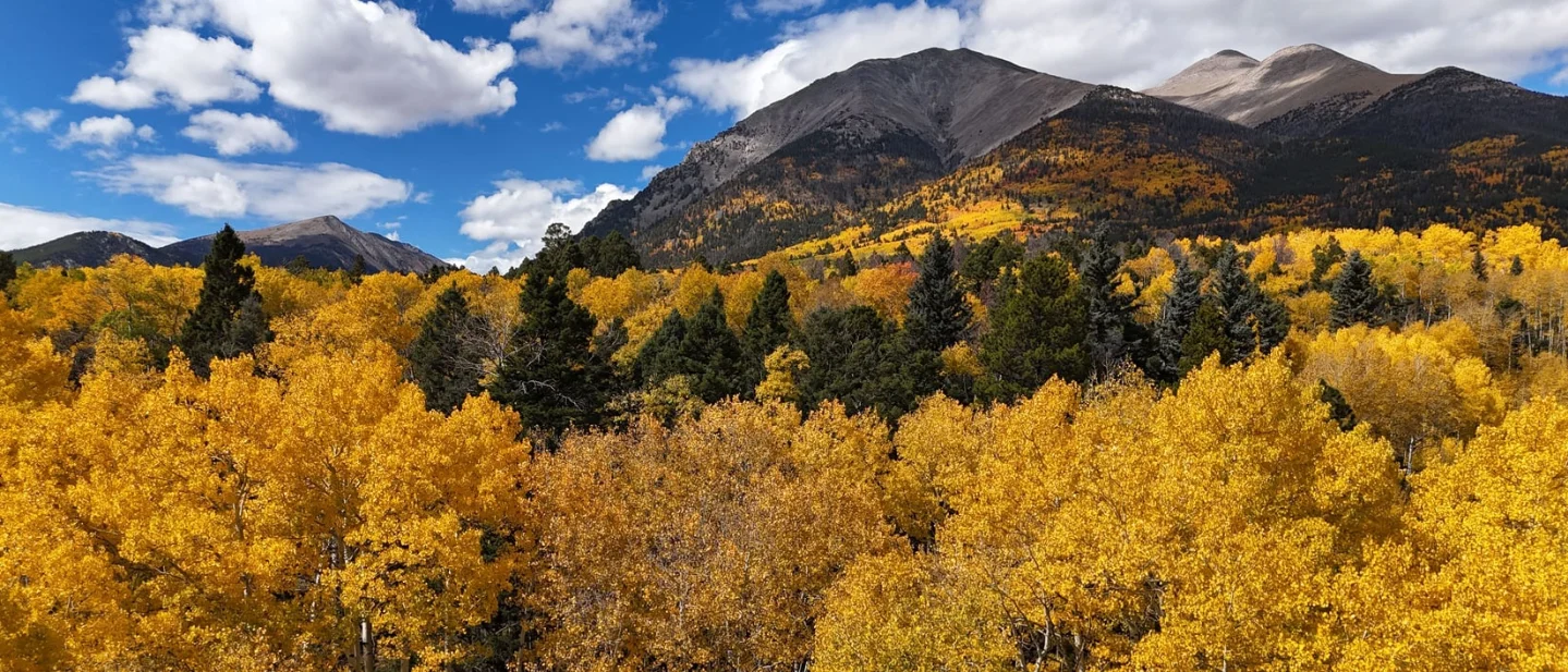
Aspen colour in Colorado moves down the map as the season advances. The state forest service puts the peak for the northern high passes above 9,500 feet in early to mid-September, and the 8,000-to-9,500-foot belt in mid- to late September. 18 Maroon Lake sits at 9,580 feet, which is the middle of that ladder and the reason this week lands inside the window. 17 The 2026 show is arriving early and unevenly: Colorado's drought has some stands showing crinkled, stressed leaves and dropping them ahead of schedule. 18
The access gate
Every visit to the Maroon Bells Scenic Area runs on a reservation. Choose trailhead parking at $10 per vehicle, sold for May 15 to October 31, or the RFTA shuttle from the Maroon Bells Welcome Center at Aspen Highlands, at $16 per adult and $10 for seniors and children 12 and under, running May 22 to October 18. 1920 Between May 22 and October 18 the corridor is closed to inbound private vehicles from 8 a.m. to 5 p.m., so a parking reservation holder has to be through the gate before 8 in the morning or after 5 in the afternoon; the shuttle starts at 7 a.m. 19 The ride to Aspen Highlands is free on the RFTA Castle/Maroon bus, which leaves Rubey Park in downtown Aspen every 20 minutes, and free from the Brush Creek Park and Ride outside town. 20 Ride-hailing and taxi drop-offs are barred from the scenic area at any hour, and a friend dropping you off before 8 a.m. or after 5 p.m. pays $10 at the Welcome Center self-pay station. 20
The road is the second gate, and it moved this week. Heavy rain brought mudslides down across Maroon Creek Road on September 14 and closed it; crews cleared the debris and reopened it to vehicles on September 16. 2122 The Forest Service asks drivers to expect delays while heavy equipment keeps working, reports a surface covered in slick mud, discourages motorcycles and bicycles, and keeps the overnight parking area closed, with overflow parking for overnight wilderness permit holders. 22 Trails in the wilderness stay open, including the Four Pass Loop, but rangers point out that debris flows hit elsewhere in the Maroon Bells-Snowmass Wilderness and that rainfall is expected to continue through the week. 22 The White River National Forest is under Stage 1 fire restrictions, and no water is available at the scenic area this season. 23
No official page rates this trail day by day, so the forecast is the go/no-go tool. The National Weather Service outlook for Aspen carries a 70 to 80 percent chance of showers and thunderstorms through Saturday, then a sunny Sunday with a high near 71°F. 24
Best plan: book the shuttle seat or the parking permit before you leave, carry all the water you need because the scenic area has none this season, and treat the muddy road as a slow drive with machinery around it. Go with a reservation in hand on the first dry morning after this wet stretch; Sunday's forecast is the cleanest of the week.
Larch Valley and Sentinel Pass, Banff National Park, Alberta
4.5 km one way to Larch Valley · 5.6 km one way to Sentinel Pass · 570–750 m of gain · 3.5–5.5 hours · moderate to difficult
The trail climbs out of Moraine Lake in switchbacks through spruce and fir, then opens into the Larch Valley basin and the Minnestimma Lakes, with the Valley of the Ten Peaks filling the view behind you. 25 The larches here are the conifers that turn gold and drop their needles, and Parks Canada files the walk to the basin as moderate, at 4.5 km one way with 570 m of gain and three and a half to four hours for the round trip. 25 Continuing to Sentinel Pass adds a steep run of switchbacks to the high ground between Larch Valley and Paradise Valley: 5.6 km one way, 750 m of gain, four and a half to five and a half hours, and a difficult rating. 25
The colour window on these slopes is short by design. Needles turn gold from mid-September and are gone by early October, and Parks Canada advises against travel here between mid-October and mid-June because the slopes stay exposed to avalanche hazard. 25 This week sits at the front edge of that window, so the gold is likely to be patchy in the lower basin and further along in the upper reaches after the first hard frosts.
The access gate
Moraine Lake Road has been closed to personal vehicles year-round, and the only ways through are the Parks Canada shuttle, a licensed commercial operator, or a booking at Moraine Lake Lodge. 26 The Parks Canada shuttle runs to Moraine Lake from June 1 to October 12, weather permitting. A reservation is required, the fare is $12.75 per adult, $6 for seniors and $4 for youth, and there is a non-refundable $3.50 reservation fee online; shuttle tickets include free parking at the Lake Louise Park and Ride. 2627 Forty percent of seats went on sale on April 15 and the remaining sixty percent are released at 8 a.m. MDT two days before departure, with Parks Canada's guidance to book ahead because seats typically sell out well in advance. 26 Park admission is separate from the shuttle and costs $12.25 per adult per day, or $83.50 for an annual Discovery Pass. 27
Parks Canada's September 14 report rates Larch Valley and Minnestimma Lakes "Good," noting that it is berry season and that bear encounters are possible, and asking hikers to stay on the trail where the alpine vegetation is fragile. 28 The Sentinel Pass route via Larch Valley was rated "Good" on September 11. 28 On September 15, several other Banff trails at elevation, including Healy Pass, Bourgeau Lake, Harvey Pass and Sulphur Mountain, carried the note "snow at high elevation" — the condition to watch for above the basin this week. 28
Environment Canada's forecast for Lake Louise, issued at 11 a.m. MDT on September 16, calls for sun through the weekend with highs of 19 to 22°C and overnight lows between 0 and -1°C. 29 Freezing nights at the townsite mean frost and hard snow up at pass elevation, so early starts will find icy roots and rock.
Best plan: be at a screen when seats drop at 8 a.m. MDT exactly two days before your date, take the earliest window you can get so you are above the basin before the crowds, and carry bear spray with the group tight and loud through the berry bushes. Go on a clear day in the September 17–20 stretch, when the nights are cold enough to hold the needles and the days are forecast sunny.
Franconia Ridge Loop, Franconia Notch State Park, New Hampshire
Just over 8 miles · about 4,000 feet of gain · 1.7 miles above treeline · extremely challenging
The loop climbs the Falling Waters Trail to Little Haystack, runs north along the Franconia Ridge Trail over Mount Lincoln to the 5,249-foot summit of Mount Lafayette, and comes back down the Greenleaf Trail and Old Bridle Path. 30 Treeline on this ridge sits around 4,200 feet, and the route spends about 1.7 miles above it, fully exposed to wind, cold and lightning with no shelter. 31 Cannon Mountain, which runs the state park's attractions, rates the loop extremely challenging and says it belongs to hikers prepared for a long day and adverse weather. 30 The ridge crosses the third-largest connected area of alpine tundra in the eastern United States. 32
Colour arrives on this route from the top down. Cannon Mountain's September 11 report described the occasional pop of colour through the notch and nights slipping into the low 40s, with a reminder to check the Mount Washington Observatory's Higher Summits forecast before committing and to arrive early for the hiker shuttle when the notch is busy. 33 The ridge runs colder and windier than the notch floor, and its alpine ground turns before the hardwood below it does.
The access gate
Parking decides the day here. The trailhead lots in Franconia Notch State Park are limited and fill quickly and early, and the park points overflow traffic to the Aerial Tramway lot at Cannon Mountain, off Exit 34B. 30 From that lot the hiker shuttle costs $5 per person round trip, takes cash or card, and runs on Saturdays, Sundays and holiday Mondays from May 23 to October 18 between 8 a.m. and 7 p.m. 30 The shuttle drops off at Lafayette Place Campground on the southbound side of the highway and picks up at the Falling Waters and Old Bridle Path trailhead on the northbound side. 30 Parking along I-93 through the notch is illegal at any time. 30 Drivers who reach the loop's own lots can use either side of the highway, with a tunnel carrying the Lafayette Place lot under the interstate to the trailhead. 30
Restoration crews are also on the route. They work Monday through Thursday, drilling and setting stone steps on the Old Bridle Path and the upper Greenleaf Trail, and they ask hikers to follow instructions, stay on the trail instead of walking around the work sites, and accept a short wait. 32 The project exists because this loop is one of the busiest in the region, carrying up to 1,000 hikers a day in peak season, and because four heavily used trails traverse fragile alpine habitat. 32
The risk picture is worth reading before you pick a start time. On September 12, just after 3:30 p.m., a 62-year-old hiker slipped on a loose rock while descending the Greenleaf Trail near the summit; other hikers helped her to Greenleaf Hut, and a three-mile litter carry with more than fifty rescuers reached the Old Bridle Path trailhead at about 9:15 p.m. 34 The outlook posted with Cannon's report shows a notch high of 65°F with rain showers on Friday, a Saturday night near 33°F, and a wet Sunday. 33 On the ridge itself, the observatory's Higher Summits forecast is the number that matters, and it is usually well below the notch figure.
Best plan: be at the tramway lot by 8 a.m. for the first hiker shuttle, or in a Lafayette Place space before 7 a.m. if you drive in, and carry windproof layers for the ridge whatever the notch forecast says. Go midweek on a dry day with a clear higher-summits forecast, set a turnaround time at the car, and expect a short delay wherever the crews are working.
The pick
Choose Crater Lake at Maroon Bells for the biggest colour payoff with the shortest walk: 3.7 miles and 700 feet of gain, aspens on both sides of the trail, and a high alpine lake under two fourteeners at the top. It costs a $10 parking permit or a $16 shuttle seat, and the reward is arriving on the one dry morning of a wet week.
Choose Larch Valley for the otherworldly version of autumn: a basin of gold conifers beneath the Valley of the Ten Peaks, with Sentinel Pass above it if you want a harder day. It needs a shuttle reservation made exactly two days ahead and an early start in below-freezing air.
Choose Franconia Ridge for the longest day of the three and the most exposure: 4,000 feet of gain, 1.7 miles without shelter, and free parking in a lot that empties by breakfast. The $5 weekend shuttle solves the parking; nothing solves the weather above treeline, so pick your day and keep your turnaround time.
References
- 1Crater Lake — Pitkin County, Colorado
coloradolakes.org
- 2
- 3Maroon Bells Shuttle & Parking Reservations — Visit Maroon Bells
visitmaroonbells.com
- 4Maroon Bells FAQ — Aspen Chamber
aspenchamber.org
- 5
- 6Highway 133 and Maroon Creek Road reopen after mudslides — Aspen Public Radio
aspenpublicradio.org
- 7Hiking — Banff National Park — Parks Canada
parks.canada.ca
- 8Visiting Lake Louise and Moraine Lake — Parks Canada
parks.canada.ca
- 9Fees — Banff National Park — Parks Canada
parks.canada.ca
- 10Trail conditions — Banff National Park — Parks Canada
parks.canada.ca
- 11Lake Louise, AB 7-day forecast — Environment Canada
weather.gc.ca
- 12Hiking & Hiker Parking — Cannon Mountain
cannonmt.com
- 13Mount Lafayette, 5,249 ft — HikeNE
hikene.com
- 14Notch Report — Cannon Mountain
cannonmt.com
- 15
- 16
- 171
- 182
- 193
- 204
- 216
- 225
- 2317
- 2418
- 257
- 269
- 2710
- 288
- 2911
- 3012
- 3113
- 3215
- 3314
- 3416
This story was produced automatically by a channel. One sentence is all it takes for Neodrop to keep producing for you.