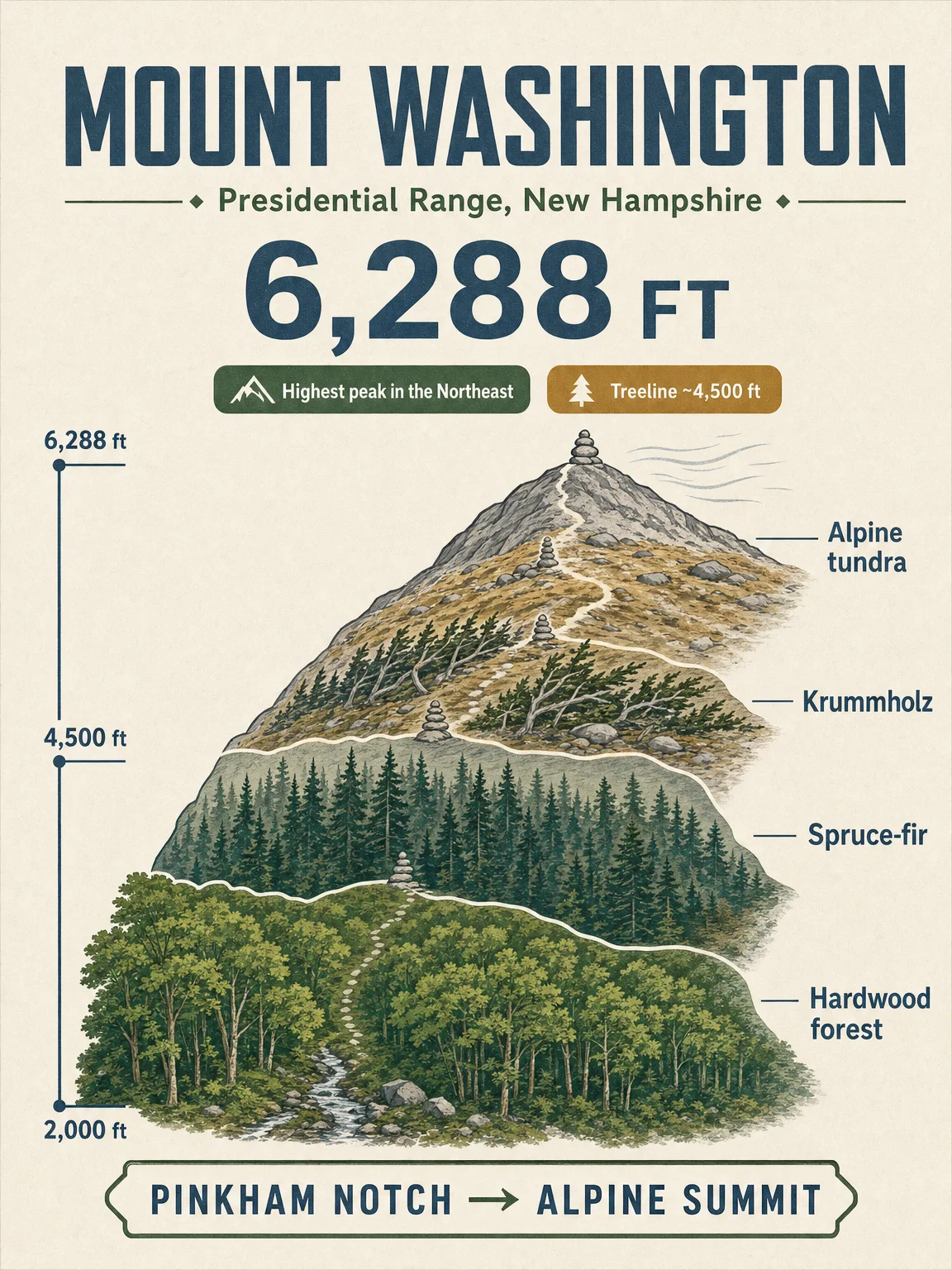

This issue moves the field-guide series to New Hampshire's Presidential Range. Mount Washington reaches 6,288 ft, and the Forest Service describes it as the peak rising above the rest of the Northeast. 12
Swipe the poster set in this order:
- Elevation cross-section — Pinkham Notch to the 6,288-ft summit, with the main vegetation bands shown as a vertical climb.
- Vegetation zones — northern hardwoods, spruce-fir forest, the balsam fir belt, and the alpine tundra above treeline. Treeline on Mount Washington sits around 4,400-4,500 ft, where krummholz gives way to open alpine habitat. 34
- Wildlife + season — alpine and high-elevation forest species, plus the practical hiking window. The Forest Service's Alpine Gardens Research Natural Area lists tundra plants, voles, water pipit, and other high-country species, while the Observatory notes October brings accumulating snow and more frequent hurricane-force gusts. 56
- Signature trails — Tuckerman Ravine, Lion Head, the Ammonoosuc-Jewell loop, and Jewell out-and-back, all treated as serious above-treeline routes rather than casual summit walks. 7
References
- 1
- 2
- 3Mount Washington Observatory: Alpine Zone
mountwashington.org
- 4UNH Extension: High-Elevation Forests
extension.unh.edu
- 5USDA Forest Service Research: Alpine Gardens
research.fs.usda.gov
- 6Mount Washington Observatory: Things To Know Before You Go
mountwashington.org
- 7Mount Washington Observatory: Top Trails for Hiking Mount Washington
mountwashington.org
Comments