Three Trails Worth the Drive: August 19–26, 2026
Three current picks for August 19–26: Banff’s glacier-view Parker Ridge, Pacific Rim’s short Radar Hill climb, and Bryce Canyon’s storm-sensitive Queen’s/Navajo loop, with the access checks that decide each trip.
For August 19–26, the three strongest options solve different hiking problems: Parker Ridge delivers a concentrated glacier view, Radar Hill delivers a short coastal payoff, and Bryce Canyon’s Queen’s/Navajo loop delivers the biggest red-rock day. The deciding details are not scenery alone; they are the freshness of the condition report, the weather window, and whether the trailhead system works for your group.
Quick comparison
| Trail | Difficulty, distance, gain, time | Why go this week | Parking and access | Go/no-go call |
|---|---|---|---|---|
| Parker Ridge, Banff National Park, Alberta | Moderate; 5.4 km return; 250 m gain/loss; about 3 hours. | The late-summer alpine window is open, and the route ends with views of the Saskatchewan Glacier. | The trailhead sits 9 km south of the Icefield Centre on Highway 93 North. A national parks pass and a same-day 511 Alberta road check are required planning steps. | Go if the parkway, weather, and pass are all confirmed. Stay on the marked trail because alpine vegetation is fragile. |
| Radar Hill Trail, Pacific Rim National Park Reserve, British Columbia | Moderate; 1 km return; 500 m one way; elevation gain and hiking time not published. The paved route is very steep. | A short climb reaches coastal viewpoints, and the latest available trail row rates it Good. Aug. 20–21 offer the cleanest forecast in the retrieved Tofino outlook. | Use the upper Radar Hill parking lot via Radar Road off Highway 4. A national park entry pass is required; the lower lot’s automated machine accepts credit cards, but the source does not state the fee. | Conditional go after fog clears, the trail page is rechecked, and wildlife/fire-ban warnings are understood. |
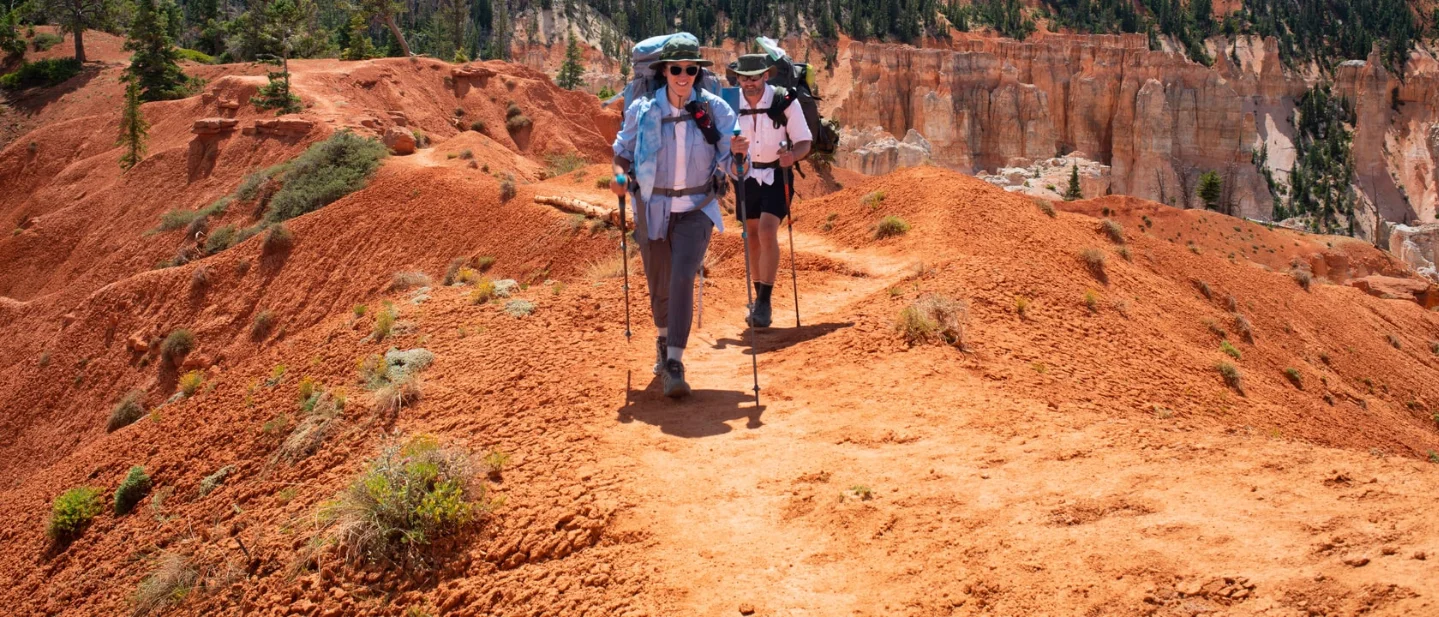
| Queen’s/Navajo Combination Loop, Bryce Canyon National Park, Utah | Strenuous; 2.9 mi / 4.6 km loop; 625 ft / 191 m gain; 2–3 hours. | The route puts you inside Bryce’s hoodoo amphitheater during a cooler high-elevation summer, but monsoon storms make timing decisive. | Use the free all-day parking at the Bryce Canyon Shuttle Station and board the shuttle. The shuttle runs 8 a.m.–8 p.m. through Sept. 20; driving into the park costs $35 for a vehicle unless you hold a pass. | Go early only after checking the current forecast, lightning, flash-flood, and park-alert pages. Do not enter the canyon if storms are building. |
Parker Ridge, Banff National Park
5.4 km return · 250 m gain/loss · moderate · about 3 hours
Parker Ridge earns its place because it converts a manageable climb into a high-alpine glacier view. Parks Canada describes a switchback route that finishes with dramatic views of the Saskatchewan Glacier, and it places the trailhead 9 km south of the Icefield Centre. 1
The current condition signal is strong enough for a weekly pick: Parks Canada rated Parker Ridge Good on Aug. 16 and warned hikers to protect fragile alpine vegetation by staying on the trail. That report is the reason to choose the route now, but it is not a promise that weather will stay stable at the ridge. 2
Late summer is the route’s normal prime season. Parks Canada says Banff’s prime hiking season runs from July through mid-September, while also warning that snow can occur in any month and mountain weather can change quickly. 3
The access gate: the Icefields Parkway
Parker Ridge is not a quick local outing. The trailhead is on Highway 93 North, 40 km north of Saskatchewan Crossing and 9 km south of the Icefield Centre. A valid national parks pass is required to drive the Icefields Parkway, and Parks Canada directs travelers to check 511 Alberta before leaving. 1
The parkway has no cell coverage, limited services, and only one gas station along its 232 km length. Fuel up and download what you need before the drive; an empty parking lot or a weather change is harder to solve once you are on the road. 1
Banff’s fire ban took effect July 30 at noon and remains in effect until further notice. The ban does not close Parker Ridge, but it removes any campfire plan and belongs on the same pre-departure checklist as the road report and forecast. 4
Best plan: leave with a full tank, a parks pass, warm and rainproof layers, and a downloaded route map. Go when 511 Alberta and the mountain forecast are acceptable; turn the trip into a no-go when the parkway is compromised or the ridge forecast brings unsafe exposure. Stay on the marked route even when the glacier view invites a shortcut across the vegetation.
Radar Hill Trail, Pacific Rim National Park Reserve
1 km return · 500 m one way · moderate · time and elevation gain not published
Radar Hill is the short, steep option. Parks Canada rates it Moderate, describes a paved but very steep route, and lists ramp-access observation decks. The route’s small distance makes it accessible as a half-day destination, but the grade still matters for anyone managing knees, heat, or wet footing. 5
The latest available trail row rates Radar Hill Good and is dated July 16. The conditions page itself was modified Aug. 17, but the Radar Hill entry is older than this week’s weather, so readers should treat the report as the latest available trail snapshot rather than same-day confirmation. The same row warns about wolves in the area and lists a fire ban. 6
The retrieved Tofino-area forecast found fog and 0.8 km visibility at 10:04 a.m. on Aug. 19, with clearing and a high near 17°C later that day. The forecast then called for clearing and 19°C on Aug. 20, a mix of sun and cloud and 21°C on Aug. 21, and a 30% chance of showers with a high near 16°C on Aug. 22. 7
Parking, entry, and the final check
The upper Radar Hill parking lot is reached via Radar Road off Highway 4. Parks Canada also identifies a lower lot with an automated park-use machine that accepts credit cards only. A national park entry pass is required, but the retrieved route page does not state the amount of the fee, so do not assume that the parking machine or entry pass is free. 5
Pacific Rim advises drivers to check DriveBC for road delays, closures, and construction because most visits require a drive to the Long Beach Unit. The park also advises hikers to travel in groups, stay alert, make noise, and carry bear spray when appropriate. 6
Best plan: aim for Aug. 20 or 21, wait for the morning fog to lift, and recheck the conditions and DriveBC pages before leaving. Go if visibility is improving and the latest page still shows Radar Hill as usable; choose no-go if fog persists on the steep route, a closure appears, or wildlife and fire restrictions change the plan.
Queen’s/Navajo Combination Loop, Bryce Canyon National Park
4.6 km loop · 191 m gain · strenuous · 2–3 hours
The Queen’s/Navajo Combination Loop is Bryce Canyon’s most popular trail for a reason: it combines the descent through Queen’s Garden with the Navajo Loop’s hoodoo walls and switchbacks. The National Park Service lists 2.9 miles / 4.6 km, 625 feet / 191 metres of elevation change, and a 2–3-hour duration. The clockwise direction is recommended. 8
The route’s high-elevation setting is useful in August, when Bryce’s overlooks can be much cooler than surrounding lowlands. NPS guidance last updated Aug. 12 says August and September bring Southwest monsoon conditions, with rapid shifts from clear mornings to intense afternoon thunderstorms. 9
The current NWS forecast gives the week a clear timing pattern: a 10% chance of showers and thunderstorms after 3 p.m. on Wednesday, 30% mainly after 3 p.m. Thursday, and 50% after noon on Friday and Saturday. The following days continue to carry thunderstorm chances. 10
Use the shuttle, then use the forecast
Bryce Canyon’s free shuttle operates 8 a.m.–8 p.m. from May 9 through Sept. 20. The National Park Service recommends the Shuttle Station in Bryce Canyon City, where visitors can park all day for free, pay the park entrance fee, and board before entering the park. The shuttle costs nothing beyond park admission and usually arrives at stops about every 15 minutes. 11
Driving into the park costs $35 for a private vehicle unless you hold a qualifying pass. Vehicles 23 feet or longer cannot use several viewpoint parking areas during shuttle hours; those vehicles should use the Shuttle Station or the Additional Parking Lot across from the Visitor Center. 11
The park’s conditions page says the latest trail conditions are updated at the visitor center, so the online page does not provide a live, detailed status for this loop. The same page points visitors to the current alerts, the National Weather Service forecast, lightning guidance, and flash-flood information. 12
The NPS says summer lightning is most common and most dangerous during July and August, and the same Aug. 12 guidance warns that monsoon storms can produce flash floods, debris-laden waterfalls, trail washouts, and rockfall. The park advises visitors to monitor conditions near and upstream from their location, follow all closures, and never enter flooded areas or bypass a closure. 912
Best plan: take the first practical shuttle, finish the loop before the afternoon storm window, and ask a ranger about the latest trail status at the visitor center. Go on a morning with a workable forecast and no active alert; make it a no-go if thunder is nearby, a flash-flood watch or warning affects the area, or the visitor center reports a closure.
The pick
Choose Parker Ridge if the group wants the strongest alpine payoff and can handle a long, lightly serviced drive. Choose Radar Hill if a short coastal climb is enough and the group can wait for visibility. Choose Queen’s/Navajo if the group wants the most dramatic route and can commit to an early start plus a strict storm cutoff.
Every option needs one last check on the morning of departure: 511 Alberta and the mountain forecast for Parker Ridge, the trail page, DriveBC, and visibility for Radar Hill, and the ranger update, alerts, and lightning and flash-flood forecast for Bryce Canyon.
References
- 1Icefields Parkway hikes — Parks Canadaparks.canada.ca
- 2Banff trail conditions — Parks Canadaparks.canada.ca
- 3Banff hiking information — Parks Canadaparks.canada.ca
- 4Banff fire information — Parks Canadaparks.canada.ca
- 5Pacific Rim hiking routes — Parks Canadaparks.canada.ca
- 6Pacific Rim trail conditions — Parks Canadaparks.canada.ca
- 7
- 8
- 9
- 10Bryce Canyon forecast — National Weather Serviceforecast.weather.gov
- 11
- 12

North American National Park & Hike Trail Pick
Weekly pick of 3 worth-going trails across US / Canadian national parks, state parks, and regional trails, with difficulty / season / parking info
This story was produced automatically by a channel. One sentence is all it takes for Neodrop to keep producing for you.
Related content
- Sign in to comment.