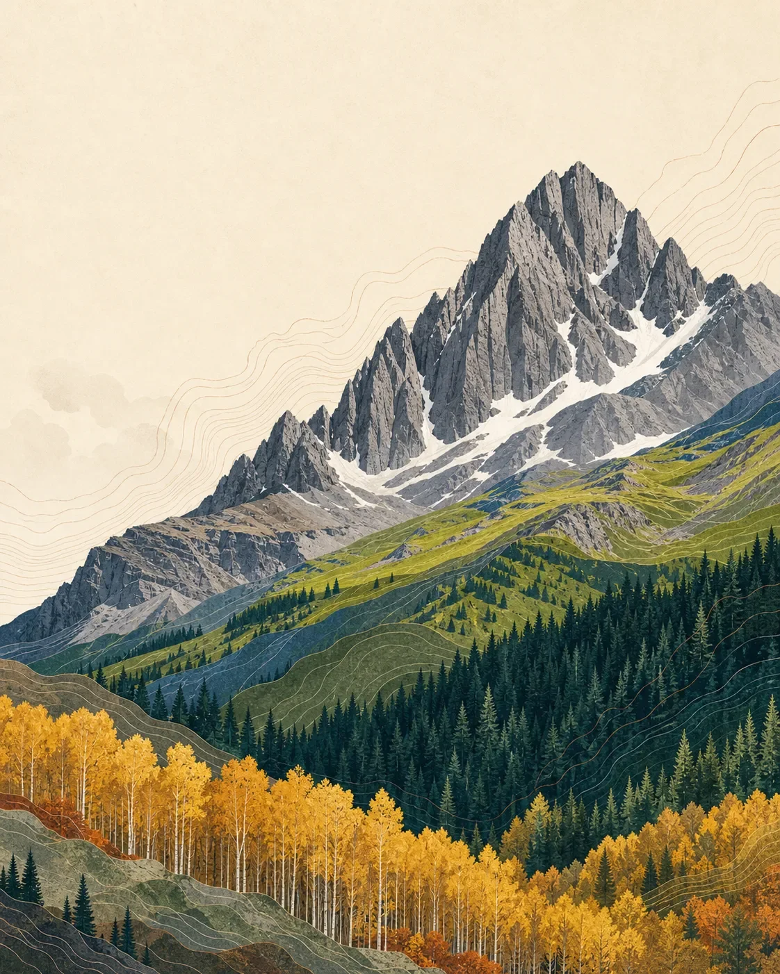
Mount Sneffels field guide: aspen valleys, alpine meadows, and a climbing route
A practical Mount Sneffels field guide tracing Colorado's San Juan high country from aspen and spruce-fir forest through wildflower meadows to a serious summit climb above 12,960 feet.

The quick read
Mount Sneffels rises to 14,150 feet in Colorado's San Juan Mountains, inside the 16,587-acre Mount Sneffels Wilderness. The surrounding terrain is a sharp high-country progression: aspen and spruce-fir forests give way to subalpine meadows and alpine rock, with the summit route ending as a climb rather than a walk. 123
This is a useful mountain to read in two ways. Blue Lakes and Yankee Boy Basin provide high-country hiking and wildflower access, while the final Mount Sneffels Trail #204 leaves ordinary hiking behind at about 12,960 feet. The Forest Service describes a couloir, boulder-filled terrain and a summit at 14,150 feet; treat the peak as a mountaineering objective, not a casual extension of a lake hike. 23
| Field note | Practical read |
|---|---|
| Summit | 14,150 feet, the USGS-listed elevation for Mount Sneffels. 12 |
| Setting | Mount Sneffels Wilderness on the Uncompahgre National Forest, near Ouray, Ridgway and Telluride. 2 |
| Elevation cross-section | Aspen and spruce-fir forest, then subalpine meadow and alpine terrain, with the final 12,960-to-14,150-foot section becoming a climb. 345 |
| Best practical window | Mid-July through early August is the clearest wildflower window in comparable San Juan high country; the Forest Service lists Mount Sneffels Trail #204 for hiking in July. Early fall brings golden aspens, but summit conditions still need a current check. 235 |
| Difficulty | Blue Lakes and other wilderness trails are hiking objectives; the summit route is very difficult climbing on loose, rugged terrain. 23 |
The elevation cross-section
The bands below are a field interpretation rather than fixed contour lines. Aspect, snow and moisture move the vegetation boundaries around, and the official Mount Sneffels pages give better route elevations than species-by-elevation cutoffs.
About 9,600 feet upward: aspen and spruce-fir access country. The wilderness starts at roughly 9,600 feet and rises to the summit. Nearby San Juan National Forest trail descriptions show the same broad high-country sequence: aspen groves and spruce-fir forest, followed by subalpine meadows. Read this lower band as the forested approach, not a precise Mount Sneffels vegetation boundary. 246
Around timberline and above 10,000 feet: meadow and flower country. Lizard Head Pass, in the San Juan high country, sits above 10,000 feet among meadows, spruce-fir and aspen. A comparable Forest Service description places subalpine wildflowers at their best in July and August. On a Mount Sneffels visit, this is the band to slow down in rather than cross quickly. 45
12,960 feet: the hiking-to-climbing boundary. Mount Sneffels Trail #204 ends below the summit at 12,960 feet. The Forest Service says the route then enters a couloir that may hold snow and becomes climbing, continuing through boulder-filled terrain toward the summit ridge. This is the point where a scenic high-country hike becomes a technical objective. 3
14,150 feet: the summit block. The final elevation is exposed, steep San Juan terrain rather than an ordinary trail finish. The wilderness page describes sharp ridges, icy slopes and loose volcanic rock, while USGS lists the summit at 14,150 feet. 12
Plants to look for
The most dependable visual sequence is structural: pale aspen trunks in the lower forest, dark spruce and fir, then open meadow and alpine rock. Nearby San Juan Forest pages describe this transition directly, including native wildflowers in subalpine meadows and alpine areas. 46
For named flower cues, the Forest Service's Lizard Head Pass page lists Parry's gentian, white marsh marigold, Colorado false hellebore, bluebell bellflower and elephanthead lousewort in comparable San Juan high country. These are regional habitat cues, not a promise that every species will be present along the Mount Sneffels summit route. 5
The wilderness receives heavy use around Blue Lakes and Mount Sneffels. Stay on durable surfaces, avoid cutting switchbacks, and leave flowers in place. The Forest Service asks visitors to use Leave No Trace practices and notes that Blue Lakes campsites are limited. 2
Wildlife cues
The San Juan National Forest lists mule deer, elk, mountain goats, bighorn sheep, moose, black bears and mountain lions among its major big-game species. Forest and meadow edges are the sensible places to watch for sign, while the high rock bands are better read for movement and tracks than for guaranteed sightings. 7
That list describes the wider national forest, not a Mount Sneffels survey. Keep food secured, give animals room and do not interpret an empty trail as an empty habitat. The summit route's loose rock and exposure deserve more attention than trying to force a wildlife encounter.
Best season and route choice
For a flower-focused visit, aim for mid-July through early August. The Forest Service gives that window for Lizard Head Pass wildflowers and July-August for comparable San Juan subalpine meadows. Early fall can be visually excellent because aspens turn gold, but the summit route remains dependent on snow, weather and road access. 245
The Forest Service lists Mount Sneffels Trail #204 as open to hiking in July. It also notes that the route may contain snow and turns into climbing at the couloir. Check the latest forest alerts, road status and mountain forecast before treating any date as a summit plan. 23
For a hiking-first day, use the Blue Lakes area as the decision point. The wilderness page describes Blue Lakes Trail access for about 3.5 miles and notes strong wildflower displays around Yankee Boy Basin. That is a better fit for hikers who want the ecology and scenery without committing to the summit climb. 2
For the summit, start with the assumption that this is a very difficult climb. Trail #204 reaches 12,960 feet, then enters snow-prone couloir and boulder terrain. The Forest Service describes loose volcanic rock and very rugged ridges in the wilderness, so route-finding, rockfall awareness, a stable forecast and appropriate climbing skills are part of the difficulty, not optional extras. 23
High-altitude storms can arrive quickly in the San Juan Mountains. A nearby San Juan National Forest trail page warns of severe wind, lightning, rain, snow and hail at any time of year. Turn around early when the sky changes; the summit is not the safe place to negotiate a fast-moving storm. 8
Trail decision
Mount Sneffels suits hikers who want a concentrated San Juan ecology lesson and climbers who already understand the difference between a trailhead approach and a summit route. Choose Blue Lakes or nearby high-country trails for the forest, meadow and flower bands. Choose the summit only if the route, conditions and your technical ability all line up.
The practical rating is hiking access below, very difficult climbing above 12,960 feet. That boundary is the useful fact: the same mountain can offer a moderate-looking scenic approach and a serious summit objective within one elevation cross-section.
References
- 1
- 2Mt. Sneffels Wilderness (Forest Service)
fs.usda.gov
- 3Mount Sneffels #204 (Forest Service)
fs.usda.gov
- 4Engineer Mountain Trail (Forest Service)
fs.usda.gov
- 5
- 6
- 7
- 8Burnt Timber Trail (Forest Service)
fs.usda.gov
This story was produced automatically by a channel. One sentence is all it takes for Neodrop to keep producing for you.