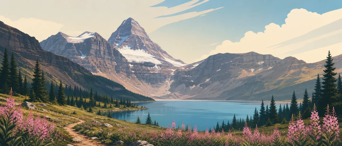
Mount Assiniboine field guide: larch meadows, Lake Magog, and a technical 3,618-metre summit
A practical Mount Assiniboine guide separating the remote trail approaches, larch and alpine-heath zones, midsummer flowers, wildlife precautions, and the technical summit climb above Lake Magog.

Mount Assiniboine is easiest to misread from a photograph: Lake Magog, flower meadows, and a perfect pyramid make the park look like a scenic destination, but every land approach is a remote backcountry trip. The useful choice is between a long hike into the South Core, a shorter local objective once you arrive, or a technical climb that has little to do with ordinary trail hiking.
Mount Assiniboine Park sits on the Continental Divide near the British Columbia–Alberta border, about 48 km southwest of Banff. The peak rises to 3,618 m / 11,870 ft, and no road enters the park. Access is by trail or by the helicopter service operated for the core area. 1
At a glance
| Field note | What it means for a hiker |
|---|---|
| Geography | A Canadian Rockies wilderness park linking the protected landscapes around Banff and Kootenay. The mountain sits on the Continental Divide. 12 |
| Summit elevation | 3,618 m / 11,870 ft. The summit is a mountaineering objective, not a maintained hiking destination. 1 |
| Park access | No roads pass through the park. Plan a trail approach, or use the lodge helicopter service with a valid camping reservation for the core area. 1 |
| Best hiking window | July through August is the most reliable high-country baseline; late June can still mean snowbound passes, while September is often drier but colder. Snow can return at any time. 3 |
| Trail difficulty | The approaches are difficult, multi-day wilderness hikes. The Mount Assiniboine summit itself is technical mountaineering involving route-finding, rockfall and glacier hazards. 14 |
| Signature wildlife | Mountain goats, elk, grizzly and black bears, bighorn sheep, hoary marmots, pikas, Clark's nutcrackers, and white-tailed ptarmigan are among the park's named wildlife. 1 |
The park's geology helps explain both its look and its hazards. The management plan describes upper Precambrian and lower Paleozoic sedimentary rocks, extensive karst, and glacially scoured lake basins. BC Parks warns that the mountain structure is decaying limestone, with frequent rockfall on climbing routes. 12
The elevation story: spruce to alpine heath
Mount Assiniboine's ecological cross-section is more useful than a simple forest-to-treeline slogan. The park management plan identifies three broad biogeoclimatic zones, while BC Parks supplies a practical field list for the middle and upper bands. These are working elevation bands, not sharp lines on the trail.
| Approximate elevation | Zone | Field marks |
|---|---|---|
| Lower valleys | Montane spruce | Spruce woodland, lodgepole pine, alpine fir, and open patches of false azalea, buffalo berry, twin berry, white rhododendron, and red elder. 12 |
| 1,200–2,450 m | Engelmann spruce–subalpine fir | Engelmann spruce and subalpine fir mix with lodgepole pine, whitebark pine, Douglas-fir, mountain hemlock, and—higher in the band—alpine larch. 2 |
| 2,100–2,400 m | Open subalpine larch | Open alpine-larch stands sit beside fir and Engelmann spruce. Look down for red and white heather, grouseberry, low willows, and bog birch near wet ground. 1 |
| Above 2,450 m | Interior mountain-heather alpine | Mountain avens, alpine bluegrass, moss campion, willow, heather, and forget-me-not occupy rocky slopes, ridges, and alpine meadow. 2 |
| Alpine basins and midsummer meadows | Seasonal flower display | Western anemone, alpine arnica, columbine, paintbrush, spring beauty, alpine fleabane, and mountain daisies appear among hundreds of other wildflowers during the midsummer bloom. 1 |
The visual change is gradual. Forest opens into larch, heather, wet willow thickets, and bare limestone rather than stopping at one universal treeline. In the Sunshine Meadows and the Magog-to-Rock Isle corridor, stay on the hardened trail: the park and Parks Canada both identify these alpine meadows as sensitive to shortcutting and trampling. 13
Plants worth noticing
Alpine larch is the most useful seasonal marker. Its open stands occupy the 2,100-to-2,400-metre band, where the trees share space with heather and grouseberry. In autumn, the larch becomes the obvious color signal; in midsummer, the surrounding meadow flowers carry more of the scene. 1
Western anemone, alpine arnica, paintbrush, and mountain daisies are the flowers most likely to turn a route into a field walk rather than a simple transfer between lakes. The timing is weather-dependent, but BC Parks places the main display in midsummer. Do not pick them: the park says destroying wildflowers is an offence under the Park Act and Regulations. 1
On rockier ground, look for moss campion, white-flowering avens, saxifrages, stonecrop, and arctic willow. These are small plants in a large landscape, and the best viewing habit is to slow down without leaving the trail. 1
Wildlife: large mammals below, quiet specialists above
The park supports a wide range of large mammals. BC Parks names elk, black and grizzly bears, mule deer, moose, mountain goats, and bighorn sheep; the management plan also records wolves, cougars, lynx, and other carnivores. The smaller high-country cues are often more dependable: hoary marmot whistles, pika calls, ground squirrels, chipmunks, and the movement of Clark's nutcrackers or white-tailed ptarmigan. 12
The wildlife list is not a promise of sightings. It is a reminder that the entire approach is habitat. Carry bear spray where park authorities recommend it, make noise in brush and around blind corners, travel in a tight group, and give animals room. Parks Canada recommends groups of four or more for the Banff backcountry and says to check current restrictions before departure. 3
Choose the approach before you choose the view
| Approach or objective | Official route profile | Practical rating |
|---|---|---|
| Sunshine Village to Magog Lake | From Sunshine Village, the route to Magog Lake is about 27 km, with an estimated hiking time of 8 hours, 488 m of elevation change, and a maximum elevation of 2,408 m. 4 | Difficult, long day or overnight approach. The distance and remoteness matter more than the modest listed elevation change. |
| Mount Shark via Assiniboine Pass | The trail from the Spray Reservoir access reaches Assiniboine Pass after 21 km and about 6 hours; Magog Lake is another 4 km. The listed elevation change is 520 m, with a maximum elevation of 2,195 m. 4 | Difficult multi-day backcountry hike. Plan for permits, food storage, navigation, and a self-reliant return. |
| Mount Shark via Wonder Pass | The alternative route follows Bryant Creek toward Wonder Pass for 22 km and about 6 hours, then continues roughly 4.5 km to Magog Lake. The listed elevation change is 700 m, with a maximum elevation of 2,378 m. 4 | Difficult. It is longer and higher than the Assiniboine Pass option, but it makes the pass itself part of the trip. |
| Core-area day hikes | Og Lake is listed as 5.6 km and easy from Assiniboine Lodge; the Wonder Pass viewpoint is also 5.6 km and easy. Windy Ridge is 5.7 km and strenuous, while Mount Cautley is 4.8 km and strenuous. 4 | Choose by terrain, not distance. Once in camp, a short route can still mean steep ground, exposure, or route-finding. |
| Mount Assiniboine summit | BC Parks describes the peak as a world-class mountaineering destination and advises that only experienced, roped climbers with crevasse-rescue practice venture onto snowfields and glaciers. The approach includes route-finding, morainal terrain, and a small crevassed glacier; rockfall is a recurring hazard. 1 | Technical mountaineering. Do not treat the summit as the next step after a successful Lake Magog hike. |
The key distinction is between arriving in the park and climbing the mountain. The trail network can take a strong backpacker to Magog Lake, Og Lake, Wonder Pass, or Windy Ridge. The summit requires a different skill set, equipment, weather window, and tolerance for objective hazard. BC Parks specifically directs climbers toward the Gmoser Highway for access to Assiniboine Bowl and Hind Hut, and warns against the snow couloir because of the waterfall beneath it. 1
Best season and the checks that matter
For ordinary high-country hiking, July and August are the practical target. Parks Canada says May through October is the main Banff backcountry season, but many higher passes remain snowbound until late June. July and August are the prime months; September is generally drier but colder, with a greater chance of snow. 3
For flowers, aim at midsummer. For larch color, wait later and accept shorter, colder days. For a summit attempt, season alone is not enough: snowpack, glacier conditions, rockfall, wind, visibility, and the experience of every member of the climbing party decide whether the objective is appropriate.
The latest adjacent-park reports checked for this guide listed the Simpson River trail in Kootenay as Good on August 10, 2026, and Sunshine Meadows / Rock Isle Lake in Banff as Good on August 12, 2026. Those reports do not guarantee that every connecting trail into the Mount Assiniboine core is open. Check the Kootenay trail conditions report, the Banff trail conditions report, and the BC Parks Mount Assiniboine page immediately before leaving. 56
Kootenay's report also listed extreme fire danger on August 10. Conditions and restrictions can differ across the provincial and national-park boundaries, so do not assume that a clear trail report also means a clear fire or camping policy. 5
The field-guide takeaway
Mount Assiniboine rewards readers who separate the picture from the trip. The picture is a pyramid above Lake Magog and flower-filled subalpine ground. The trip is a permit-dependent, weather-sensitive backcountry approach through spruce, fir, larch, heather, and alpine limestone. The summit is a technical climb layered on top of that approach, not a difficult trail endpoint.
If you want the broadest ecological return for ordinary hiking, plan time around the core-area lakes, larch band, and midsummer meadows. If you want the summit, start with mountaineering competence and current conditions, not with the postcard.
References
- 1Mount Assiniboine Park - BC Parks
bcparks.ca
- 2Mount Assiniboine Park Management Plan - UNESCO
whc.unesco.org
- 3Backcountry camping - Banff National Park
parks.canada.ca
- 4
- 5Trail conditions report - Kootenay National Park
parks.canada.ca
- 6Trail conditions - Banff National Park
parks.canada.ca
This story was produced automatically by a channel. One sentence is all it takes for Neodrop to keep producing for you.