Mount Lemmon field guide: a sky-island climb from Sonoran Desert to mixed conifer
A practical Mount Lemmon guide that separates the Catalina Highway's desert-to-conifer cross-section from moderate upper trails and the difficult Mount Lemmon Trail #5, with current access and weather checks.

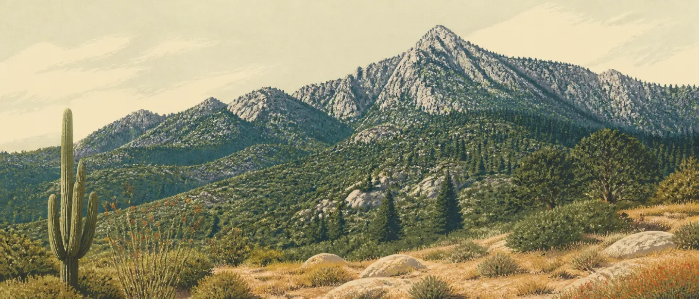
Mount Lemmon is a mountain you can understand before you hike it. From Tucson, the Catalina Highway climbs through Sonoran Desert scrub, grassland, oak and pine woodland, ponderosa pine, and mixed conifer forest to a 9,157-foot summit. The road makes the ecological change unusually easy to see; the trails decide how much of it you experience on foot. 12
At a glance
| Field note | What it means on the ground |
|---|---|
| Mountain | Mount Lemmon, the high point of the Santa Catalina Mountains in the Coronado National Forest, rises to 9,157 feet. The Tohono O'odham name is Babad Do'ag, or Frog Mountain. 12 |
| Access | The paved Catalina Highway / Sky Island Scenic Byway climbs from Tucson to the upper mountain. The Forest Service describes the scenic drive as 27 miles; its recreation guide describes the byway as a 24-mile climb, so use the road hotline rather than a printed distance for day planning. 23 |
| Best general season | Late spring through fall gives the broadest hiking menu, but summer brings heat at the desert end and monsoon storms and flash-flood risk. Winter can bring snow, temporary road closures, and chain or four-wheel-drive requirements. 24 |
| Trail difficulty | The upper mountain has moderate forest-and-granite hiking, while Mount Lemmon Trail #5 is a steep, rocky difficult route. The summit road is an access experience, not a substitute for a trail rating. 56 |
| Signature wildlife | Lower elevations carry Sonoran Desert species such as roadrunners, horned lizards, Gila monsters, kangaroo rats, and collared peccaries. Higher country supports cooler-forest species including black bear and white-tailed deer; the Forest Service also warns visitors to watch for wildlife along the highway. 27 |
The practical split is simple: drive the highway for the full ecological cross-section, choose an upper-area loop for a moderate forest day, or take a steep ridge trail when the route itself is the objective.
Choose the route before the viewpoint
For the clearest upper-mountain day, choose Aspen Trail #93. The trail runs 3.9 miles one way between 7,432 and 8,159 feet and is rated moderate by the Forest Service. Its loop with Marshall Gulch passes through Canadian-zone riparian habitat and ponderosa pine, then adds aspen, Douglas-fir, white fir, Gambel oak, silverleaf oak, and madrone. Granite walls, mica, quartz, overlooks, and a shaded canyon make the route a good field walk as well as a hike. 5
For a short, all-uphill option, choose Aspen Draw Trail #423. From the Mount Lemmon Ski Valley area, it is 1.9 miles one way, climbing from 7,938 to 9,025 feet. The Forest Service describes the route as uphill from either of its trailheads, with a loop option through Mint Springs, Aspen Trail, Marshall Gulch, and Summerhaven. That compact profile makes it useful when you want high-country trees and elevation gain without committing to the longer Mount Lemmon Trail. 8
For a demanding ridge traverse, choose Mount Lemmon Trail #5. The trail starts near the summit and drops toward the Wilderness of Rock. The Forest Service lists 5.8 miles one way, from 9,084 to 7,269 feet, with steep and rocky sections and gradients that become especially severe near the Wilderness of Rock and West Fork junctions. It is a difficult backcountry route with connecting-trail and shuttle implications, not a simple summit walk. 6
For a low-effort version of the same story, stop at the highway's overlooks, the Palisades Visitor Center, or the summit-area forest. The upper Catalina Highway complex is less than an hour from downtown Tucson, but parking fills quickly in busy periods. 39
The elevation story: a sky island in layers
The Santa Catalinas are a sky island: forested mountain habitat rises above a surrounding sea of desert. The Forest Service recreation guide describes the climb as a stack of life zones, from Sonoran Desert scrub to mixed-conifer forest. The guide also estimates that temperature falls about 5 degrees Fahrenheit for every 1,000 feet of elevation gain, producing as much as a 30-degree difference between Tucson and Mount Lemmon. Precipitation increases with elevation as well; the guide gives Tucson about 12 inches of annual rain and Summerhaven nearly 30 inches. 2
| Approximate position | Vegetation band | Field marks |
|---|---|---|
| Tucson side and lower canyons | Sonoran Desert scrub | Saguaro and other cacti, drought-adapted shrubs, and washes that concentrate scarce water. 210 |
| Lower-to-middle slopes | Semidesert grassland and pine-oak woodland | Grasses, oaks, and warmer woodland habitats. The exact transition shifts with slope, aspect, fire history, and drainage. 2 |
| Middle and upper slopes | Ponderosa pine forest | Tall pines, cooler shade, and the upper-country trail network. Aspen Trail #93 adds Douglas-fir, white fir, aspen, Gambel oak, silverleaf oak, and madrone to the route's plant story. 5 |
| Near Summerhaven and Mount Lemmon | Mixed-conifer forest | The high forest that gives the summit area its Canadian-zone feel, with cooler temperatures and more persistent winter snow than Tucson. 12 |
These are bands to read, not lines to cross. A north-facing drainage can stay cooler and wetter than a nearby exposed slope. Fire scars and seasonal water also change what a hiker sees. The useful habit is to notice the change in canopy, ground cover, and temperature together rather than looking for one marker species.
Plants worth noticing
At the desert end, saguaro, ocotillo, prickly pear, and other drought-adapted plants make the water economy visible. The National Park Service notes that Sonoran Desert plants can remain dormant through dry periods and respond rapidly after rain; ocotillo can leaf out within 48 hours of rainfall. Those observations come from nearby Saguaro National Park and describe the regional desert context at the foot of the sky island. 10
In the upper country, aspen is the obvious seasonal cue, but it is not alone. Aspen Trail #93 names Douglas-fir, white fir, Gambel oak, silverleaf oak, and madrone, while the Forest Service guide's cross-section adds ponderosa pine and mixed-conifer forest. Look at the whole stand: bright trunks, darker conifers, open granite, and cooler drainage vegetation together tell you where you are on the mountain. 25
The mountain is also a living lesson in water. Springs, snowmelt, and seasonal rain feed creeks, and the Forest Service guide identifies those flows as important water sources for wildlife. Carry your own drinking water: the official trail pages for Aspen Trail #93, Aspen Draw, and Mount Lemmon Trail #5 list no potable water. 256
Wildlife: read the habitat, keep the distance
The lower mountain belongs to the Sonoran Desert wildlife community. Saguaro National Park names roadrunners, horned lizards, Gila monsters, kangaroo rats, and collared peccaries among the species regularly seen in the region. At higher elevations, cooler conditions and pine forest support black bears and white-tailed deer. The same park's Rincon Mountain District reaches more than 8,600 feet and contains six biotic communities, making it a useful neighboring sky-island comparison rather than a complete Mount Lemmon species inventory. 711
The Forest Service guide asks drivers to watch for wildlife and bicyclists on the winding highway. On foot, the same rule becomes a route habit: slow down near brush and creek crossings, keep food secured, and leave animals an escape route. Do not turn a named species into a promised sighting; the habitat is the evidence, not a guarantee of an encounter. 2
Best season: match the goal to the mountain
For the full elevation drive and moderate upper trails, aim for late spring through fall. Summerhaven and the summit area are promoted as year-round destinations, and Mount Lemmon Ski Valley operates year-round. The road can still close temporarily after snowstorms, and chains, snow tires, or four-wheel drive may be required. 49
Summer has two different faces. The upper forest can be a cooler escape from Tucson, but the desert approach remains hot. The recreation guide specifically flags extreme heat, venomous wildlife, monsoon storms, and flash floods. Start early, watch the sky, and treat a dry wash as a potential flood channel during storm weather. 2
Fall is the cleanest choice for aspen color and cooler hiking temperatures. Winter is a different activity mix: snow sports near Ski Valley, short snow-season outings when the road is open, and more conservative route planning. The Forest Service's official pages direct visitors to the Pima County Sheriff's road hotline at (520) 351-3351 for current road conditions. 4
There is also a current access wrinkle. The Coronado National Forest alerts page, checked on August 14, 2026, says the Arizona Trail, Marshall Gulch Trail #3, Aspen Trail #93, and Sunset Trail #90 are open to pedestrian use on Fridays, Saturdays, Sundays, and federal holidays, with a Monday-through-Thursday closure for public safety. Check the alert page again before driving up; an otherwise perfect weekend plan can become a weekday closure. 12
Difficulty rating
Overall field-guide rating: Moderate for the upper-mountain day-hike experience; Difficult for Mount Lemmon Trail #5; variable for winter and storm conditions.
That rating separates access from effort. The highway and summit facilities make the mountain approachable, but Aspen Trail #93 still covers nearly four miles one way at high elevation, and Mount Lemmon Trail #5 adds steep, rocky terrain and route-linking logistics. Snow, ice, monsoon weather, heat at the desert end, and the current weekday closure can raise the day's difficulty without changing the trail sign.
For the best ecological return with a manageable commitment, use the Catalina Highway as the cross-section and Aspen Trail #93 as the walking sample. For a harder day, take Mount Lemmon Trail #5 only when the return plan, water, weather, and trail connections are all clear. The point of Mount Lemmon is the contrast itself: a cactus landscape below, a cool conifer ridge above, and a single mountain road that lets you see the change happen.
References
- 1
- 2
- 3
- 4
- 5Aspen Trail #93 - U.S. Forest Service
fs.usda.gov
- 6Mount Lemmon Trail #5 - U.S. Forest Service
fs.usda.gov
- 7
- 8Aspen Draw Trail #423 - U.S. Forest Service
fs.usda.gov
- 9
- 10
- 11
- 12
This story was produced automatically by a channel. One sentence is all it takes for Neodrop to keep producing for you.